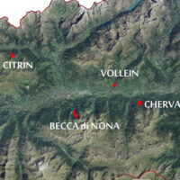
The Aosta Valley is a small alpine region affected by numerous landslides, varying in size and type, ranging from isolated rock falls to rotational/translational slides up to extensive deep landslides. The study of such landslides, functional to a more effective risk management and to guarantee adequate safety standards, represents a primary necessity for a mountain territory like this ...
Geological-geotechnical monitoring systems are one of the most effective tools for landslide characterization, both in terms of landslide detection and for monitoring purposes. The regional monitoring network of Regione Lombardia represents an exemplary case in Italy, with as many as 44 landslides monitored, of which more than half in real time.
The management of monitoring networks and early warning systems represents a complex component, in ...

Climate change has a powerful impact on high-altitude Alpine sectors and glaciers. This impact often turns into an increase in instability processes that can lead to very high-risk conditions. These risk conditions can significantly affect the usability of areas characterized by intense tourist flows, making risk management very ...
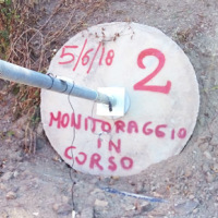
Geo-Hydrological risks are one of the main sources of economic losses for our country causing a huge number of victims and damages. From 1966 to 2015, landslides and floods caused 1948 casualties, 3524 injured and more than 412,000 displaced people. The Venetian mountain has always been subject to major landslides and, almost every year, new emergencies occur with the intensification of the autumn and spring rains, which are increasing due to ...
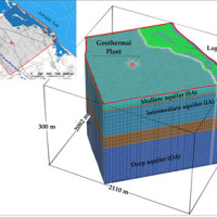
The topic of low geothermal enthalpy is crucial as a strategy to mitigate and adapt to climate change.
With this in mind, the structuring of environmental knowledge and information on the topic of low geothermal enthalpy in its various forms and a test site activity to deepen current knowledge on the regulatory context and on the effects on subsoil and on groundwater of geothermal plants is envisaged on a territorial ...
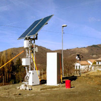
The Municipality of Ne (GE) is involved by an important landslide in the Arzeno and Prato di Reppia areas. The phenomenon is monitored using standard techniques for some years. The goals of this study is increasing the knowledge of the phenomenon using automatic monitoring ...
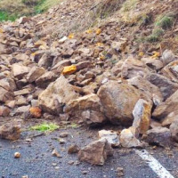
Among all types of landslide phenomena present in Alpine environment, the rockfalls are certainly the most impacting, because they also are extremely widespread. Rockfall are very difficult to monitor and they are often managed exclusively through the execution of active or passive works aimed at risk mitigation. Due to the rockfalls impulsive behavior, it is a difficult task to locate them a priori. The problem of rockfalls can be approached ...
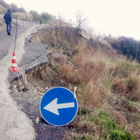
During about two months, two rain events that occurred in the periods 25-26 November 2016 and 22-25 January 2017 affected Calabria region, producing landslides and floods and causing huge damage on large ...
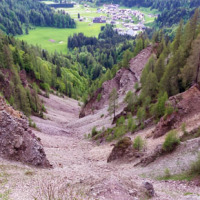
Past debris flows in the Rio Kortol catchment arise concerns for the safety of the village of Sauris di Sotto, and urge new studies for the assessment of hazard and the choice of risk mitigation ...
The R&D project SMoRI starts from two needs to be reconciled. The first, coming from the scientific community, concerns a best definition of integrated monitoring systems aimed at controlling the conditions of high geo-hydrological risk. The second need is to acquire by the industrial partners a specialized know-how on new technologies related to Cloud Computing and I.o.T. and on the environmental ...
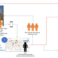
The management of emergencies, in particular those determined by natural events, is complex and must be able to use all the available cognitive elements. During emergencies, it is possible to acquire useful data regarding the processes that determine the same emergencies. These data can contribute to significantly improve planning and design of prevention ...
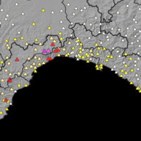
Since 2013, CNR IRPI went in with the collection of information on rainfall events that have resulted in landslides in the Liguria region. Rainfall thresholds can be used in early warning systems for the prediction of the occurrence of rainfall-induced landslides. To respond to a request of the Italian national Department for Civil Protection (DPC), CNR IRPI designed and developed SANF, an Italian acronym for National Early Warning System for ...
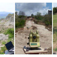
The development of new systems for monitoring of landslides is often the synthesis of geomatics and applied geology. In particular, the development of innovative low-cost systems must have a strong geomatics and technological component supported by the definition of required elements done by end users (engineering geologists). The development of low-cost monitoring systems can represent a strategic choice, above all, to guarantee an increasing ...
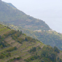
The project aims at defining the type of expected natural hazards, the modeling approaches relevant for their evaluation, and possible monitoring tools in specific areas prone to landslide risk within the "UNESCO site Portovenere, Cinque Terre and the Islands (Palmaria, Tino and Tinetto)" along the "Blue Trail" from Monterosso through ...
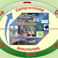
The improved understanding of the underlying physical processes of extreme events is closely linked to the development and verification of procedures to better control, analysis and validation of hydrological data for the description and visualization of meteorological events creating an operational "database of event" which enables to better identify under what conditions hazards ...
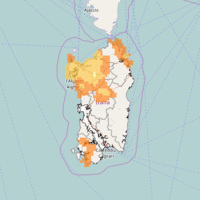
In Italy, landslides are triggered by intense and/or prolonged rainfall. The spatial and temporal forecast of multiple landslides triggered by rainfall in wide areas relies primarily on empirical rainfall thresholds. It is widely believed that the thresholds are influenced by the local topographic (morphological), lithological, soil, and climatic settings. For this reason, it is necessary to define local rainfall thresholds. Reliable local ...
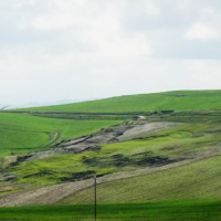
The Apulia region is affected by multiple types of geo-hydrological instability processes such as sinkholes, flash floods and landslides.
Landsliding mainly affects the north-western sector of the Region (bordering with Apennine chain) and the sea rocky cliffs.
The sub-Appennine Daunia portion of the Region is exposed to landslide risk due to hydro-geological setup of the soil/rock deposits, the poor mechanical properties of the ...
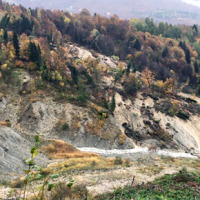
The Tessina Landslide has been, almost continuously, monitored by IRPI, Padova Unit, since its main reactivation in April 1992. Therefore the Veneto Region entrusted IRPI with the continuation of such activity to be extended to the Lamosano landslide too, in order to identify the most effective countermeasure to mitigate the induced ...
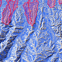
In recent years, following short and intense meteoric events, along the railway line of the Department of Reggio Calabria, there have been a series of interruptions in correspondence of basins below 3-4 km2. Based on the current procedures for risk mitigation in RFI, in the event of a "red alert" issued by the Civil Protection, RFI management locate along the railway line personal in correspondence of the area in question. This procedure is ...
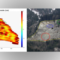
The landslide monitoring represents a strategic activity, especially for those phenomena for which it is not possible (for technical or financial reasons) to realize stabilization interventions of the landslide. Nevertheless, the data acquisition is only the first part of the project, to which it is necessary to couple an on line management of the processed data and to realize monitoring ...
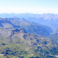
The Aosta Valley region presents a landscape almost totally occupied by mountain. In this context, a number of meaningful landslides is present, which vary from rock falls to deep-seated gravitational slope deformation (DsGSD), passing for the complex landslides. The study of these phenomena, finalized to guarantee suitable standard of safety and to facilitate a compatible development, results a fundamental necessity for this ...
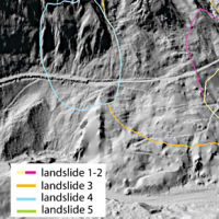
L’area del "Passo della Morte" (UD) è interessata da una situazione di grave dissesto a causa della presenza di più movimenti franosi. Questi sono caratterizzati da elevata pericolosità in relazione alle caratteristiche intrinseche dei fenomeni (volumetrie e velocità di spostamento), alla morfologia del versante ed alla geologia dell'area. La loro presenza mette a rischio la rete stradale che collega la Carnia con il Cadore e l’asta ...
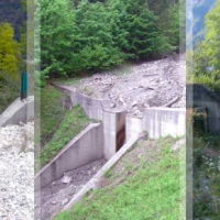
Some areas mapped in the Piani di Assetto Idrogeologico (Watershed Management Plan) of Piave, Brenta-Bacchiglione and Livenza Rivers require specific studies aimed at assigning a degree of hazard. Among the warning areas, there are numerous alluvial fans. The Soil Conservation Division of Veneto Region, in charge of the inquiry, identified the need to find an objective method for assessing the hazard of such ...
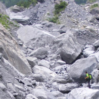
Environmental sensor monitoring is continuously developing, both in terms of quantity (i.e. measurement sites), and quality (i.e. technological innovation). Environmental monitoring is carried out by either public or private entities for their own specific purposes, such as scientific research, civil protection, support to industrial and agricultural activities, services for citizens, security, education and information.
The left Cenischia ...
Large part of the territory is affected by geomorphological instability, often threatening the anthropic environment. Technical and socio-economic reasons often impose coexistence with the risks. Therefore, appropriate risk mitigation and/or reduction strategies must be implemented. Field and laboratory investigations, monitoring, modelling techniques and cartographic analyses are essential tools to acquire the necessary ...
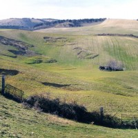
In Italy rainfall are among the main causes of trigger of shallow landslides, that yearly cause fatalities, damage, and severe economic losses. Identification of the amount of rainfall needed to trigger landslides, and the forecasting of rainfall-induced landslides, are of interest for the scientific community, as well as for the whole ...
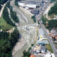
Il progetto GeSeFlu nasce dalla necessità della Regione Lombardia mediante il Piano Operativo Regionale (Direttiva Comunitaria 2000/60/CE) di disporre di specifici Programmi di Gestione dei sedimenti per i sottobacini redatti in attuazione della Direttiva del Comitato Istituzionale dell’Autorità di Bacino del fiume Po (deliberazione n. 9 del 5 aprile ...
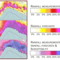
In Italy, landslides are triggered by intense and/or prolonged rainfall. The spatial and temporal forecast of multiple landslides triggered by rainfall in wide areas relies primarily on empirical rainfall thresholds. It is widely believed that the thresholds are influenced by the local topographic (morphological), lithological, soil, and climatic settings. For this reason, it is necessary to define local rainfall thresholds. Reliable local ...
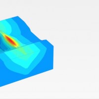
The project AIM-DAMS is aimed at developing a laboratory of integrated and advanced environmental monitoring for the control of the behavior of the earth-dams due to the different factors acting on the dams during their lifetime. Based on the integration of innovative and non-invasive sensors, as well as recent monitoring techniques and numerical modelling, the project is intended to fulfill the need of the dam management agencies of using ...
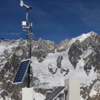
The Planpincieux Glacier is one of the glaciers that characterize the Italian side of the massif of the Grandes Jorasses. It is considered a temperate glacier and its front is currently located near a morphological step that determines a strong propensity to the activation of frequent ice falls in particular during the summer. These phenomena are typical of this glacier, but its particular asset may cause, as already occurred in the past, to ...
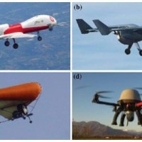
The environment monitoring has several purposes, including the prevention of geo-hydrogeological risks, forest fires, or prevention and suppression of illegal activities. The SMAT-F2 main objective is to define, design and develop an advanced monitoring system of the territory based on innovative unmanned air systems, coordinated by a supervision and coordination station (SSC). The first phase of the project, called SMAT-F1, finished at ...
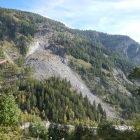
The Mont de La Saxe landslide affects the south-western side of Mont de La Saxe near Courmayeur, Valle d'Aosta. This landslide at present can be considered one of the most critical active landslides in the Italian Alps. The estimated unstable mass is more than eight millions of cubic meters and the main elements at risk are the hamlets of La Palud and Entreves, and the motorway access to the international tunnel of the Mont ...
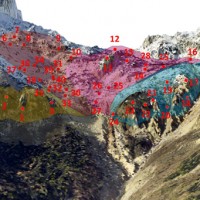
At the beginning of November 2010 exceptional rainfall events stroke the Veneto Region causing the re-activation of the Rotolon landslide which is a serious threat to the town of Recoaro Terme, Vicenza, ...
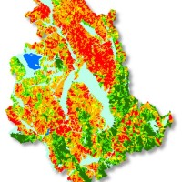
Realizzazione di modelli e carte di suscettibilità da frana tipo scorrimento per il territorio della Regione ...
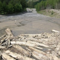
Sediment transport in small mountain catchments (drainage area < 10-20 km2) is a fundamental process for the equilibrium and the dynamics of the whole channel network. At the same time, sediment transport can create high-risk conditions due to the occurrence of extreme phenomena such as debris flow, hyperconcentrated flow, and flood with intense bedload, usually triggered by intense and short duration rainfall. In order to properly manage ...
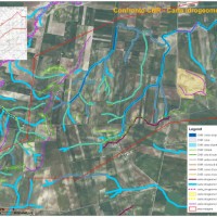
Existing geomorphological maps on the Apulian territory show some inconsistencies, that might have effects as concerns the limits of restriction areas for the location of works. To have available an updated and scientifically sound product, TRE Spa asked CNR IRPI a scientific consultancy for the production of geomorphological ...
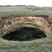
Within the framework of the project “Register of the Caves and Artificial Cavities of Apulia Region” (PO FESR 2007-2016), committed by the Ecology Service to the Apulian Speleological Federation (FSP), this latter involved CNR-IRPI to guarantee high scientific value to the documents to be produced, and to work with the cavers in the different phases of the ...
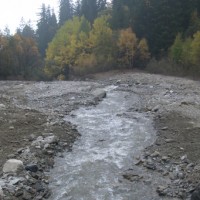
Decision matrices may contribute to mountain watershed management by defining coherent event scenarios that take into account the type of flow processes (e.g., water floods with bedload, debris flows), their geomorphic effects, and the interactions with hydraulic control ...
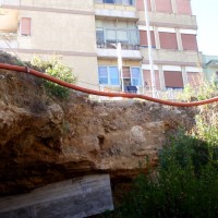
Sinkholes occur as sudden collapses of the ground, related to natural cavities produced by karst processes in soluble rocks, or to man-made cavities deriving from different types of human activities in different historical ages. Sinkholes are widespread all over the world, and the related hazard is extremely high, with very severe damage to built-up areas and human infrastructures, and heavy losses to the ...
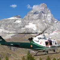
The permafrost degradation is a probable cause of the increase of rock instabilities and rock falls observed in recent years in high mountain areas. It causes the thaw of the ice filling rock discontinuities producing water that subsequently freezes again, inducing stresses that lead to rock falls. Rock-falls are among the most hazardous instability processes in high mountain environments because of their velocity and the difficulty to ...
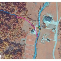
The accurate representation of the channel network is fundamental in cartography. The increasing availability of high-resolution, LiDAR-derived DTMs provides an excellent topographic basis for the representation of the channel network, but requires innovative techniques for managing and processing ...
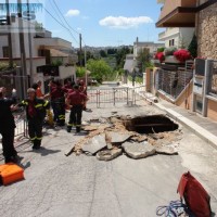
The widespread sinkholes that involve large sectors of the Apulian territory are related to natural cavities produced by karst processes in soluble rocks, or to man-made cavities deriving from different types of human activities in different historical ages. The related hazard is extremely high, with very severe damage to built-up areas and human infrastructures, and heavy losses to the ...
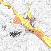
The Tiber River Basin Authority (ABT) and the Umbria Region (Service Water Resources and Hydraulic Risk), considering the verified underestimation of the flood-prone areas in the Paglia River basin provided by the Italian PAI (hydro-geological management plan) and the update of rating curves, decided to revise the hydrological study of the drainage basin in order to re-estimate the flood hazard maps for the Paglia River reach bounded upstream ...

The territory of Calabria is affected by numerous landslides and, more generally, has a strong propensity to develop hydrogeological instability. A measure of this condition is provided by the data of the current PAI, limited to the examined areas (villages and households with more than 200 inhabitants), that identifies over 1700 high-risk situations and more than 700 at very high risk: a total of over 2,400 situations in which a hazard to the ...
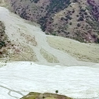
In international literature, it is now widely recognized that alluvial fans are areas of high geomorphic activity. Debris flows and flash floods occur episodically in these environments, and place many communities at high risk. Calabria (southern Italy) is a region where alluvial fans widely occur. In this region, the presence of mountain fronts/alluvial and/or coastal plain, or deep and narrow valleys debouching into larger valleys are key ...
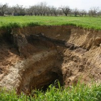
The widespread occurrence of sinkholes related to man-made cavities in Apulia highlights the need to perform a careful reconnaissance of the artificial caves over the whole region, and of their stability conditions. Knowledge of the presence and typology of artificial cavity, and of its main features, is a mandatory step for the mitigation of the sinkhole ...
The project activities were carried out in two phases:
delineation of flooding-prone areas for many river reaches selected in the secondary hydrographic network of Tiber River basin (2009-2011);
analysis of the severe flood event that affected the Paglia river basin on November ...
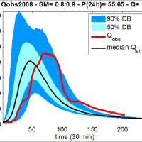
The project activities were carried out in two phases:
"dynamic scenarios of flood risk" identification through hydrologic-hydraulic modeling addressed to Civil Protection activities (2009-2011);
operational implementation of developed dynamic scenarios of flood risk and results dissemination trough web-GIS technologies, also within the context of Floods Directive 2007/60 /EC (2012-203); flood forecasting models implementation; ...
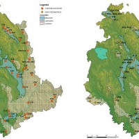
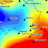
SECLI Project is aimed to assess the combined effects of processes related to natural and anthropogenic climate change on water resources, both surface and groundwater, in the Umbrian territory, identifying the possible consequences of such effects on drinking water policy, and on how these may affect the existing system of withdrawals and ...
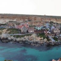
The research project can be included within the context of increasing hydrogeological instability also due to climate change and aims at investigating coastal instability in the island of Malta. This aspect has been until now slightly dealt with, despite significant risk issues, as evidenced from a series of accidents/damages recorded after landslide ...
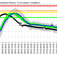
The project activities concern:
development and implementation of: 1) a semi-distributed continuous hydrological model (MISDc) for real-time soil moisture estimate and river discharge prediction in the Upper-Middle Tiber River basin; 2) a flood wave routing model (STAFOM-RCM) for stage hydrograph forecasting at some selected hydrometric stations in the Tiber River basin;
support for installation of soil moisture sensors in the ...
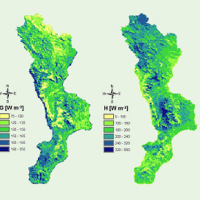
EPSILON Italia, the leader of the partnership proposing the project, is a SME, located in Calabria, specializing in the delivery of advanced services for the protection and management of natural resources, with a high standard of quality and technological content. The SME is also actively involved in the development and implementation of new technologies and in R&D activities conducted both in their own and in partnership with universities ...
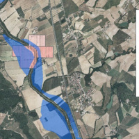
On 25-27 November 2005, the territory of central Italy was affected by heavy rainfall that hit the Tiber River basin and, mainly, the province of Perugia. The meteoric event had a significant phase with a duration of approximately 48 hours with widespread precipitation up to a maximum accumulated value higher than 100 mm. Significant increases in water levels occurred in most rivers of Upper-Middle Tiber
causing extended flooding in ...
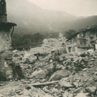
Il progetto presidi soddisfa un’esigenza normativa (D.P.C.M. 27/02/2004) e conoscitiva della Protezione Civile Regionale del Piemonte; diventa uno strumento funzionale all’aggiornamento dei punti di criticità idrogeologica del territorio, individuati e verificati dopo una complessa indagine retrospettiva e lunga concertazione di diversi Enti territoriali competenti, e al loro monitoraggio durante le fasi parossistiche di eventi di piena o ...
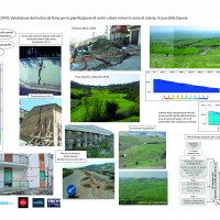
The Strategic Project PS_119 was aimed at developing a methodology for the landslide risk assessment, applicable at the regional scale and based on the most advanced knowledge in the fields of geology, geotechnics, structural engineering and urban planning. This assessment was based on a deterministic approach of the landslide processes and the risks related to them. The failure slope mechanisms, the structural damages due to landsliding and ...
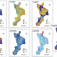
The purpose of Convention contracted between the Research Institute for Geo-Hydrologic Protection (Rende) and the Department of Physics of the University of Calabria for partnership in the Program CE INTERREG IIIB – ARCHIMED – SyNaRMa is to provide: i) the landslide-susceptibility maps for the different rock complexes of Calabria, ii) the definition of some important unstable slopes that can damage urban areas and main roads and railways of ...
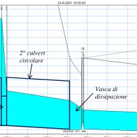
The artificial reservoirs are fundamental for water resources management, by regulating releases to meet the different users request (industrial, irrigation, hydropower, etc.), and for downstream territories floods defence through lamination of critical flood waves.
The main objective of the project concerns the review of hydrological-hydraulic studies carried out for the Montedoglio dam, on Tiber River, Casanuova dam, on Chiascio River, ...
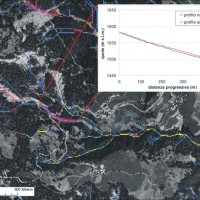
The assessment debris-flow hazard is of utmost importance in the management of alpine catchments. The analysis of morphometric variables of drainage basins and channels can contribute to preliminary assessment of debris-flow hazard at regional ...
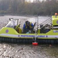
The study of the evolution of the watercourses is traditionally based on the use of historical maps and aerial photographs for the comprehension of the planimetric changes and on the use of topographical sections in order to have also the measure of the altimetric change occurred in the considered time interval.
Through this approach it is possible, for the Po basin, to have the first indications of the main watercourses evolution starting ...
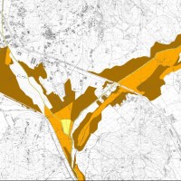
The activities of the project concern the delineation of hazard maps for return periods of 50, 100, 200 and 500 years for many reaches of interest identified in the secondary hydrographic network of Tiber ...
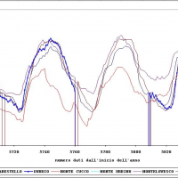
The activities of the project concerns the analysis and processing of hydro-meteorological data collected by the monitoring network of the Umbria Region for the period 1994-2014. In particular, the study regards the rainfall, temperature and water level time series. In addition, the discharge series corresponding to observed water levels are estimated for at hydrometric station through the rating curve estimated on the basis of flow velocity ...
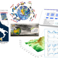
Rainfall-induced shallow landslides and floods are the most common and dangerous natural hazards, mainly due to their high temporal frequency, which causes fatalities and high economic damage worldwide. Climate changes will exacerbate this critical framework since an increase in extreme weather events is ...
 Climate change has a powerful impact on high-altitude Alpine sectors and glaciers. This impact often turns into an increase in instability processes that can lead to very high-risk conditions. These risk conditions can significantly affect the usability of areas characterized by intense tourist flows, making risk management very ...
  Geo-Hydrological risks are one of the main sources of economic losses for our country causing a huge number of victims and damages. From 1966 to 2015, landslides and floods caused 1948 casualties, 3524 injured and more than 412,000 displaced people. The Venetian mountain has always been subject to major landslides and, almost every year, new emergencies occur with the intensification of the autumn and spring rains, which are increasing due to ...
  The topic of low geothermal enthalpy is crucial as a strategy to mitigate and adapt to climate change.
With this in mind, the structuring of environmental knowledge and information on the topic of low geothermal enthalpy in its various forms and a test site activity to deepen current knowledge on the regulatory context and on the effects on subsoil and on groundwater of geothermal plants is envisaged on a territorial ...
  Among all types of landslide phenomena present in Alpine environment, the rockfalls are certainly the most impacting, because they also are extremely widespread. Rockfall are very difficult to monitor and they are often managed exclusively through the execution of active or passive works aimed at risk mitigation. Due to the rockfalls impulsive behavior, it is a difficult task to locate them a priori. The problem of rockfalls can be approached ...
  The R&D project SMoRI starts from two needs to be reconciled. The first, coming from the scientific community, concerns a best definition of integrated monitoring systems aimed at controlling the conditions of high geo-hydrological risk. The second need is to acquire by the industrial partners a specialized know-how on new technologies related to Cloud Computing and I.o.T. and on the environmental ...
  The management of emergencies, in particular those determined by natural events, is complex and must be able to use all the available cognitive elements. During emergencies, it is possible to acquire useful data regarding the processes that determine the same emergencies. These data can contribute to significantly improve planning and design of prevention ...
  The improved understanding of the underlying physical processes of extreme events is closely linked to the development and verification of procedures to better control, analysis and validation of hydrological data for the description and visualization of meteorological events creating an operational "database of event" which enables to better identify under what conditions hazards ...
  The Apulia region is affected by multiple types of geo-hydrological instability processes such as sinkholes, flash floods and landslides.
Landsliding mainly affects the north-western sector of the Region (bordering with Apennine chain) and the sea rocky cliffs.
The sub-Appennine Daunia portion of the Region is exposed to landslide risk due to hydro-geological setup of the soil/rock deposits, the poor mechanical properties of the ...
  In recent years, following short and intense meteoric events, along the railway line of the Department of Reggio Calabria, there have been a series of interruptions in correspondence of basins below 3-4 km2. Based on the current procedures for risk mitigation in RFI, in the event of a "red alert" issued by the Civil Protection, RFI management locate along the railway line personal in correspondence of the area in question. This procedure is ...
  The Aosta Valley region presents a landscape almost totally occupied by mountain. In this context, a number of meaningful landslides is present, which vary from rock falls to deep-seated gravitational slope deformation (DsGSD), passing for the complex landslides. The study of these phenomena, finalized to guarantee suitable standard of safety and to facilitate a compatible development, results a fundamental necessity for this ...
  Some areas mapped in the Piani di Assetto Idrogeologico (Watershed Management Plan) of Piave, Brenta-Bacchiglione and Livenza Rivers require specific studies aimed at assigning a degree of hazard. Among the warning areas, there are numerous alluvial fans. The Soil Conservation Division of Veneto Region, in charge of the inquiry, identified the need to find an objective method for assessing the hazard of such ...
  Environmental sensor monitoring is continuously developing, both in terms of quantity (i.e. measurement sites), and quality (i.e. technological innovation). Environmental monitoring is carried out by either public or private entities for their own specific purposes, such as scientific research, civil protection, support to industrial and agricultural activities, services for citizens, security, education and information.
The left Cenischia ...
  The project AIM-DAMS is aimed at developing a laboratory of integrated and advanced environmental monitoring for the control of the behavior of the earth-dams due to the different factors acting on the dams during their lifetime. Based on the integration of innovative and non-invasive sensors, as well as recent monitoring techniques and numerical modelling, the project is intended to fulfill the need of the dam management agencies of using ...
  The Planpincieux Glacier is one of the glaciers that characterize the Italian side of the massif of the Grandes Jorasses. It is considered a temperate glacier and its front is currently located near a morphological step that determines a strong propensity to the activation of frequent ice falls in particular during the summer. These phenomena are typical of this glacier, but its particular asset may cause, as already occurred in the past, to ...
  The environment monitoring has several purposes, including the prevention of geo-hydrogeological risks, forest fires, or prevention and suppression of illegal activities. The SMAT-F2 main objective is to define, design and develop an advanced monitoring system of the territory based on innovative unmanned air systems, coordinated by a supervision and coordination station (SSC). The first phase of the project, called SMAT-F1, finished at ...
  The Mont de La Saxe landslide affects the south-western side of Mont de La Saxe near Courmayeur, Valle d'Aosta. This landslide at present can be considered one of the most critical active landslides in the Italian Alps. The estimated unstable mass is more than eight millions of cubic meters and the main elements at risk are the hamlets of La Palud and Entreves, and the motorway access to the international tunnel of the Mont ...
  Within the framework of the project “Register of the Caves and Artificial Cavities of Apulia Region” (PO FESR 2007-2016), committed by the Ecology Service to the Apulian Speleological Federation (FSP), this latter involved CNR-IRPI to guarantee high scientific value to the documents to be produced, and to work with the cavers in the different phases of the ...
  Sinkholes occur as sudden collapses of the ground, related to natural cavities produced by karst processes in soluble rocks, or to man-made cavities deriving from different types of human activities in different historical ages. Sinkholes are widespread all over the world, and the related hazard is extremely high, with very severe damage to built-up areas and human infrastructures, and heavy losses to the ...
  The accurate representation of the channel network is fundamental in cartography. The increasing availability of high-resolution, LiDAR-derived DTMs provides an excellent topographic basis for the representation of the channel network, but requires innovative techniques for managing and processing ...
  The widespread sinkholes that involve large sectors of the Apulian territory are related to natural cavities produced by karst processes in soluble rocks, or to man-made cavities deriving from different types of human activities in different historical ages. The related hazard is extremely high, with very severe damage to built-up areas and human infrastructures, and heavy losses to the ...
  The Tiber River Basin Authority (ABT) and the Umbria Region (Service Water Resources and Hydraulic Risk), considering the verified underestimation of the flood-prone areas in the Paglia River basin provided by the Italian PAI (hydro-geological management plan) and the update of rating curves, decided to revise the hydrological study of the drainage basin in order to re-estimate the flood hazard maps for the Paglia River reach bounded upstream ...
  In international literature, it is now widely recognized that alluvial fans are areas of high geomorphic activity. Debris flows and flash floods occur episodically in these environments, and place many communities at high risk. Calabria (southern Italy) is a region where alluvial fans widely occur. In this region, the presence of mountain fronts/alluvial and/or coastal plain, or deep and narrow valleys debouching into larger valleys are key ...
  The widespread occurrence of sinkholes related to man-made cavities in Apulia highlights the need to perform a careful reconnaissance of the artificial caves over the whole region, and of their stability conditions. Knowledge of the presence and typology of artificial cavity, and of its main features, is a mandatory step for the mitigation of the sinkhole ...
  The project activities were carried out in two phases:
"dynamic scenarios of flood risk" identification through hydrologic-hydraulic modeling addressed to Civil Protection activities (2009-2011);
operational implementation of developed dynamic scenarios of flood risk and results dissemination trough web-GIS technologies, also within the context of Floods Directive 2007/60 /EC (2012-203); flood forecasting models implementation; ...
  SECLI Project is aimed to assess the combined effects of processes related to natural and anthropogenic climate change on water resources, both surface and groundwater, in the Umbrian territory, identifying the possible consequences of such effects on drinking water policy, and on how these may affect the existing system of withdrawals and ...
  The project activities concern:
development and implementation of: 1) a semi-distributed continuous hydrological model (MISDc) for real-time soil moisture estimate and river discharge prediction in the Upper-Middle Tiber River basin; 2) a flood wave routing model (STAFOM-RCM) for stage hydrograph forecasting at some selected hydrometric stations in the Tiber River basin;
support for installation of soil moisture sensors in the ...
  EPSILON Italia, the leader of the partnership proposing the project, is a SME, located in Calabria, specializing in the delivery of advanced services for the protection and management of natural resources, with a high standard of quality and technological content. The SME is also actively involved in the development and implementation of new technologies and in R&D activities conducted both in their own and in partnership with universities ...
  On 25-27 November 2005, the territory of central Italy was affected by heavy rainfall that hit the Tiber River basin and, mainly, the province of Perugia. The meteoric event had a significant phase with a duration of approximately 48 hours with widespread precipitation up to a maximum accumulated value higher than 100 mm. Significant increases in water levels occurred in most rivers of Upper-Middle Tiber
causing extended flooding in ...
  Il progetto presidi soddisfa un’esigenza normativa (D.P.C.M. 27/02/2004) e conoscitiva della Protezione Civile Regionale del Piemonte; diventa uno strumento funzionale all’aggiornamento dei punti di criticità idrogeologica del territorio, individuati e verificati dopo una complessa indagine retrospettiva e lunga concertazione di diversi Enti territoriali competenti, e al loro monitoraggio durante le fasi parossistiche di eventi di piena o ...
  The artificial reservoirs are fundamental for water resources management, by regulating releases to meet the different users request (industrial, irrigation, hydropower, etc.), and for downstream territories floods defence through lamination of critical flood waves.
The main objective of the project concerns the review of hydrological-hydraulic studies carried out for the Montedoglio dam, on Tiber River, Casanuova dam, on Chiascio River, ...
  The activities of the project concerns the analysis and processing of hydro-meteorological data collected by the monitoring network of the Umbria Region for the period 1994-2014. In particular, the study regards the rainfall, temperature and water level time series. In addition, the discharge series corresponding to observed water levels are estimated for at hydrometric station through the rating curve estimated on the basis of flow velocity ...


