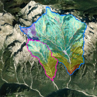
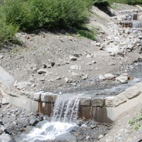
Mass wasting is a threat to residential areas and infrastructure, causing widespread destabilization in alpine stream channels, also in relation to ongoing climatic changes. Although hillslope sediment supply represents a critical factor for stream channel stability during heavy rainstorms, there is a general lack of procedures for quantifying sediment availability and composition. Moreover, we lack validated empirical models for estimating ...
The MUHA project is building upon the idea to address disaster management cycle consisting of preparedness-response-mitigation-rebuild components in the ADRION countries. It will connect the observed and modelled hazards and risks related to the integrated water cycle, by effectively join them with the existing and improved coping capacity developed by national, bilateral and EU Civil Protection ...
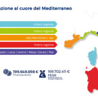
The ADAPT project, co-funded by the Interreg Italy-France Maritime Program 2014-2020, aims to adapt the Italian and French cities of the Upper Tyrrhenian to the consequences of climate change, with particular reference to the urban flash floods caused by intense meteorological ...
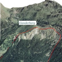
A Deep-seated Gravitational Slope Deformation (DGSD) affects the south-west flank of mount Ganderberg (Moso in Passiria – BZ). The continuous displacements of the landslide induce secondary hazardous phenomena. A 800.000 m3 rock slab shows signs of incipient movement; a detachment could create a natural barrier on the river ...
Debris-flow monitoring in instrumented areas is an invaluable way to gather field data that may improve the understanding of these hazardous phenomena, as well as for the development of warning systems. The number of monitoring sites and the amount of recorded data on debris flows, however, still remain limited if compared to landslides and fluvial sediment transport. This motivated the Autonomous Province of Bozen-Bolzano to implement a new ...
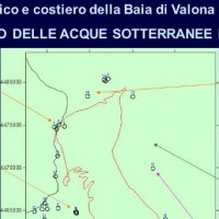
The project CISM faces problems related to marine Albanian waters in view of the Adriatic basin, which must meet various environmental problems in other portions of the Adriatic Sea, which are still influenced by the contribution of Albanian waters. CISM is not only a time of growth of the scientific culture of Albania, but also a landmark in the international scenario of the Adriatic ...
The project considered the strong demand of local institutions to select the best existing practices, in relation to different national and local characteristics, considering the regulatory ...
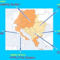
Hydrometeorological monitoring and flood forecasting are indispensable in preventing hydraulic hazard and ensuring civil protection. Implementing a sustainable plan to combat floods requires further activities, such as best practices for agricultural, forestry and land use management in flood risk areas. Methodologies must be developped within a transnational context, transending local ...
The RISK-AWARE project contributed to at fostering our collective ability to forecast the consequences of severe meteorological conditions, including high intensity and prolonged rainfall periods. For the purpose, geological/geomorphological models that predict the location and timing of landslides, or the propensity of a territory to generate slope failures, are of primary ...
