16 services found
Crowdmapping of earthquake induced rock falls
Making reports of rockfall in the area affected by the earthquake in central Italy in 2016.
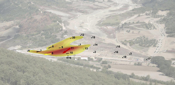
Threedimensional Displacement Analysis
The 3DA software is a new procedure that allows retrieving in near-real-time 3D surface deformation models starting from data acquired via robotized total stations or others system that acquire the…

Aerofototeca
The CNR IRPI archive preserves 170.000 aerial photographs useful for stereoscopic applications. Most part of those photographs were taken during a number of surveys carried out between 1954 and 2005…
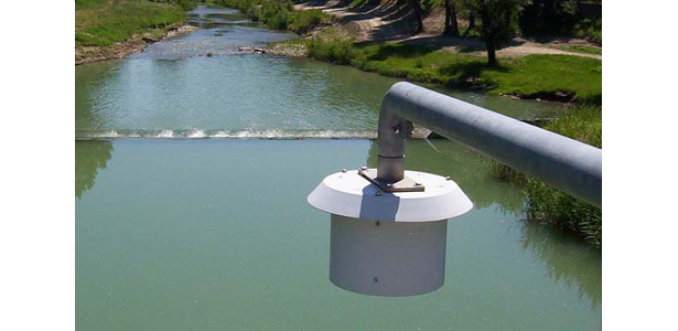
Hydro-meteorological Monitoring
The hydro-meteorological monitoring is the operational tool for the measures of atmospheric, hydrologic ad hydraulic variables characterizing the hydrological cycle and it represents the grounds of IRPI’s research activities finalized…

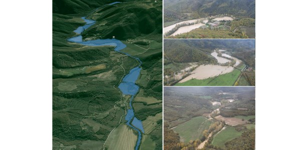
Hydrological-hydraulic validation of satellite data
The service aims to assess the potential of different satellite products (from active and passive micro-waves, optical, SAR, spectroradiometers, radiometers sensors) in retrieving the main hydrological-hydraulic variables such as rainfall,…
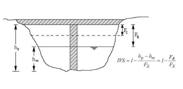
Levees and bridges vulnerability
Assessment of bridge piers/abutments vulnerability to scour and overtopping hazard, assessment of levee vulnerability to seepage and overtopping hazard. The analysis is based on clearly identified criteria. Specifically, overtopping (IVS)…
Flood events analysis
The service is based on a procedure consisting of four main steps: the analysis of hydro-meteorological data for the reconstruction of flood event in terms of precipitations and saturation conditions…

Climate change impact on extreme events
The service analyzes the climate change impact on the main hydro-meteorological variables involved in the hydrological cycle and, in particular, on extreme events of rainfall and discharge (droughts and floods).…

Aerial and terrrestrial LiDAR surveys
The study of the evolution of the territory and especially of the of geo-hydrological instabilities can be often based on the use of high resolution digital terrain models. The possibility…
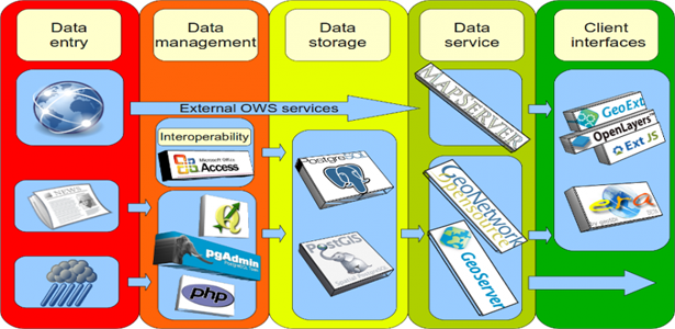
Cartographic web services
We provide maps and layers through standard OGC services and WebGIS applications. Our aim is to disseminate information on landslides and floods hazards and the related risk. More specifically the services focus on…
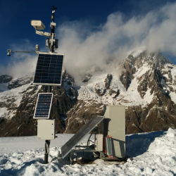
Landslide monitoring
Following the recent technological development, the role of landslides monitoring has become increasingly important, especially for the study and management of large landslides in emergency scenarios. In the last decades,…
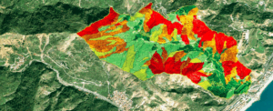
Landslide Susceptibility Models and Maps
A landslide susceptibility map forecasts where landslides are expected to occur in the future based on terrain conditions, including local morphological, geological, and land use settings. Using different colors, a…
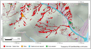
Event Landslide Inventory Map
An Event Landslide Inventory Map (ELIM) shows the location and extent of landslides caused by a specific natural trigger, such as an intense rainfall event, a period of prolonged rainfall,…

Landslide Inventory Map
A Landslide Inventory Map (LIM) shows the location, spatial extent and type of landslides in a region

SANF – Sistema di Allerta Nazionale per la previsione di Frane indotte dalla pioggia in Italia
SANF is a landslide early warning system based on the comparison between rainfall measurements and forecasts and empirical rainfall thresholds. Specifically, the system consists of three components: (i) for rainfall…