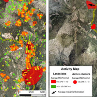
The project is focused on monitoring geohazard-associated ground deformations, a key prevention action specifically addressed to urban areas and critical infrastructures. The project will propose a procedure to produce maps to assess continuously the potential impact of geohazard activity. These maps will provide inputs to support early warning, giving information on the stability of the monitored areas and to evaluate the expected ...
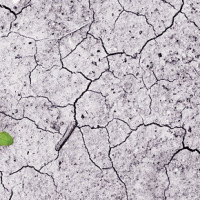
Climate change strongly impacts the whole European territory. Drought severely affects agriculture; precipitation extremes are associated with flooding, severe damage to properties and lives; temperature extremes can increase mortality; the seasonality and availability of snow affects water resources and winter tourism; wind speed or sunshine hours affect the production of renewable energy. These relations can be studied through the computation ...
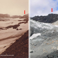
The project focuses on climate predictions from seasonal-to-decadal timescales for the Mediterranean region (here defined as the domain encompassing the Mediterranean basin and the surrounding areas), and their applications in different sectors. The IRPI contribution will cover this aspect of the project, with specific reference to the conditions and evolution of cryosphere resources (WP4, Task ...

SAFETY aims at providing Civil Protection Authorities with the capability of periodically evaluating and assessing the potential impact of geohazards (volcanic activity, landslides and subsidence) on urban areas. The project improves the effort to detect and map geohazards, assess their activity and evaluate their impact on built-up areas and infrastructures ...
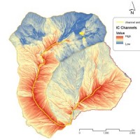
Water and sediment connectivity has emerged in recent years as a significant conceptual framework for understanding the transfer of surface water and sediment through landscapes. Connectivity can be seen both as a driver of hydrological and geomorphic processes within a catchment and as an emergent catchment property that is the result of processes acting at different ...

The responsibilities within natural hazards involve citizens and volunteers as first actors of civil protection. The prevention implicates technical volunteers, but the priority implies now awareness of local citizens. The involvement of population creates context-specific strategies of territorial surveillance and management. MAppERS empowers “crowd-sourced mappers” through smart phone applications and sensors, with geo-tagged information, ...
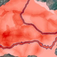
FLIRE is a demonstration project aiming to the development of an integrated Decision Support System (DSS) for both flash floods and forest fires risk assessment and management. The DSS tool will be designed by using state of art tools, technologies and methods and taking into account prevention, adaptation and interaction issues. The final model will be online available to key stakeholders and relevant authorities (local and national) for the ...
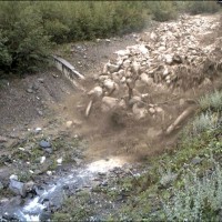
The understanding of the changing equilibrium between sediment supply from upstream and sediment transport capability of a river is important for the success of integrated water resource management. In Alpine river basins, intensive sediment transport processes and sediment continuity have a notable impact on several water management issues posing multiple use conflicts related to hydropower, ecology, flood control ...
ABOT is one of the Pilot projects on Development of Prevention Activities to Halt Desertification in Europe, partly funded by DG Environment of the European Commission. The objective of the pilot projects is to support the development of concrete pilot initiatives on innovative technologies, techniques or practices in order to contribute to the exchanges of good practice and innovation for halting the desertification in ...
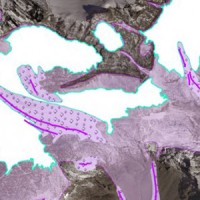
The project is included in Operative Program of the European cross-border territorial cooperation "Alcotra 2007-2013". It brings together specialized scientific expertise Italian and French that deal to study the mountain and its dangerousness. It is divided into a part of studies conducted on the entire framework of the Western Alps and in actions on the pilot sites identified by the ...
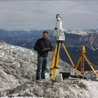
Permafrost is very sensitive to climate change and the risks associated with its degradation affect traffic routes, settlements and infrastructure. Data on the distribution of permafrost are inconsistent and there is no common strategy to tackle this problem. Local administrators should have the means to manage the risks associated with the degradation of the ...
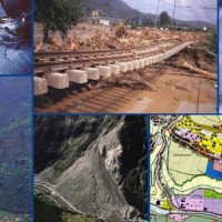
The observed increase in disastrous events over the last decades, associated with a low perception of risk by the communities involved, along with the lack of efficient, socially accepted and environmentally sound remedial measures are amongst the motivation behind this research project. The adaptation of a combined multi-risk-oriented analysis, in which the investigations focus more on the interdependence of events rather than on single event, ...
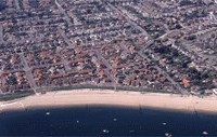
‘Response’ (or ‘Responding to the risks from climate change’) is a three-year Project supported by the LIFE financial instrument of the European Community, completed in December 2006. The Project provides a framework for understanding and preparing for the impacts of climate change around the European ...
 Climate change strongly impacts the whole European territory. Drought severely affects agriculture; precipitation extremes are associated with flooding, severe damage to properties and lives; temperature extremes can increase mortality; the seasonality and availability of snow affects water resources and winter tourism; wind speed or sunshine hours affect the production of renewable energy. These relations can be studied through the computation ...
  The project focuses on climate predictions from seasonal-to-decadal timescales for the Mediterranean region (here defined as the domain encompassing the Mediterranean basin and the surrounding areas), and their applications in different sectors. The IRPI contribution will cover this aspect of the project, with specific reference to the conditions and evolution of cryosphere resources (WP4, Task ...
  SAFETY aims at providing Civil Protection Authorities with the capability of periodically evaluating and assessing the potential impact of geohazards (volcanic activity, landslides and subsidence) on urban areas. The project improves the effort to detect and map geohazards, assess their activity and evaluate their impact on built-up areas and infrastructures ...
  Water and sediment connectivity has emerged in recent years as a significant conceptual framework for understanding the transfer of surface water and sediment through landscapes. Connectivity can be seen both as a driver of hydrological and geomorphic processes within a catchment and as an emergent catchment property that is the result of processes acting at different ...
  The responsibilities within natural hazards involve citizens and volunteers as first actors of civil protection. The prevention implicates technical volunteers, but the priority implies now awareness of local citizens. The involvement of population creates context-specific strategies of territorial surveillance and management. MAppERS empowers “crowd-sourced mappers” through smart phone applications and sensors, with geo-tagged information, ...
  FLIRE is a demonstration project aiming to the development of an integrated Decision Support System (DSS) for both flash floods and forest fires risk assessment and management. The DSS tool will be designed by using state of art tools, technologies and methods and taking into account prevention, adaptation and interaction issues. The final model will be online available to key stakeholders and relevant authorities (local and national) for the ...
  The understanding of the changing equilibrium between sediment supply from upstream and sediment transport capability of a river is important for the success of integrated water resource management. In Alpine river basins, intensive sediment transport processes and sediment continuity have a notable impact on several water management issues posing multiple use conflicts related to hydropower, ecology, flood control ...
  ABOT is one of the Pilot projects on Development of Prevention Activities to Halt Desertification in Europe, partly funded by DG Environment of the European Commission. The objective of the pilot projects is to support the development of concrete pilot initiatives on innovative technologies, techniques or practices in order to contribute to the exchanges of good practice and innovation for halting the desertification in ...
  The project is included in Operative Program of the European cross-border territorial cooperation "Alcotra 2007-2013". It brings together specialized scientific expertise Italian and French that deal to study the mountain and its dangerousness. It is divided into a part of studies conducted on the entire framework of the Western Alps and in actions on the pilot sites identified by the ...
  Permafrost is very sensitive to climate change and the risks associated with its degradation affect traffic routes, settlements and infrastructure. Data on the distribution of permafrost are inconsistent and there is no common strategy to tackle this problem. Local administrators should have the means to manage the risks associated with the degradation of the ...
  The observed increase in disastrous events over the last decades, associated with a low perception of risk by the communities involved, along with the lack of efficient, socially accepted and environmentally sound remedial measures are amongst the motivation behind this research project. The adaptation of a combined multi-risk-oriented analysis, in which the investigations focus more on the interdependence of events rather than on single event, ...


