
NSPO Projects
Spectral signatures library for semi-automatic event landslide recognition and mapping
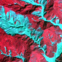 Earthquakes and strong rainfall precipitations, cause worldwide landslide. Inventories of the ground effects of an event must be prepared in a few days or less for the residual risk management. Satellite images and image analysis techniques have started to back up traditional mapping methods. Purpose of this project is to increase the automatization of image ...