
Landslide monitoring Innovative methods and instruments
Background
The development of new systems for monitoring of landslides is often the synthesis of geomatics and applied geology. In particular, the development of innovative low-cost systems must have a strong geomatics and technological component supported by the definition of required elements done by end users (engineering geologists). The development of low-cost monitoring systems can represent a strategic choice, above all, to guarantee an increasing diffusion of monitoring units able to measure the deformations of a given slope.
Purpose
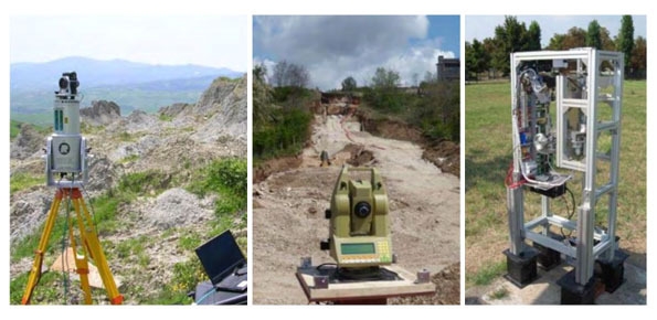
The development of low-cost monitoring systems based on GNSS and photogrammetric technologies. The project’s primary objective is the development of low-cost GNSS monitoring stations with single-frequency receivers.
Results
The project allowed the development and application of a composite methodology for the landslide monitoring which consists of low-cost monitoring units and UAV for the periodic monitoring of the evolution of five case studies located in northern Piedmont.
Products
A low-cost GNSS monitoring unit with mass market low cost single frequency receivers was developed. UAVs were also used for the development of methodologies for the periodic monitoring of landslides.
 Internal contact person: daniele giordan -