Flooding-prone areas delineation for hydraulic risk assessment for river reaches of the secondary hydrographic network in Tiber river basin
Background
The activities of the project concern the delineation of hazard maps for return periods of 50, 100, 200 and 500 years for many reaches of interest identified in the secondary hydrographic network of Tiber River
Purpose
Flooding-prone areas delineation for return period of 50, 100, 200 and 500 years.
Methods
The flooding-prone areas have been identified through a procedure based on three main steps:
- knowledge of the territory: acquisition of the cartography of the areas potentially affected by flooding, physiographic and geo-morphological characteristics of the hydrographic network and drainage catchment;
- hydrological analysis: addressed to evaluate the maximum flow discharge and the corresponding volumes in river sections of interest and for flood events with return period equal to 50, 100, 200 and 500 years. To estimate the design hydrograph, we used both the empirical approaches and a procedure based on a conceptual semi-distributed rainfall-runoff model implemented and tested for several basins of Upper-Middle Tiber with sizes ranging from few tens km2 up to several hundred km2.
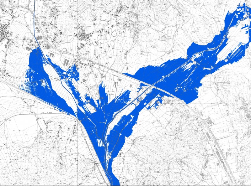
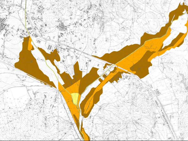
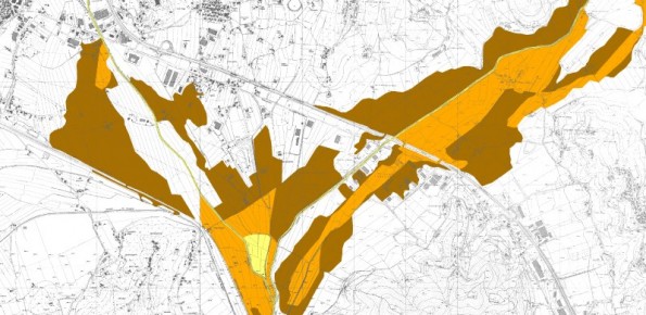
- hydraulic analysis: addressed to evaluate the flood routing process in the selected river reaches and the areas affected by flooding. The study has been carried out through one and/or two-dimensional hydraulic modelling depending on the complexity and the hydraulic-morphological characteristics of the investigated case studies.
Results
Flood hazard maps for return period equal to 50, 100, 200 and 500 years.