
Agreement with the Ligurian Regional Agency for Environmental Protection (ARPAL)
Experimentation, validation and development of the regional warning system for the forecast of rainfall-induced landslides in Liguria
Background
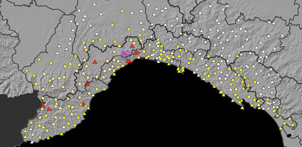
Since 2013, CNR IRPI went in with the collection of information on rainfall events that have resulted in landslides in the Liguria region. Rainfall thresholds can be used in early warning systems for the prediction of the occurrence of rainfall-induced landslides. To respond to a request of the Italian national Department for Civil Protection (DPC), CNR IRPI designed and developed SANF, an Italian acronym for National Early Warning System for Rainfall Induced Landslides. SANF forecasts the possible occurrence of landslides by comparing rainfall measurements and forecasts with empirical rainfall thresholds at national scale. On a regional scale, since 2013 the CNR IRPI has developed the SARF Liguria (Regional Early Warning System for Rainfall Induced Landslides in Liguria) for the Centro Funzionale Meteo-Idrologico di Protezione Civile (CFMI-PC). The system compares the regional threshold with the rainfall measurements recorded by the regional rain gauge network (OMIRL, Osservatorio Meteo Idrologico of the Liguria Region) managed by the CMFI-PC and with the rainfall forecast provided by ARPAL (Regional Agency for the Protection of the Ligurian Environment).
Purpose
Goals of the project are:
- The collection, organization and analysis of information on rainfall-induced landslides in the Liguria Region for the validation of the SARF Liguria.
- The design and implementation of a database for the collection, management and interrogation of spatial data related to landslide events in Liguria.
- Analysis and integration of radar data in the forecast of rainfall-induced landslides in the SARF Liguria.
- The creation of the susceptibility map of the regional territory.
- The validation of the SARF Liguria forecasts
Methods
Information on rainfall-induced landslides is obtained searching mainly from chronicle sources (national and local newspapers available online), technical reports of landslide events compiled by local civil protection authorities. Information is stored in a database. The database structure has been implemented to be compatible with the Flood Directive 2007/60 / CE and with the INSPIRE Directive (Directive Infrastructure for Spatial Information in Europe).
The data structure of the SARF Liguria is based on the use of measured and forecasted rainfall data imported from the platform for the management of geospatial data of the DPC.
For statistical modeling of susceptibility, the open-source code LAND-SE developed by CNR IRPI and described in Rossi & Reichenbach (2017) was used.
Results
The SARF Liguria has been upgraded by implementing:
- a new algorithm for the possible landslide initiation, which uses the rain estimates provided for the 3, 6, 12, 24 and 48 hours after the calculation time;
- a new graphical interface with additional features and maps, in order to make the information available to the civil protection operator as complete as possible, both during the forecast phase and during the monitoring phase;
- a measured rainfall product, obtained by combining the rainfall measurements with the rain estimates provided by the Monte Settepani (SV) radar;
- a new map of landslide susceptibility with ground resolution of 25 m.
Furthermore, the CNR IRPI has built and implemented a database structure capable of recording, organizing and managing non-homogeneous information on landslides and floods, historical or recent, which have or have not caused damage to the population, structures and infrastructures.
Products
- Catalogue of rainfall events that triggered landslides in Liguria from 2004 to 2018;
- Database for the recording, organization and management of non-homogeneous information on landslides and floods, historical or recent, which have or have not caused damage to the population or to structures / infrastructures.
- Update of the SARF Liguria system with a new graphical interface and new calculation algorithms, including landslide forecasts at 3, 6, 12, 24 and 48 hours and forecasts using the estimated rainfall from radar.
- New susceptibility map on a regional scale
Conclusions
We expect that the results of the SARF Liguria project may contribute to mitigate – through prevention – landslide risk reducing the number of fatalities and injured people caused by rainfall-induced landslides in the Liguria region.


 Internal contact person: maria teresa brunetti -