Theme: Landslide
EGMS data in PAI planning tools
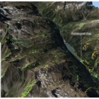 In recent decades, InSAR data has been extremely helpful in identifying and delineating active landslides, as well as enhancing our understanding of geo-hydrological instability. However, due to the complexity and limitations of interpreting InSAR data, there is a need for guidelines to facilitate its operational use in detecting slow landslide ...
 Prediction of Rainfall-INduced landslides – Improving multi-scale TerritoriAL Early warning through aRTificial intelligence
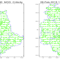
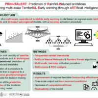 Predicting the occurrence of rainfall-induced landslides is a crucial task for civil protection purposes. Several landslide early warning systems are currently operating worldwide at different spatial scales. In Italy, landslide alerts are issued for territorial units named Alert Zones, covering a few thousand km². Usually, regional-scale warning models rely on rainfall thresholds, which require a few parameters and provide clear results in ...
 Gestione delle Monografie Operative relative ai grandi fenomeni franosi inseriti nella rete di monitoraggio della regione autonoma Valle d’Aosta
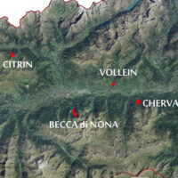 The Aosta Valley is a small alpine region affected by numerous landslides, varying in size and type, ranging from isolated rock falls to rotational/translational slides up to extensive deep landslides. The study of such landslides, functional to a more effective risk management and to guarantee adequate safety standards, represents a primary necessity for a mountain territory like this ...
 Analisi di rischio di flusso della rete di monitoraggio delle frane della regione Lombardia
Geological-geotechnical monitoring systems are one of the most effective tools for landslide characterization, both in terms of landslide detection and for monitoring purposes. The regional monitoring network of Regione Lombardia represents an exemplary case in Italy, with as many as 44 landslides monitored, of which more than half in real time.
The management of monitoring networks and early warning systems represents a complex component, in ...
Which characteristics should optical satellite images have to detect and map landslides? It depends …
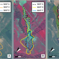 Landslides leave discernible signs on the land surface, most of which can be captured in remote sensing images. On the images the signs appear as modification of the photographic characteristics as tone, colour, mottling and texture, or/and as modification of morphological characteristics including shape, curvature, convexity and concavity. These signs are the landslide signature. Trained geomorphologists analyse remote sensing images and map ...
 Effects of climate change on landslides
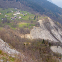 Worldwide, landslides pose a serious threat to the population, causing fatalities, widespread damages, and significant economic losses. Different phenomena influence the stability of slopes and can cause landslides, among which the main factor is rainfall. Rainfall is strongly controlled and influenced by climate and its variations. Therefore, it is to be expected that climate changes influence slope stability at different temporal and ...
 What’s underneath?
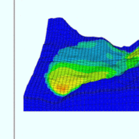 When soil behaviour is studied, whether landslide soils are concern, levee materials or foundations, the problem regarding how much and how reliable information about the soil properties we have available has to be addressed.
Understanding “what’s beneath” the visible surface is fundamental, yet complicated. Drillings are performed to analyse the stratigraphy of soils (the order and the thickness of the different soil levels) and ...
 Damaging geo-hydrological events in Calabria from 1990 to 1999
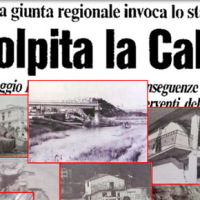 We published a book entitled “Eventi alluvionali in Calabria nel periodo 1990-1999” (Alluvial events in Calabria from 1990 to 1999)
Link to the Book»
The volume is the result of a study that lasted more than a year, and was part of long-lasting research effort to investigate historical landslide and flood events in Calabria, which started in the ‘70s of last century.
To search the information, we went to the Public Provincial ...
 Historical landslides and floods in Calabria
 Landslides and floods tend to hit places that by their nature and geographic location are more likely than others to be damaged. Knowing the location of these places, and how they have been affected in the past by landslides and floods, allows to draw damage scenarios for possible future events.
For years, we have studied historical landslide and flood events in Calabria. Our investigations have allowed us to reconstruct a unique historical ...
 How we map landslides
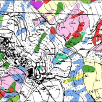 A landslide is the movement of a mass of rock, debris or earth along a slope under the influence of gravity.
Landslides pose serious threats in many areas of the world, and knowing their location, distribution and classification is important for land use planning. Landslide identification and mapping is a fundamental activity for an effective defence from the damage caused by landslides to the population and to structures and the ...
 Landslides in the Solar System
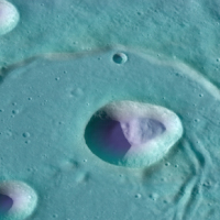 On Earth, landslides are hazardous phenomena often associated with economic damage and loss of human lives. The most common natural triggers of terrestrial landslides are intense or prolonged rainfall, earthquakes, rapid snow melting, and volcanic activity. But what are the main natural triggers of landslides on other solid bodies of the Solar System?
Since the early 70’s of the last century, landslides were observed on the surface of the ...
 Kinematics of slow-moving active landslides
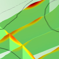 We experiment the application of 3D numerical modelling techniques for the analysis of the kinematics of slow-moving active landslides. The activity assesses the hazards posed by slow-moving landslides, determines the factors controlling the slope processes, investigates the potential evolution of the active slopes, and helps selecting appropriate slope mitigation strategies.
We exploit modern numerical modelling techniques based on finite ...
 Forecasting rainfall-induced landslides
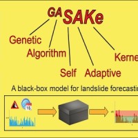 We developed GASAKe, Genetic Algorithm-based Self-Adaptive Kernel, a new model to predict the time of occurrence of rainfall induced landslides.
GASAKe predicts the time of occurrence of single landslides or groups of similar landslides, both shallow and deep-seated, using a threshold than when exceeded determines the initiation of the landslides. The triggering threshold is defined using historical information on rainfall and ...
 Earthquake-induced landslides
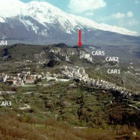 Landslides and earthquakes are important geological hazards in Italy, where mountains and hills dominate a landscape characterized by the presence of weak geological materials. The geological and morphological settings result in high susceptibility to landslides under seismic conditions. Italy is also one of the most active tectonic regions in Europe; and seismic shaking is known to have caused landslides in Italy.
Numerous historical ...
 Where we should not expect landslides?
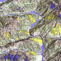 Landslide susceptibility is the propensity of a territory to generate landslides.
Many methods are available to determine landslide susceptibility, whereas only a few attempts were made to outline areas not likely to generate landslides i.e., non-susceptible landslide areas. This is surprising, because for planning purposes it is just as important (if not more important) to know where landslides are not expected than to know where landslides ...
 Joint modeling of landslides and erosion processes
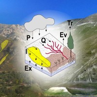 Different approaches have been proposed to model landslide and erosion processes separately. Only a few attempts have been made to model landslide and erosion jointly. Some models consider the effects of landslides on sediment yield and transport. In other cases, landslides and erosion processes are components of a landscape evolution model. However, existing models do not describe jointly the triggering mechanisms of landslide and erosion ...
 How to define rainfall thresholds automatically
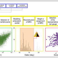 The empirical rainfall thresholds while representing a useful approach used to forecast landslide occurrence in wide areas, are affected by several uncertainties related to the rainfall and the landslide information accuracy, the reconstruction of the rainfall events responsible for the failure, and the method to calculate the thresholds. Definition of the rainfall conditions responsible for landslides is a crucial issue and may contribute to ...
 Landslide susceptibility models and maps
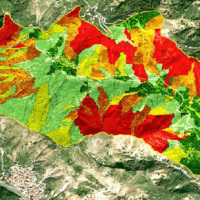 Landslide susceptibility is the likelihood of a landslide occurring in an area, given the local terrain conditions. It is the degree to which an area can be affected by future landslides i.e., an estimate of “where” landslides are more likely to occur.
Landslide susceptibility does not consider the temporal occurrence or the magnitude of the expected landslides. In mathematical language, landslide susceptibility can be expressed as the ...
 Integrated multi-scale methods for seismically induced landslide hazard zonation
 The research activity aims at defining a coherent and unambiguous framework for the assessment and zonation of seismically induced landslides, at different geographical, temporal and management scales. To this end, the project works at the pre-event temporal scale, concerning spatial planning and soil protection and corresponding to years to decades time periods, and at the real-time or civil protection scale, corresponding to time periods ...
 Earth observation and climate change
Sistema di Allertamento Nazionale per la previsione del possibile innesco di fenomeni Franosi indotti da piogge lungo l’infrastruttura ferroviaria di RFI
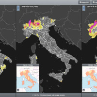 SANF-RFI is a landslide early warning system along the RFI national railway Infrastructure. The system forecasts the possible occurrence of landslides by comparing rainfall measurements and forecasts with empirical rainfall thresholds for the possible occurrence of landslides. Specifically, the system consists of three components: (i) for rainfall and other data input and storage, (ii) for data processing and analysis, and (iii) for the ...
 Preventive evaluation of land instability hazards
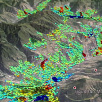 The urbanisation of seismically active areas, coupled with the ongoing change in climate patterns, require a shift in the approaches to land/infrastructure instability hazard assessment and risk reduction. This is particularly relevant in seismically active regions where the recurrent damage from landsliding, subsidence and ground deformations can be widespread. Geotechnical investigations and in situ monitoring of land prone to instability are ...
 Agreement with the Ligurian Regional Agency for Environmental Protection (ARPAL)
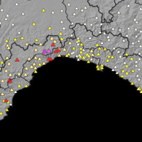 Since 2013, CNR IRPI went in with the collection of information on rainfall events that have resulted in landslides in the Liguria region. Rainfall thresholds can be used in early warning systems for the prediction of the occurrence of rainfall-induced landslides. To respond to a request of the Italian national Department for Civil Protection (DPC), CNR IRPI designed and developed SANF, an Italian acronym for National Early Warning System for ...
 Hydrological monitoring and prediction of shallow landslides through remote sensing observations
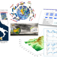 Rainfall-induced shallow landslides and floods are the most common and dangerous natural hazards, mainly due to their high temporal frequency, which causes fatalities and high economic damage worldwide. Climate changes will exacerbate this critical framework since an increase in extreme weather events is ...
 Landslide monitoring Innovative methods and instruments
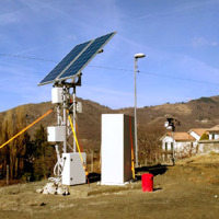
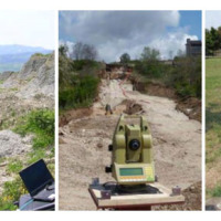 The development of new systems for monitoring of landslides is often the synthesis of geomatics and applied geology. In particular, the development of innovative low-cost systems must have a strong geomatics and technological component supported by the definition of required elements done by end users (engineering geologists). The development of low-cost monitoring systems can represent a strategic choice, above all, to guarantee an increasing ...
 Cartografia delle frane nell’area dell’invaso di Casanuova (PG)
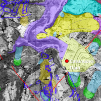 The reservoir of Casanuova on the Chiascio river, Central Umbria, occupies an area affected by numerous landslides, already identified in the regional cartographies. However, the potential interaction between the evolution of landslides and the reservoir is not evaluable because the available landslide inventories are not updated and do not contain information on the morphological evolution over time of the slopes that drain into the reservoir. ...
 Tessina and Lamosano Landslides Monitoring
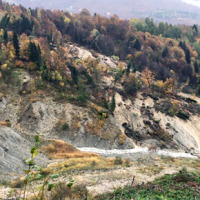 The Tessina Landslide has been, almost continuously, monitored by IRPI, Padova Unit, since its main reactivation in April 1992. Therefore the Veneto Region entrusted IRPI with the continuation of such activity to be extended to the Lamosano landslide too, in order to identify the most effective countermeasure to mitigate the induced ...
 Study and monitoring activities on Arzeno landslide – Municipality of Ne (GE)
Geological investigations in the catchment of the Rio Kortol
Geohazard impact assessment for urban areas
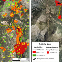 The project is focused on monitoring geohazard-associated ground deformations, a key prevention action specifically addressed to urban areas and critical infrastructures. The project will propose a procedure to produce maps to assess continuously the potential impact of geohazard activity. These maps will provide inputs to support early warning, giving information on the stability of the monitored areas and to evaluate the expected ...
 Rheology of geological processes
 Critical and depositional friction angles are characteristic for the deposition of a granular mass; the wrong angle adoption determines the ineffectiveness of a containment basin. The term is used with different meanings and measured by various procedures. The numerical simulation is a useful tool for the hazard assessment, but the definition of friction needed parameters requires insights on their ...
 STRESS
 The STRESS project is intended to design, implement and test a prototype of a Spatial Information Infrastructure (SII) enabling the provision to spatial planners and risk managers of new data and tools to improve hydro-geological susceptibility, hazard and impact assessment as well as to experiment alternative decision making ...
 Landslides investigation and mitigation at Passo della Morte (UD)
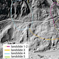 L’area del "Passo della Morte" (UD) è interessata da una situazione di grave dissesto a causa della presenza di più movimenti franosi. Questi sono caratterizzati da elevata pericolosità in relazione alle caratteristiche intrinseche dei fenomeni (volumetrie e velocità di spostamento), alla morfologia del versante ed alla geologia dell'area. La loro presenza mette a rischio la rete stradale che collega la Carnia con il Cadore e l’asta ...
 Large landslides: Monitoring, Modelling and Mitigation
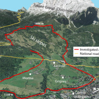 The study of the dynamics of large landslide is a heuristic process based on the integration of multiple investigation techniques: geological and geomorphological analysis, monitoring systems (traditional and innovative) and numerical models. Risk mitigation may require major interventions that call for detailed studies on the specific ...
 Monitoring of the Gollone landslide, Acceglio (CN)
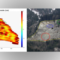 The landslide monitoring represents a strategic activity, especially for those phenomena for which it is not possible (for technical or financial reasons) to realize stabilization interventions of the landslide. Nevertheless, the data acquisition is only the first part of the project, to which it is necessary to couple an on line management of the processed data and to realize monitoring ...
 Safe Landscapes: prevention and adaptation strategies
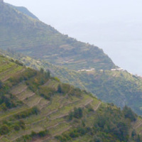 The project aims at defining the type of expected natural hazards, the modeling approaches relevant for their evaluation, and possible monitoring tools in specific areas prone to landslide risk within the "UNESCO site Portovenere, Cinque Terre and the Islands (Palmaria, Tino and Tinetto)" along the "Blue Trail" from Monterosso through ...
 Sino-Italian Joint Laboratory on Geological and Hydrological Hazards
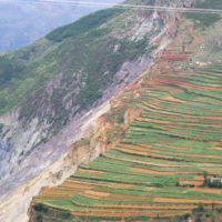 Both China and Italy are characterized by large mountainous areas, where natural hazards (e.g., geological and hydrological hazards such as debris flows, landsides, flash floods) are widespread and seriously threatening local society. It is noted that, almost 67% and 76% of the territories are covered by mountains in China and Italy, respectively and the youngest chains in the Eurasia, namely the Alps and the Tibetan Plateau, are characterized ...
 Agreement with the Autonomous Region of Sardinia
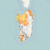 In Italy, landslides are triggered by intense and/or prolonged rainfall. The spatial and temporal forecast of multiple landslides triggered by rainfall in wide areas relies primarily on empirical rainfall thresholds. It is widely believed that the thresholds are influenced by the local topographic (morphological), lithological, soil, and climatic settings. For this reason, it is necessary to define local rainfall thresholds. Reliable local ...
 Landslide Multi-Hazard Risk Assessment, Preparedness and Early Warning in South Asia Integrating Meteorology, Landscape and Society
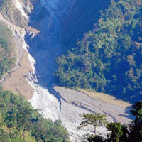 In India, as in many other areas in Asia and in the world, landslides are abundant and frequent, and they represent a serious hazard to the local population. The aim of LANDSLIP is to develop tools, including operational systems, to contribute to reducing impacts of hydrologically related landslide multi-hazards and to building resilience to landslides in vulnerable and hazard-prone areas of ...
 Database of landslides in Calabria to be uploaded in the SyNaRMa computerized archives
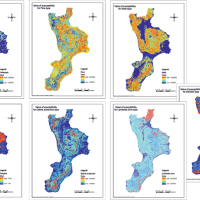 The purpose of Convention contracted between the Research Institute for Geo-Hydrologic Protection (Rende) and the Department of Physics of the University of Calabria for partnership in the Program CE INTERREG IIIB – ARCHIMED – SyNaRMa is to provide: i) the landslide-susceptibility maps for the different rock complexes of Calabria, ii) the definition of some important unstable slopes that can damage urban areas and main roads and railways of ...
 Threedimensional Displacement Analysis
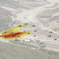 The 3DA software is a new procedure that allows retrieving in near-real-time 3D surface deformation models starting from data acquired via robotized total stations or others system that acquire the surface displacements. The measurements are first pre-processed and then implemented on 3D maps that include vector arrows representative of the intensities and of the real directions of motion in a given system of coordinates. The 3D surface ...
 Mappatura, Modellazione e Previsione Multiscala dei RIschi GEo-idroLogici
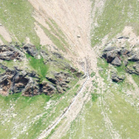 Italy has a tradition of scientific research and technological development on hazardous natural phenomena in general, and specifically on geo-hydrological hazards. Within the CNR, the “Progetti Finalizzati” Soil Conservation and Geodynamics (in the ’70s and ’80s), and GNDCI – the National Group for the Defence from Hydrogeological Disasters (in the ’80s and ’90s), have contributed to the advancement of knowledge ...
 Aerofototeca
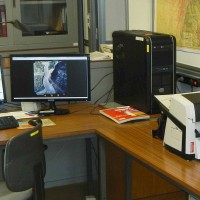 The CNR IRPI archive preserves 170.000 aerial photographs useful for stereoscopic applications. Most part of those photographs were taken during a number of surveys carried out between 1954 and 2005 in tha Padan Plain, Triveneto and Liguria (Northern Italy) but some examples date from the 1920s, 1930s and 1940s.
In this documentation the effects of many floods and landslides events can be observed. In particular, we would mention the aerial ...
 Historical ARchive of COsenza
 ARCO is the historical archive concerning the geo-hydrological events that occurred in Calabria (south Italy) between 1850 and 1990. The archive is made of 506 folders. 45 folders contain projects of land reclamation, management works of fluvial basins and refunding requests carried out after earthquakes. 461 folders, sorted per municipality, contain refunding requests due to geo-hydrological events, communications between citizens and public ...
 Multi Scale and Multi Hazard MApping Space Solutions
Forecasting system for geo-hydrological risk
Investigation of the Montaguto Landslide
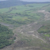 In the spring of 2006, a large failure started moving in the Montaguto municipality, Campania, southern Italy, 40 km ENE of Benevento and 35 km SW of Foggia. The movement was a partial reactivation of an older mass movement in the same general area. In April 2010, the earthflow reached the Cervaro River valley, advancing at a maximum rate of approximately 5 ...
 Landslide monitoring
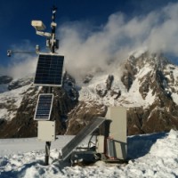 Following the recent technological development, the role of landslides monitoring has become increasingly important, especially for the study and management of large landslides in emergency scenarios. In the last decades, CNR IRPI developed a range of skills dedicated to the design, installation and management of monitoring systems that can be considered for a technical and scientific support in many national emergencies. CNR IRPI can apply ...
 Landslide Susceptibility Models and Maps
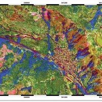
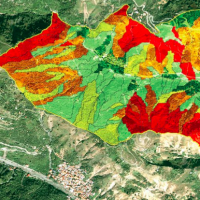 A landslide susceptibility map forecasts where landslides are expected to occur in the future based on terrain conditions, including local morphological, geological, and land use settings. Using different colors, a landslide susceptibility map shows forecasted levels of landslide susceptibility in a region. Using specific software, LSMMs can be prepared whene new landslides or new environmental (e.g., morphological, geological, land use) data ...


