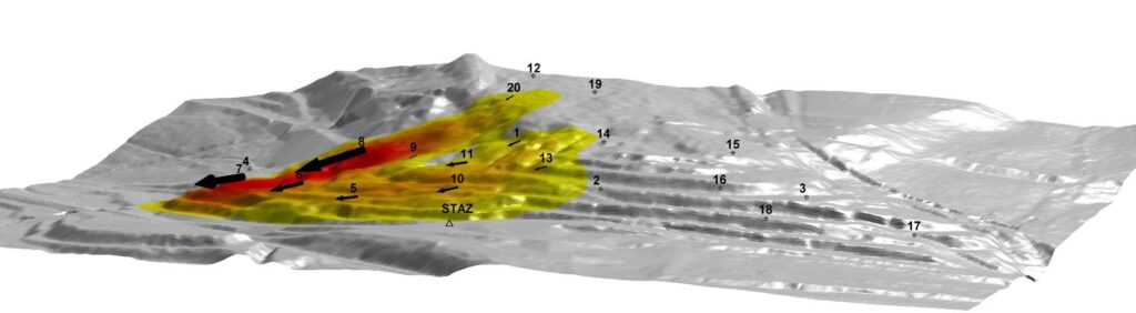
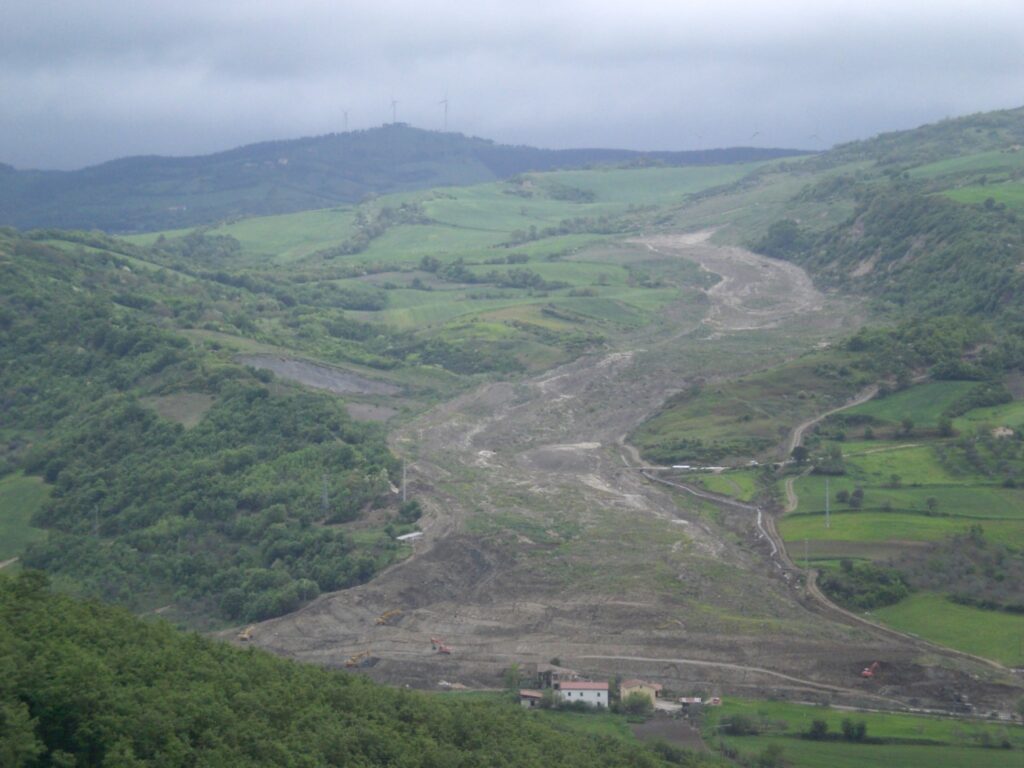
Investigation of the Montaguto Landslide

Monitoring, analysis and interpretation of the Montaguto Landslide.

Background

In the spring of 2006, a large failure started moving in the Montaguto municipality, Campania, southern Italy, 40 km ENE of Benevento and 35 km SW of Foggia. The movement was a partial reactivation of an older mass movement in the same general area. In April 2010, the earthflow reached the Cervaro River valley, advancing at a maximum rate of approximately 5 m/day

Purpose

The earthflow damaged the SP90 provincial road and covered approximately 300 m of the national railroad that connects Naples to Foggia. The traffic along the railroad and the road was interrupted for about three months causing severe problems for the residents, the local economy, and the national railway system. The consequences extended throughout southern and central Italy. The Italian national Civil Protection Department led a large-scale effort to mitigate the effects of the moving landslide, re-open the railway, and re-construct the provincial road.

Methods

The Geohazards Monitoring Group (GMG), on behalf of the CNR IRPI, worked to study the landslide’s evolution employing a monitoring system in near-real-time and performing a comparative analysis of a set of DTMs available from 2006.

Results

The availability of LIDAR survey, a GBInSAR system (managed by the University of Florence) and three robotic total stations (managed directly by CNR IRPI – GMG) has allowed the reconstruction of the recent evolution and the identification the cause-effect relationship between precipitation and reactivations of the phenomenon.

Products

Displacement maps provided in near real time on the dedicated website (with access controlled) to increase the knowledge of the landslide activity. Comparison and analysis of multi-temporal digital models acquired by LiDAR surveys. Interpretation of the dynamic of the phenomenon also aimed at a more appropriate and efficient design of the mitigation works

Conclusions

The activities have enabled a thorough characterization of the landslide and to increase the knowledge on the phenomenon. The obtained results have also allowed improving the quality of designs by increasing the price/performance.