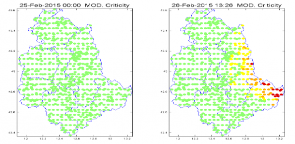
Description
Real time evaluation of the rainfall and soil moisture conditions over the analysis grid point, and the combination with the available vulnerability and susceptibility information for the definition of the dynamic risk scenario.
Users/Purpose
- Local Civil Protection authorities (municipal, regional, functional centers) and the National Department of Civil Protection to support in real-time the monitoring and management of landslide events.
- National and international universities and research institutes interested in developing, improving and comparison of flood forecasting modelling/procedures for real-time monitoring and management.
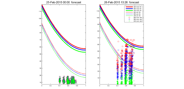
Methods and technologies
The soil saturation conditions are obtained through a soil water balance model over all the analysis grid points. The forecasted rainfall is then compared with specific rainfall thresholds that take into account the soil saturation conditions. Four warning indicators are then defined and combined with susceptibility and vulnerability information for the dynamic risk scenario.