
Preventive evaluation of land instability hazards
Preventive evaluation of land instability (landslides, subsidence) and infrastructure instability hazards in seismically active areas via satellite remote sensing and in situ geophysical and geotechnical investigations (VAPIT)
Background
The urbanisation of seismically active areas, coupled with the ongoing change in climate patterns, require a shift in the approaches to land/infrastructure instability hazard assessment and risk reduction. This is particularly relevant in seismically active regions where the recurrent damage from landsliding, subsidence and ground deformations can be widespread. Geotechnical investigations and in situ monitoring of land prone to instability are necessarily limited in terms of spatial and temporal coverage and need to be complemented by remote sensing and geophysical surveying.
Purpose
The project aims to promote the employment of complementary, cost-effective approaches (“preventive monitoring” via satellite remote sensing, reconnaissance geophysical surveying) and the integration of space- and ground-based geotechnical information for early detection and assessment of potential land and infrastructure instability hazards in seismically active areas.
Methods
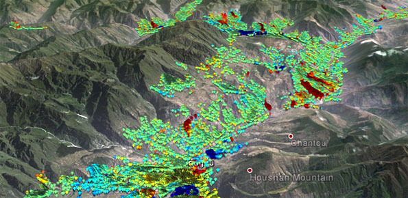
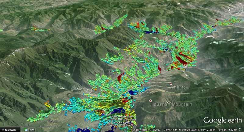
Advanced multi-temporal interferometry techniques using high resolution satellite radar imagery
Long-term accelerometer monitoring (local networks) and the exploitation of low-cost reconnaissance techniques based on the analysis of ambient noise recorded by portable seismic instruments (tromographs)
Geo-hydro-mechanical monitoring of unstable slopes in Southern Italy, for improved long-term landslide/ground instability hazard assessment and provision of ground truth to be integrated with space-derived information
Results
Main/expected results:
- promote complementary, cost-effective approaches (“preventive monitoring” via satellite remote sensing, reconnaissance geophysical surveying) and the integration of space- and ground-based information for early detection and assessment of potential land/infrastructure instability hazards
- improve our understanding of site effects and seismic slope failure mechanisms through a systematic in situ (on slopes) accelerometer monitoring of earthquake shaking
- develop better-constrained approaches to seismic landslide hazard assessments by exploring low-cost reconnaissance investigation techniques based on the analysis of ambient noise recorded by portable seismic instruments
- improve our understanding of the relations between causative/triggering factors and landslide occurrence/re-activations and provide better-constrained landslide hazard assessment via long-term geo-hydro-mechanical monitoring
Products
Preventative estimate of land instability (landslides, subsidence, differential settlements) and infrastructure instability hazards in seismically active areas has obvious practical implications in the field of risk reduction (safety of life and private / collective property protection). The results obtained through the activities carried out within the project will have practical implications in terms of risk prevention.
Conclusions
The availability and quality of data represent a critical issue for reliable site-specific land/infrastructure instability hazard assessment. Regular satellite remote sensing, reconnaissance geophysical surveying and long-term geo-hydro-mechanical monitoring will improve our comprehension of instability processes and thus help in hazard assessment. The in situ monitoring efforts will also provide much needed ground truth data to be integrated with space-derived information.
 Internal contact person: janusz wasowski -