
Cartografia delle frane nell’area dell’invaso di Casanuova (PG)
Monitoraggio della evoluzione morfologica nel tempo dei movimenti franosi nel bacino dell’invaso della diga di Casanuova sul fiume Chiascio, attraverso la caratterizzazione geomorfologica e multitemporale delle frane (L_EAUT)
Background
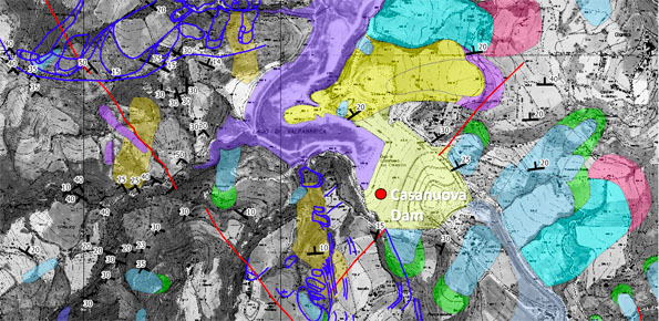
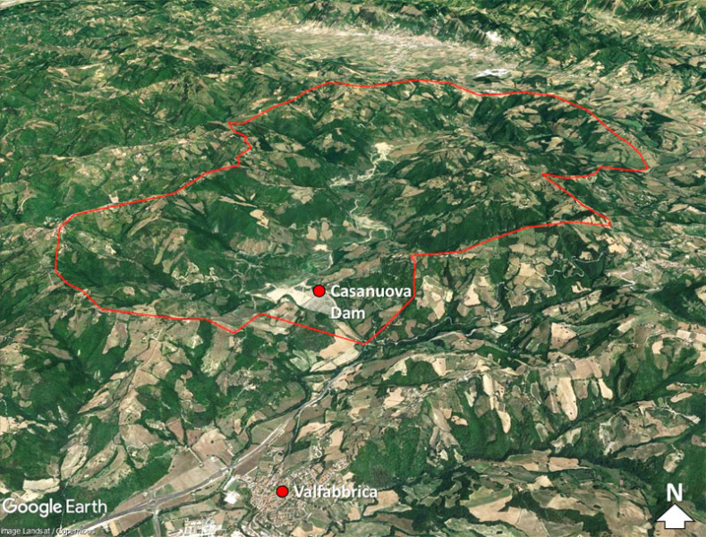
The reservoir of Casanuova on the Chiascio river, Central Umbria, occupies an area affected by numerous landslides, already identified in the regional cartographies. However, the potential interaction between the evolution of landslides and the reservoir is not evaluable because the available landslide inventories are not updated and do not contain information on the morphological evolution over time of the slopes that drain into the reservoir. This general condition, added to problems of local instability found in the circumstances of the dam, has led to the non-use of the infrastructure.
Purpose
The project aims to perform a census of the landslides present in the area of the Casanuova dam, as well as an analysis of the temporal evolution of the most significant landslides in relation to the levels to be reached with the reservoir.
Methods
Critical review of existing documentation including geological and geomorphological thematic maps. Interpretation of stereoscopic aerial photographs at different scales and dates. Multi-temporal analysis of aerial photographs related to 5 flights, between 1954 and 2004. Field checks aimed at verifying geomorphological and photogeological interpretations and collecting geo-structural data.
Results
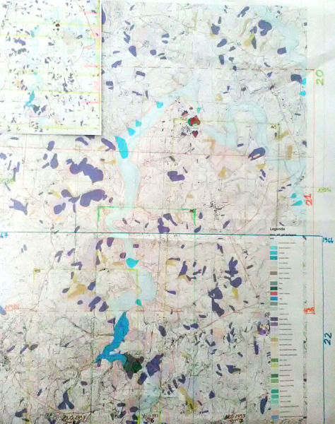
For an area of about 65 km2 it will be realized: (i) a geomorphological landslide inventory map that shows information related to landslides that have left visible signs on the territory and (ii) a photo-geological map useful for defining possible relations between landslides and geo-structural features.
For a limited portion of the study area, a multi-temporal landslide inventory map will be compiled, which will provide information on the temporal evolution of the landslides occurring in the last 65 years.
Products
Geomorphological landslide inventory map for an area of about 65 km2.
Multi-temporal landslide inventory map for a portion of the area of about 10 km2, including the portion of unstable slopes subject to the oscillation of the reservoir levels.
Photo-geological map for an area of about 65 km2, in which will be reported elements related to lithological limits, traces and attitude of stratification, evidence of lineaments and faults.
Thematic maps will be realized at scale 1: 10,000.
The thematic information will be provided in digital format and organized in a database.
Conclusions
The activities foreseen by the project will allow an updated inventory of the landslides present in a 65km2 wide area encompassing the Casanuova reservoir. After the project it will be possible to analyze the temporal evolution of the most unstable slopes and subject to the oscillation of the reservoir levels. This information can be used for better management of the reservoir.
 Internal contact person: francesco bucci -