Theme: Risk
POLARIS: POpuLutAtion at RIsk of geo-hydrological events in Italy
 Despite the large number and frequency of landslides and floods that affect our territories, and the information on landslides and floods available also online, the subject of geo-hydrological hazards remains poorly known to the Italian citizens. The lack of understanding reflects in the limited perception of the population on the geo-hydrological risks in Italy.
One reason for the lack of understanding is the way in which the subject of ...
 PRogetto IntegratO di mitigazione del RIschio da sprofondamento di caviTÀ
 Il progetto intende formulare una metodologia innovativa, basata su un approccio multi-disciplinare, per una valutazione appropriata della suscettibilità al collasso di cavità artificiali in aree urbane del territorio italiano, considerando le peculiarità geologiche e geo-meccaniche degli ambienti ipogei, nonché le loro interazioni con gli elementi vulnerabili dell’ambiente urbanizzato. In particolare, si intende predisporre una ...
 Migliorare l’attenzione del pubblico per una più efficace comunicazione del rischio
 La sperimentazione ad ampio raggio condotta negli ultimi anni per testare sul campo la funzionalità e l’efficacia della procedura semplificata per la rielaborazione dei ricordi traumatici (RINOEL) ha consentito di evidenziare con sempre maggior chiarezza gli effetti esercitati da tali ricordi sull’attenzione di una persona. La capacità di concentrazione di un individuo, e dunque la sua abilità di focalizzare l’attenzione, risente ...
 IntEractions between hydrodyNamics and bioTic communities in fluvial Ecosystems: advancement in the knowledge and undeRstanding of PRocesses and ecosystem sustainability by the development of novel technologieS with fIeld monitoriNg and laboratory testinG
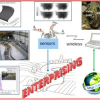 The development of an innovative system for monitoring river flows during extreme events and the impact of hydrodynamic pressures on ecosystems are two important challenges identified by the World Meteorological Organization for flood event control and by the European Commission for the European Biodiversity Strategy for the protection of ecosystems and ...
 Valutazione del rischio idraulico finalizzata alla individuazione di interventi di mitigazione per la ricostruzione post-sisma
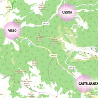 The seismic events that have affected central Italy since 24 August 2016 have caused extensive damage in the municipalities of Castelsantagelo sul Nera, Ussita and Visso (Marche Region). In order to proceed with the reconstruction, it is necessary to carry out interventions to reduce the hydraulic risk in urban ...
 Risk Management System (RMS)
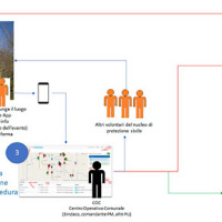 The management of emergencies, in particular those determined by natural events, is complex and must be able to use all the available cognitive elements. During emergencies, it is possible to acquire useful data regarding the processes that determine the same emergencies. These data can contribute to significantly improve planning and design of prevention ...
 Monitoring and landslides risk in the Maierato area
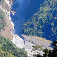
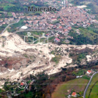 The Maierato landslide (Vibo Valentia Province) is a complex movement, which involved a significant thickness of geomaterials (rocks and soils) and rapidly flowed away for one kilometre. Owing that, the surrounding zone is interested by the same geological settings that predisposed the Maierato landslide, it is useful to identify any elements indicative of the presence of instabilities that can be triggered and evolved as the Maierato ...
 From population risk perception to social vulnerability in coastal areas subject to climate change: a proposal for risk management strategies in two Mediterranean regions
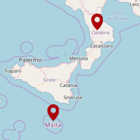 Coastal areas are particularly sensitive to climate change. Because these areas have become particularly susceptible to extreme physical phenomena because of a significant increase in human pressure, climate change will cause heightened exposure and vulnerability of the population. The Authorities ought to make strong efforts to: i) take the necessary measures and actions to reduce the negative impacts of the natural phenomena on the coastal ...
 Models of geo-hydrological processes
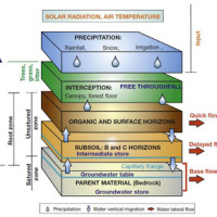 The area of interest specifically refers to the study of the following themes: extreme hydrological events and their interaction with slopes and watercourses; soil water erosion; debris flows; slope stability; triggering instability mechanisms; evolution of slope movements; monitoring systems for gravitational movements for the purpose of alerting for the mitigation of geo-hydrological risk. The activities proposed in the module are therefore ...
 Progetto PON Governance
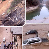 Il progetto prevede un’attività di servizio e di supporto tecnico scientifico per la realizzazione di progetti standard che affrontano i temi della pianificazione comunale di protezione civile e degli strumenti che possono rendere maggiore la sua efficacia. Il progetto propone uno schema che consente di definire, con metodologia rigorosa e omogenea, le attività da svolgere e il modo in cui svolgerle, per la realizzazione di un modello di ...
 Smart Monitoring of basins subject to high geohydrological risk
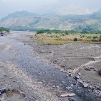 The R&D project SMoRI starts from two needs to be reconciled. The first, coming from the scientific community, concerns a best definition of integrated monitoring systems aimed at controlling the conditions of high geo-hydrological risk. The second need is to acquire by the industrial partners a specialized know-how on new technologies related to Cloud Computing and I.o.T. and on the environmental ...
 Documentation and analysis of flash floods
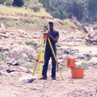 Flash floods occur in small to medium size river basins, and are characterised by fast temporal evolution. Because of their intensity and short warning times, flash floods often cause not only major economic damage, but also loss of lives.
An integrated approach to documentation and analysis of flash floods has to include the following issues:
post-flood observations aimed at estimating peak discharge and reconstructing temporal ...
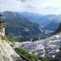
 We monitor the Planpincieux Glacier, along the Italian side of the Grandes Jorasses, Aosta Valley
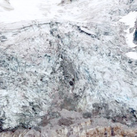 Glaciers are typical of the Alpine landscape, and an important source of water. Undoubtedly fascinating, glaciers are very complex and yet surprisingly poorly known. In the Alps, many studies focus on the volumetric changes of glaciers, proving their almost systematic reduction in the current climatic period. Little is known about the daily behaviour of Alpine glaciers. This is partly due to the inhospitable and not easily accessible ...
 Preserving the quality of the scientific information
 Producing knowledge implies the responsibility to divulge it with quality, making it available for everyone. With the advent of the Internet the possibilities to retransmit knowledge have grown, but the danger is also grown of a deterioration of its quality, as the Nobel prize Gell-mann already denounced in the nineties. The project intends to propose solutions to this kind of problem, contributing to improve the expressive capacity of thesis ...
 Flood forecasting and hydraulic risk
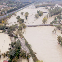 The project is focused on flood forecasting and hydraulic risk, i.e. the assessment of the effects of flooding in flood-prone areas also involving the vulnerability assessment of the hydraulic structures (dams, leaves, bridges, etc.).
The effects of flood events are not completely eliminated by structural measures, therefore it is necessary to develop complementary non-structural measures, such as real-time Flood Forecasting and Warning ...
 Hazard of alluvial fans
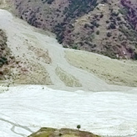 In international literature, it is now widely recognized that alluvial fans are areas of high geomorphic activity. Debris flows and flash floods occur episodically in these environments, and place many communities at high risk. Calabria (southern Italy) is a region where alluvial fans widely occur. In this region, the presence of mountain fronts/alluvial and/or coastal plain, or deep and narrow valleys debouching into larger valleys are key ...
 Methodology for the estimation of environmental risk indicators, using satellite remote sensing techniques
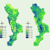 EPSILON Italia, the leader of the partnership proposing the project, is a SME, located in Calabria, specializing in the delivery of advanced services for the protection and management of natural resources, with a high standard of quality and technological content. The SME is also actively involved in the development and implementation of new technologies and in R&D activities conducted both in their own and in partnership with universities ...
 Flooding-prone areas delineation for hydraulic risk assessment for river reaches of the secondary hydrographic network in Tiber river basin
Hydrological study of the Paglia river basin
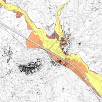 The Tiber River Basin Authority (ABT) and the Umbria Region (Service Water Resources and Hydraulic Risk), considering the verified underestimation of the flood-prone areas in the Paglia River basin provided by the Italian PAI (hydro-geological management plan) and the update of rating curves, decided to revise the hydrological study of the drainage basin in order to re-estimate the flood hazard maps for the Paglia River reach bounded upstream ...
 Numerical modelling of instability and deformation processes of soils and rocks
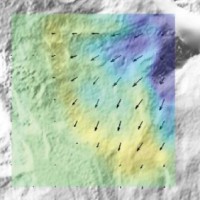 Based on the application of numerical modelling techniques, CNR – IRPI can provide consulting services on stability/instability conditions and kinematical evolution of potentially unstable slopes, underground caves, embankments, open-pit mines, landfills and any other type of natural or man-made soil/rock structure at ...
 Civil Protection Competence Centre on Geo-Hydrological Risk
 In Italy landslides and floods are frequent, widespread and dangerous phenomena, that cause fatalities and serious economic damage. In our country, landslides and floods pose major problems of scientific interest and of social and economic relevance.
The Institute is a Competence Centre for the Italian national Civil Protection Department, an Office of the Prime Minister. For the Department of Civil Protection we execute research and ...
 Space advanced project for excellence in research and enterprise
The project SAPERE is an Industrial Research oriented project (PON and FAR funds) focused on promoting the competitiveness of the National Aerospace Technology Cluster. The participants to the project include 8 private firms of the Cluster (industrial component), with Thales Alenia Space Italia being the leader, as well as academic (University) and research (CNR-National Research Council) ...
Instability problems related to man-made cavities in the Municipality of Ginosa
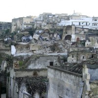 The territory of Ginosa was severely affected by flood and instability problems in October and in December 2013, as many other municipalities at the boundary between Apulia and Basilicata. In particular, on October 7, 2013, four fatalities and serious damage had to be registered. Following these events, other instabilities have occurred, including the collapse of a stretch of Via Matrice, above artificial cavities, on January 21, ...
 Mobile Application for Emergency Response and Support
 The responsibilities within natural hazards involve citizens and volunteers as first actors of civil protection. The prevention implicates technical volunteers, but the priority implies now awareness of local citizens. The involvement of population creates context-specific strategies of territorial surveillance and management. MAppERS empowers “crowd-sourced mappers” through smart phone applications and sensors, with geo-tagged information, ...
 Cost of Natural Hazards in Italy
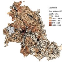 Economic analysis has produced a set of analysis on natural disasters to measure the impacts of the events, the possibility of insurance schemes, and the optimization of prevention policies. In Italy these economic analysis are not widespread and the information on damage is limited. The available estimates are limited to the public money spent for post-event reconstruction and do not correspond to the total social ...
 Stability analysis in the Fantiano quarries
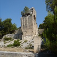 The Fantiano quarries at Grottaglie (Taranto province) are an ancient sector of extraction of the local calcarenite rock, that is now used for concerts and shows. The instability phenomena observed in the quarries forced the Municipality of Grottaglie to ask to CNR-IRPI to perform stability analyses in the ...
 FLoods and fIre Risk assessment and managEment
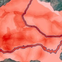 FLIRE is a demonstration project aiming to the development of an integrated Decision Support System (DSS) for both flash floods and forest fires risk assessment and management. The DSS tool will be designed by using state of art tools, technologies and methods and taking into account prevention, adaptation and interaction issues. The final model will be online available to key stakeholders and relevant authorities (local and national) for the ...
 Sediment management in Alpine basins
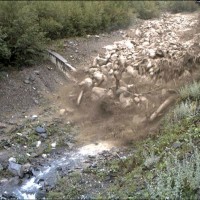 The understanding of the changing equilibrium between sediment supply from upstream and sediment transport capability of a river is important for the success of integrated water resource management. In Alpine river basins, intensive sediment transport processes and sediment continuity have a notable impact on several water management issues posing multiple use conflicts related to hydropower, ecology, flood control ...
 Monitoring system for the Hahnebaum test site
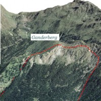 A Deep-seated Gravitational Slope Deformation (DGSD) affects the south-west flank of mount Ganderberg (Moso in Passiria – BZ). The continuous displacements of the landslide induce secondary hazardous phenomena. A 800.000 m3 rock slab shows signs of incipient movement; a detachment could create a natural barrier on the river ...
 Real-time monitoring of the “San Lorenzo” tunnel, Passo della Morte
The Via Firenze Sinkhole of in the Municipality of Gallipoli
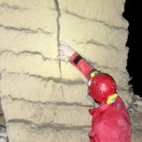 Among the most recent sinkhole events, registered in Apulia region, that occurred in Via Firenze at Gallipoli on March 29, 2007, greatly raised the attention by public opinion, having affected (likely, without causing any fatalities) the built-up areas of one of the largest towns in Salento. The event pointed out to the need to carry out detailed studies on the sinkholes related to artificial ...
 Changing Hydro-meteorological Risks as Analyzed by a New Generation of European Scientists
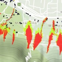 The European Commission has identified the need for adaptations in risk management as a consequence to climate and environmental changes in several documents. The implementation of risk management measures such as disaster preparedness programmes, land-use planning, regulatory zoning and early warning systems are considered essential. Further, multi-risk assessment approaches are not used in planning practice: risk indicators are hardly used ...
 Updating the list of Apulian municipalities with presence of man-made cavities
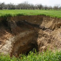 The widespread occurrence of sinkholes related to man-made cavities in Apulia highlights the need to perform a careful reconnaissance of the artificial caves over the whole region, and of their stability conditions. Knowledge of the presence and typology of artificial cavity, and of its main features, is a mandatory step for the mitigation of the sinkhole ...
 Long-term Permafrost Monitoring Network
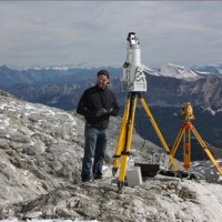 Permafrost is very sensitive to climate change and the risks associated with its degradation affect traffic routes, settlements and infrastructure. Data on the distribution of permafrost are inconsistent and there is no common strategy to tackle this problem. Local administrators should have the means to manage the risks associated with the degradation of the ...


