
News
Symposium “The Fluvial System” in Padova

On March 20 the fourth edition of the symposium “The Fluvial System” will be held at CNR IRPI of Padova. This meeting, organized by group of scientists from central-northern Italy, aims at favouring the exchange of research experiences and the collaboration between young researchers in fluvial geomorphology.
Alessandro Mondini at the ISRS symposium in Korea
Alessandro Mondini (CNR IRPI researcher) presented (21 April 2016) the final results of the project “Spectral signatures library for semi-automatic event landslide recognition and mapping” at the ISRS symposium (Korea) with a talk titled “Spectral fingerprints in a Montecarlo classification framework for event landslide mapping”
Indagine sulla percezione del rischio geo-idrologico nelle scuole dell’Umbria
Parte oggi il progetto “la percezione del rischio geo-idrologico nelle scuole dell’Umbria”. L’iniziativa, promossa dall’Istituto di Ricerca per la Protezione Idrogeologica IRPI-CNR d’intesa con l’Ufficio Scolastico Regionale è finalizzata a quantificare la percezione e a migliorare la consapevolezza che gli studenti, i loro famigliari e i docenti, hanno del rischio geo-idrologico in Umbria. Lo scopo è di favorire comportamenti individuali corretti in caso di eventi calamitosi, quali frane e inondazioni.
Il progetto si articola in più fasi. Da oggi fino alla chiusura dell’anno scolastico si richiede a tutti i soggetti coinvolti di compilare un questionario fruibile on line all’indirizzo https://goo.gl/6cetpm. Il sondaggio formulato con un linguaggio semplice ed immediato, ben si adatta all’eterogeneità dei rispondenti. I risultati dell’indagine conoscitiva serviranno a verificare quanto i rischi geo-idrologici siano percepiti e conosciuti. Successivamente, con l’apertura del prossimo anno scolastico 2016/17, saranno pianificate delle azioni congiunte tra i ricercatori di IRPI e i docenti delle scuole umbre per identificare gli argomenti e le più adeguate modalità comunicative da adottare per un eventuale approfondimento che gli insegnanti vorranno proporre ai loro studenti sul tema dissesto geo-idrologico. Infine durante il secondo quadrimestre 2016-2017, verrà somministrato un secondo sondaggio per verificare l’efficacia della campagna informativa.
Al via il progetto di ricerca “RiST Project: Ricerca Scientifica e Tecnologica nel bacino glaciale della Bessanese (Balme, TO)”
Ha preso avvio di recente il progetto di ricerca “RiST Project: Ricerca Scientifica e Tecnologica nel bacino glaciale della Bessanese (Balme, TO)”. Il progetto – realizzato con il contributo della Fondazione CRT – è coordinato dal gruppo di ricerca GeoClimAlp del CNR-IRPI di Torino ed ha fra i suoi partner il MeteoMet Consortium, il Comune di Balme ed il Rifugio Bartolomeo Gastaldi. L’obiettivo principale è quello di studiare le relazioni fra clima e processi naturali, utilizzando il bacino della Bessanese come un vero e proprio “laboratorio sperimentale all’aperto”.
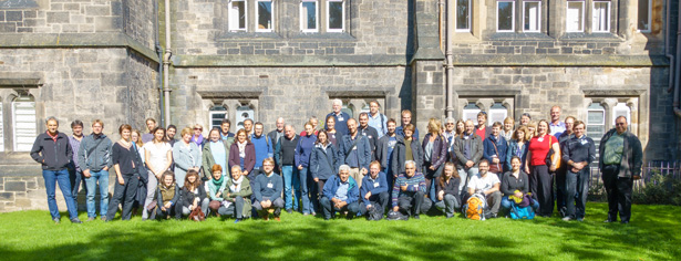
Training school on water and sediment connectivity in mountain environments
In the context of COST Action ES1306: Connecting European Connectivity Research a PhD training school on water and sediment connectivity has been organized.The school will take place in Laas/Lasa, Eastern Italian Alps, in July 25-29 2016 and is intended for PhD students involved to some extent with connectivity issues in their PhD projects.
The school format will include keynote lectures, practical workshops, field visits, and team work on selected case studies.
Maximum number of participants: 20
Application deadline: April 30
Organizing committee:
Francesco Brardinoni (University of Bologna)
Tobias Heckmann (Catholic University of Eichstaett)
Ronald Poeppl (University of Vienna)
Marco Cavalli (CNR-IRPI Padova)
Damia Vericat (University of Lleida)
New global rainfall product available (0.5 degree/daily spatial-temporal resolution), obtained from satellite soil moisture data through the SM2RAIN algorithm
Aperta la Call per partecipare al “Terzo Convegno Mondiale sui Paesaggi Terrazzati”
E’ aperta la Call per partecipare al terzo convegno mondiale sui paesaggi terrazzati che si terrà dal 6 al 15 ottobre in varie località italiane. CNR-IRPI è partner scientifico dell’evento.
Il convegno prevede l’apertura dei lavori a Venezia, quattro giorni di field trip nelle sedi locali e la sessione plenaria conclusiva a Padova.
Per maggiori dettagli potete consultare il sito www.terracedlandscapes2016.it o leggere il flyer allegato.
Per un Gargano sempre più sicuro: report finale del progetto Gargano_Lab
Comunicato Stampa
CONSORZIO DI BONIFICA MONTANA DEL GARGANO
Sede Legale: San Marco in Lamis
Sede operativa: Viale Cristoforo Colombo, 243 71121 F O G G I A
Si terrà a Foggia giovedì 24 marzo alle ore 10:30 nella Sala Convegni Energia di Cofagricoltura Foggia (Palazzo Amgas), la presentazione del report finale progetto “Gargano_Lab: sistema informativo integrato per la gestione del territorio, il monitoraggio ambientale e l’allerta di emergenza”.
Il convegno – promosso dal Consorzio di Bonifica Montana del Gargano in collaborazione con Staer Sistemi, W-Enterprise, Gem Itc e Cnr-Irpi (Istituto di Ricerca per la Protezione Idrogeologica del Consiglio Nazionale delle Ricerche) – presenterà le risultanze del progetto consortile che ha messo a punto uno strumento operativo per la pianificazione degli interventi di sistemazione idraulica nelle aree a rischio idrogeologico, supportato dal costante rilevamento delle condizioni meteo e da un sistema sperimentale ed innovativo di allerta automatico per la mitigazione dei rischi dovuti ad eventi alluvionali nel territorio interessato.
I lavori saranno aperti da Eligio G. B. Terrenzio, Presidente del Consorzio di Bonifica Montana del Gargano, cui faranno seguito gli interventi a cura di Gaetano Grasso (InnovaPuglia s.p.a.- Responsabile Misura Living Labs); Luciano Ciciretti
(Capo Settore Tecnico-Agrario Consorzio di Bonifica Montana del Gargano); Antonio Scuccimarra (Staer Sistemi srl, Foggia – Responsabile Pubbliche Relazioni Living Labs); Luca Marella (Staer Sistemi s.r.l., Foggia – Capo Progetto Living Labs); Maurizio Polemio (Consiglio Nazionale delle Ricerche – Istituto di Ricerca per la Protezione Idrogeologica); Leonardo Di Gioia Assessore Risorse Agroalimentari e Forestali Regione Puglia.
Concluderà il convegno Massimo Gargano, Direttore Generale Associazione Nazionale Consorzi di Gestione del Territorio e delle Acque Irrigue.
<<Con questa iniziativa, ha dichiarato il Presidente del Consorzio di Bonifica Montana del Gargano, Eligio G. B. Terrenzio, si rafforza l’impegno dell’Ente per il contenimento del rischio idraulico sul territorio, in modo particolare in zone spesso colpite da eventi atmosferici di particolare gravità, nella prospettiva auspicata di interventi strutturali che mettano definitivamente in sicurezza il territorio, affinchè di realizzi quella necessaria inversione di tendenza per concentrare finalmente interventi e risorse sulle cause di taluni disastri e non sugli effetti>>.
Foggia, 21 marzo 2016
Christian Massari tra i vincitori del Sony World Photography Awards 2016
HyMeX Workshop on Drought and Water Resources
The Research Institute for Geo-Hydrological Protection (I.R.P.I.) is present at “the HyMeX Workshop on Drought and Water Resources” that will be held at the Central Office of the Spanish National Research Council (CSIC) of Zaragoza (Spain) on 5th – 7th April 2016. In this meeting, the Institute is represented by the researcher Roberto Coscarelli, member of the Workshop Scientific Committee, keynote speaker and co-chairman of the first session on “Drought Description” .
The main objectives of the Workshop are to present the state-of-the-art in drought and water resources researches, coordinate and strengthen the HyMeX community in this area and discuss the future lines of work.
La collaborazione fra ICT e Geoscienze nella gestione dei rischi naturali e delle emergenze e il coinvolgimento dei cittadini
L’Istituto di Ricerca per la Protezione Idrogeologica ha partecipato il 4 febbraio 2016 presso l’Aula Magna del Politecnico di Milano al workshop “La collaborazione fra ICT e Geoscienze nella gestione dei rischi naturali e delle emergenze e il coinvolgimento dei cittadini”. In questa occasione l’IRPI è stato rappresentato dal ricercatore Simone Frigerio, il quale ha presentato il progetto europeo MAPPERS.
(L’intervista a Simone Frigerio dal minuto 2:13)
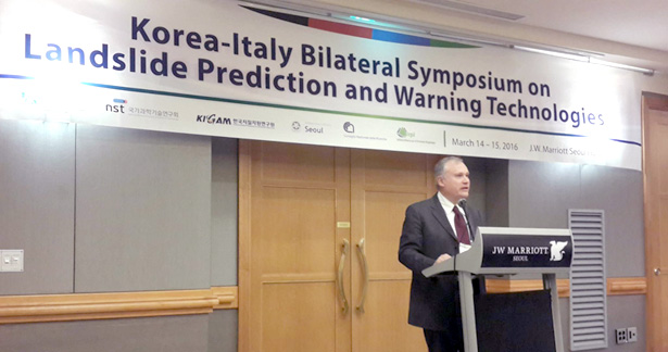
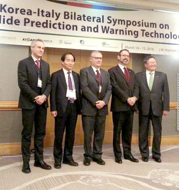
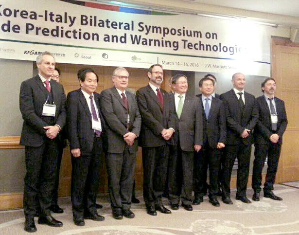
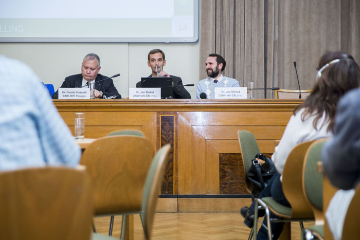
Korea-Italy Bilateral Symposium on Landslide Prediction and Warning Technologies
Fausto Guzzetti and Alessandro Mondini take part in the Italo-Korean Bilateral Symposium on landslide forecasting and warning technologies.
The symposium is hosted by the Ministry of Science, ICT and Future Planning, Korea, organized by KIGAM, Korea and IRPI CNR, and sponsored by the National Research Council of Science & Technology, Korea and the Italian Embassy in Seoul. The meeting will be held in Seoul, at the Marriot Hotel on 14 and 15 March 2016.
The first day is dedicated to to a scientific sharing of ideas, methods and information related to the study of geo-hydrological hazards, the second includes a visit to the KIGAM facilities and a visit to a monitoring site.
Joint conference of the International Consortium on Landslides (ICL) and the International Programme on Landslides (IPL), Kyoto, 8-11 March 2016
Fausto Guzzetti and Mario Parise participate to the joint conference of the International Consortium on Landslides (ICL) and the International Programme on Landslides (IPL), held at the University of Kyoto, from 8 to 11 March 2016. The first day of the meeting is devoted to design an international effort aimed at producing shared educational tools to spread knowledge on landslides and foster comprehension of their hazards and risk.
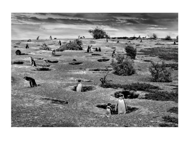
Sony Photo Award 2016 shortlisted photographer Christian Massari
Revealed the shortlist for the 2016 Sony World Photography Awards, the world’s biggest photography competition. Christian Massari, researcher of IRPI, is one of the shortlisted photographer of the Open Competion in the section Nature and Wildelife with his picture on the Magellanin Penguins at risk Climate Change. Open, Youth and Professional category winners will be revealed at a gala ceremony in central London on 21st April and will be part of the annual printed book of the competition.
The picture is viewable at the following link: http://worldphoto.org/images/image/1300512/?FromImageGalleryID=31789
Workshop in Padova: researches in the Gadria Creek
On February 19 a workshop on current research in the catchment of Gadria Creek (Eastern Italian Alps) will be held at CNR IRPI of Padova. CNR IRPI is involved in researches in the Gadria Creek, which has been instrumented by for debris-flow monitoring by the Autonomous Province of Bozen-Bolzano (Dept. of Hydraulic Works and Civil Protection). Other partner institutions are the Free University of Bozen-Bolzano (Faculty of science and Technology), the University of Padova (Dept. Land, Environment, Agriculture and Forestry), and the University of Natural Resources and Life Sciences (BOKU) di Vienna.
Risultati delle elezioni del Consiglio di Istituto
Nella giornata di ieri, mercoledì 3 febbraio 2016, dalle ore 10:00 alle ore 17:00 si sono svolte le elezioni del Consiglio dell’IStituto di Ricerca per la Protezione Idrogeologica, del CNR.
Sono risultati eletti:
In rappresentanza del personale Ricercatore e Tecnologo:
· Ing. Paolo ALLASIA
· Dott.ssa Loredana ANTRONICO
· Ing. Luca BROCCA
· Dott. Marco CAVALLI
· Dott.ssa Paola REICHENBACH
· Ing. Oreste Giuseppe TERRANOVA
· Dott. Janusz WASOWSKI
In rappresentanza del personale del personale Tecnico e Amministrativo:
· Sig. Luigi ACETO
· Sig. Fabio BARNABA
Mobilità di breve durata (Short-term mobility, STM) Bando – Anno 2016
Il Programma per la Mobilità di breve durata (STM) consente a studiosi italiani di partecipare ad attività di ricerca presso Università e/o Istituzioni di ricerca straniere di elevato prestigio scientifico.
Inoltre, consente a studiosi stranieri di elevata qualificazione accademica, appartenenti ad Università e/o Istituzioni di ricerca straniere di elevato prestigio scientifico, di essere invitati presso Istituti CNR, in modo che la ricerca italiana benefici della loro attività e presenza nel nostro paese.
Il CNR in questo modo finanzia i soggiorni di breve durata (21 giorni) dei ricercatori italiani e le brevi visite (10 giorni lavorativi) dei ricercatori stranieri che svolgono progetti di ricerca scientifica di interesse per il CNR.
Il Programma, attivo fin dal 1995, rientra nelle iniziative volte al rafforzamento della cooperazione scientifica internazionale. In particolare, consentendo la mobilità per periodi di breve durata, ha favorito l’avvio ed ha consentito il proseguimento, nel tempo, di collaborazioni che hanno portato al completamento di programmi di ricerca congiunti e al perfezionamento di tecniche altamente specialistiche.
Per partecipare al programma STM si prega voler consultare il relativo disciplinare.
Per informazioni:
PORRETTI sig.ra Antonella , tel. 06.4993.3116, fax 06.4993.2905, e-mail: antonella.porretti@cnr.it
Consulta e scarica il Bando STM per l’anno 2016 »
Le domande di partecipazione dovranno essere compilate utilizzando esclusivamente l’apposita procedura on line. La scadenza della call è il 15 febbraio 2016 alle ore 15.00 come indicato nel Bando.
Si può accedere alla procedura tramite l’Intranet del CNR al seguente indirizzo: https://intranet.cnr.it, utilizzando le credenziali con le quali si entra in Siper. All’interno dell’Intranet è sufficiente seguire il percorso: Area personale – Attività internazionali – Domande STM.
Janusz Wasowski Co-Editor-in-Chief of the Journal Engineering Geology
ELSEVIER B.V., a world leading publisher of scientific and technical literature, has recently appointed Dr. Janusz Wasowski (IRPI, Bari) to act as Co-Editor-in-Chief of the Journal Engineering Geology. Starting January 2016, he will join Prof. C.H. Juang of the Clemson University, Clemson, South Carolina, USA, who has already acted as Co-Editor-in-Chief in the last 3 years.
The journal of Engineering Geology, established in 1965 with the aim to bridge the gap between engineering and geology, this year celebrated its 50th anniversary: http://www.journals.elsevier.com/engineering-geology/article-collections/virtual-special-issue-celebrating-the-50th-anniversary/
In the most recent decades Engineering Geology has considerably expanded its focus to cover emerging technological and socioeconomic topics such as natural hazards and environmental issues. Thanks to the multidisciplinary coverage and high impact the journal has become a common publishing outlet for the researchers of CNR-IRPI.
Dr. Janusz Wasowski has matured considerable editorial experience in the past 15 years. He has guest-edited several Special Volumes published in international journals, which covered a broad spectrum of research topics ranging from slope stability and landslide assessment, collateral seismic hazards, geotechnical field investigation and in situ monitoring, to exploitation of air/space-borne remote sensing and geophysical surveying in engineering geology. Since 2007 Janusz has also been a member of the Editorial Board of Engineering Geology (ELSEVIER, B.V.) and of the Quarterly Journal of Engineering Geology and Hydrogeology (The Geological Society, London).
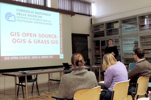
Al via il corso di formazione interno all’Istituto su “Strumenti e metodi per la gestione e l’analisi di informazioni geografiche e territoriali”
Il personale interno all’Istituto di Ricerca per la Protezione Idrogeologica ha iniziato nel pomeriggio di oggi, 15 dicembre, una tre giorni di formazione su “Strumenti e metodi per la gestione e l’analisi di informazioni geografiche e territoriali”. I principali relatori del corso Ivan Marchesini, Marco Baldo, Marco Cavalli e Alessandro Cesare Mondini, ricercatori interni all’IRPI, svilupperanno rispettivamente temi differenti: introduzione ad alcuni GIS Open Source; Sistemi a scansione laser aerotrasportati; Introduzione alla geomorfometria; Introduzione al telerilevamento satellitare.
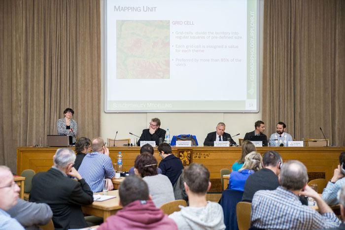
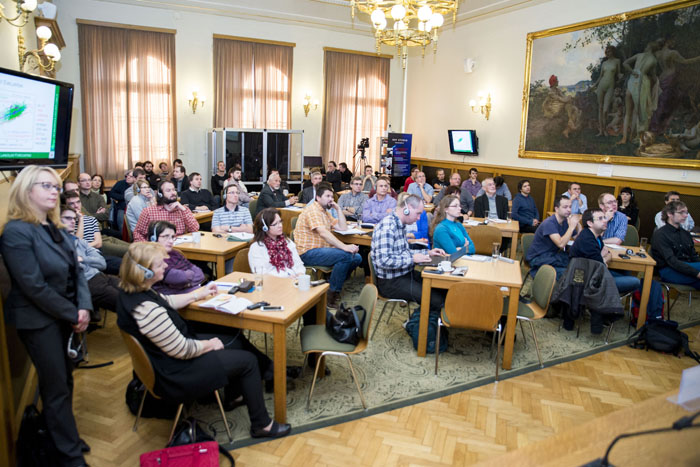
Workshop on natural hazards attracted more than sixty experts to the Academy of Sciences, Prague
More than sixty experts from the Czech Republic attended workshop held in the main building of the Czech Academy of Sciences in Prague on 3th December 2015. It was dedicated to appealing topic of “Natural hazards around us – opinions of European experts on natural and social environment changes”. The audience included not only experts from field of Earth Sciences but also professionals from civil protection, local governments, private companies and member of the Senate of the Parliament of the Czech Republic. The lecturers were focused on landslides, debris flows, rock falls and their negative impacts on society.
The workshop was organized by Institute of Rock Structure and Mechanics of the CAS (IRSM CAS) within the research program “Strategy AV21” which is dedicated to deliver the latest research results to the involved experts and public including civil protection, state and local administration and potentially affected inhabitants.
The lectures were presented by:
Prof. Thomas Glade, Vienna University, Austria
Dr. Fausto Guzzetti, director of the Research institute for geo-hydrological protection CNR, Italy
Dr. Paola Reichenbach, researcher at the Research institute for geo-hydrological protection CNR, Italy
Dr. Jan Blahůt, researcher at IRSM CAS
(text and pictures by IRSM CAS web site »)
SAFETY – Sentinel for Geohazards regional monitoring and forecasting)
European Commision has funded the SAFETY project, in the framework of the activities of the Union Civil Protection Mechanism. The project focuses on urban resilience to natural disasters in particular landslides. It builds upon existing knowledge and good practices (e.g. resilient cities scoreboard and campaign, local resilience forums, local climate change adaptation strategies).
Natural hazards around us: european experts discuss changes of the natural hazards and society
Today December 3, Paola Reichenbach and Fausto Guzzetti (researchers of ‘Istituto di Ricerca per la Protezione Idrogeologica’) take part in a workshop organized by the Academy of Sciences of the Czech Republic, in Prague.
The main focus of the seminar covers the problem of landslides and protection from them: the main European and Czech experts evaluate the current state of protection of society from the consequences of natural disasters and future prospects.
Project r.aveflow: third meeting in Munich
On December 1st a researcher at the CNR IRPI participated in Munich in the third meeting of r.avaflow project. r.avaflow is a transnational research project supported by the German Research Foundation (DFG), which is the lead agency, and the Austrian Research Fund (FWF) in the period July 2014 – June 2017. r.avaflow aims at creating a free software supporting experts in managing hazards from geophysical mass flows such as avalanches of snow or rock, or flows of debris or mud. CNR IRPI collaborates with r.avaflow project on behalf of the Autonomous Province of Bolzano – South Tyrol, which manages the debris-flow monitoring station of the Gadria catchment.
User Consultation on Disaster Risk Reduction and new satellite EO methods
We participated to the “User Consultation on Disaster Risk Reduction (DRR) and new satellite EO methods” workshop organized @ ESA Esrin, Frascati, on 27 November 2015.
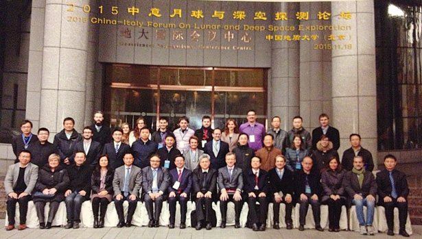
ASI MOON MAPPING PROJECT
Il progetto Moon Mapping è un programma di ricerca sulla topografia e sulla composizione della superficie lunare a cui partecipa il nostro Istituto.
Il progetto è inserito nell’accordo bilaterale siglato dal Ministry of Science and Technology, P.R. China (MOST) e dal Ministero dell’Istruzione, dell’Università e della Ricerca italiano ed è coordinato dall’Agenzia Spaziale Italiana (ASI) per l’Italia e dal National Remote Sensing Center of China. L’obiettivo è arrivare in tre anni alla realizzazione di un vero e proprio ‘atlante’ tridimensionale della Luna, con caratteristiche di omogeneità e accuratezza assolutamente inedite. Il risultato finale sarà una mappa inedita e ad alta definizione della Luna, strumento prezioso per qualsiasi futura missione.
Il programma promuove la cooperazione in campo spaziale e crea opportunità di sviluppo della ricerca attraverso la partecipazione anche degli studenti universitari dei due paesi. Il programma prevede in modo specifico il coinvolgimento di studenti delle università italiane e cinesi, che svolgeranno un programma di ricerca sui temi legati allo studio della topografia e della composizione della superficie lunare utilizzando i dati scientifici acquisiti dai satelliti cinesi Chang’e-1 e Chang’e-2.
Il 18 novembre u.s., si è aperto il “China-Italy Forum on Lunar and Deep Space Exploration” alla presenza del Presidente dell’ASI Roberto Battiston. Il programma prevede una serie di incontri in alcune delle più prestigiose università della Cina coinvolte nel progetto.
The importance of a correct landslide monitoring network results dissemination: the case study of Mont de La Saxe landslide (Courmayeur municipality, North West of Italy)
Thanks to the technological advance in the last decades, the monitoring systems of landslides have gradually acquired greater importance not only during the phase of improvement of knowledge of the phenomenon but also during emergency condition related to a possible collapse of the unstable area.
The technological evolution also increased the number of complex systems, which however are often characterized by a poor mutual compatibility. Another critical issue is the limited attention of the developers of the monitoring system for the dissemination of the results. In fact, the monitoring systems are often very complex systems dedicated exclusively to professionals with a proper background. However, this approach may not be adequate during the management of an emergency, when the sharing of information among the involved groups (from administrators to the population) is essential. A correct dissemination of monitoring data is also very important to improve the knowledge of the risk and to define a relationship of trust and cooperation among different stakeholders. Based on the experience in the management of emergency situations, the Geohazard Monitoring Group (GMG) has developed a communication strategy focused on the use of dedicated web pages (updated in near real time) and periodically bulletin which are able to share the landslide monitoring results. The web pages have been developed to support the landslide emergency management team, whereas bulletins have been developed to be very simple and user friendly.
The most representative product, developed with a team of graphic designers and communication experts, is the report updated monthly by GMG of CNR IRPI for the Autonomous Region of Valle d’Aosta, who adopted it to share the last results of the Mont de La Saxe landslide monitoring network (Municipality of Courmayeur – AO).
MAPPERS FINAL MEETING
MAppERS (Mobile Application for Emergency Response and Support) is a EU project funded under programme 2013-2015 Humanitarian Aid and Civil Protection, ECHO A5. The project dealt with the capacity of human sensors towards smartphone application (SA) in the context of prevention and crisis support for natural hazards. Actors of civil protection and the crowdsourcing create local and context-specific strategies of surveillance and territorial management.
The development proceeded for Android 4.0 onwards. The Web Application includes a Cloud Architecture, a Relational Data Base and Web services, integrated with a Cloud Notification SDK to send push notification (SMS, Emails and phone calls). The bug-fixing and training have been set during piloting and the crowdsource becomes a continuous source of development, testing and updating of each smartphone components.
MAppERS-C proposes a Personal Flood Plan toolkit. Users are voluntary registered citizens, able to create their own set of prevention measures and to share geo-located information during critical step before flooding events. MAppERS-V is a Danger Survey toolkit for rescue crew, able to collect and organize real-time and standardized information for damages during crisis.
If you would like to participate please fill the attached form (see below) and send by email to simone.frigerio@irpi.cnr.it
Keynote presentation at the third COST Action Connecteur Meeting held in Durham (UK)
On September 15th Marco Cavalli, researcher at the CNR IRPI of Padova, delivered a keynote presentation entitled “Index of Sediment Connectivity: applications and future perspectives” in the frame of the third COST Action Connecteur “Connecting European Connectivity Research” Meeting held in Durham (UK) on September 14th – 16th, 2015. The presentation is now available for download at the project website.
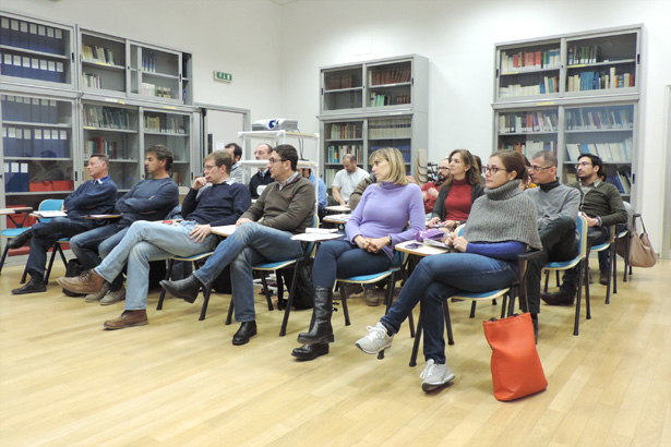
Strumenti e metodi per la gestione e l’analisi di informazioni geografiche e territoriali
Nei giorni dal 15 al 17 dicembre, il CNR IRPI propone il corso di formazione dal titolo “Strumenti e metodi per la gestione e l’analisi di informazioni geografiche e territoriali”, che vedrà l’alternarsi di vari ricercatori dell’IRPI nel presentare i vari moduli.
Il corso si propone l’obiettivo di fornire ai ricercatori e ai tecnologi dell’Istituto conoscenze e strumenti concettuali e operativi per la gestione e l’analisi di informazioni geografiche e territoriali.
Durante il corso sono previsti spazi per la discussione aperta durante i quali i partecipanti saranno invitati a commentare le lezioni e le nozioni acquisite, e a proporre problemi potenzialmente affrontabili con gli strumenti e i metodi descritti durante il corso.
Il corso è rivolto ai ricercatori, ai tecnologi e ai tecnici a tempo determinato e indeterminato, e agli assegnisti di ricerca, ai borsisti e ai dottorandi che operano nell’Istituto.
Installation of an Automatic Inclinometer System in the Breithorn landslide area – Kanton Wallis (Switzerland)

Following the European project Lampre and according between CNR-IRPI and Swiss Federal Office of the Environment, the GeoHazard Monitoring Group (GMG) have installed (21/10/2015) an Automated Inclinometer System in the BreitHorn area (Kanton Wallis) at 2900 m altitude.
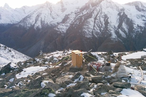
The monitoring system, patented by CNR-IRPI allows realizing automatically high-precision inclinometer measurements to evaluate deep-seated ground deformations. More informations at the following link.
Below installation video of AIS by Paolo Allasia and Franco Godone from CNR IRPI.
During installation activities was also carried out a fast aerial observation on the Randa landslide located a few kilometers from the Breithorn.
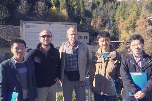
Visit of a Japanese delegation of the National Institute for Land and Infrastructure Management (NILIM) to two study sites of the Research Institute for Geo-Hydrological Protection (IRPI) of Padova
On October 23rd and 24th, 2015 a delegation of the National Institute for Land and Infrastructure Management (NILIM) of the Ministry on Land and Infrastructure of Japan, made by Dr. Fujimura and Dr. Uchida, visited two study sites of the Research Institute for Geo-Hydrological Protection (IRPI) of Padova located in South Tyrol (Northern Italy). On October 23rd, the delegation, accompanied by IRPI researchers Marco Cavalli and Lorenzo Marchi, visited the debris-flow monitoring site in the Gadria creek. On October 24th, the subject of the visit was the Ganderberg landslide where Gianluca Marcato illustrated the monitoring activities carried out by CNR IRPI.
CNR IRPI held a course for identifying landslide events
CNR IRPI, on 19 and 20 October, held a Technical and Professional Training Course on “Criteria and techniques for identifying landslide event and to estimate their impact on facilities and infrastructure“, sent to the Board of Surveyors of the Province of Ascoli Piceno (Italy).
Prima edizione del Festival della Meteorologia
![]()
Il CNR IRPI ha partecipato insieme con altri istituti, IBIMET ed ISAC, alla prima edizione del Festival della Meteorologia tenutosi a Rovereto nei giorni 16 e 17 Ottobre 2015 (http://events.unitn.it/festivalmeteorologia/il-festival). Obiettivi del Festival sono stati favorire la conoscenza reciproca e l’interazione tra le diverse realtà che in Italia operano sul campo della meteorologia, e contribuire alla diffusone e al consolidamento di una cultura meteorologica di base, attualmente carente in Italia.
Whitepaper about the use of plastic optical fibers for the monitoring of crack in concrete structure
In the framework of the industrial collaboration with AVAGO Technologies fibre GmbH, Luca Schenato and Gianluca Marcato from the CNR-IRPI unit of Padova, have published a whitepaper about the use of plastic optical fibers for the monitoring of crack in concrete structure. The whitepaper is available for download at http://docs.avagotech.com/docs/pub-005010.
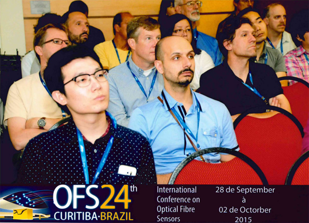
Il CNR IRPI ha partecipato alla 24ma edizione del congresso internazionale sulle fibre ottiche
The CNR IRPI attended the 24th International Conference on Optical Fibre Sensors OFS2015, held in Curitiba (Brazil) the last 28th September- 2nd October, 2015 (http://ofs24.org). The conference is acknowledged as the world’s leading conference on all topics related to photonic sensing technologies and “provides a vibrant forum for reporting the latest advances in fibre-optic and photonic sensing technologies and related devices, as well as it has fostered the exchange of knowledge and ideas within the research and industrial communities”. Luca Schenato from CNR IRPI presented a poster about an optical fiber sensor for temperature and pressure measurement to the aim of embankment monitoring developed with the University of Padova and a low cost optical fiber sensing system for crack monitoring in concrete structures developed with Avago Technologies fibre GmbH.
The CNR IRPI attended the 24th International Conference on Plastic Optical Fibers POF2015
The CNR IRPI attended the 24th International Conference on Plastic Optical Fibers POF2015, held in Nuremberg (DE) the last 22-24th September, 2015 (http://www.pof2015.de). Among the other topics, the conference covers also the “Sensors and Detectors” topic. Luca Schenato from CNR IRPI gave a talk about an optical fiber sensing system for structural health monitoring of concrete structure based on plastic optical fibers developed with Avago Technologies fibre GmbH.
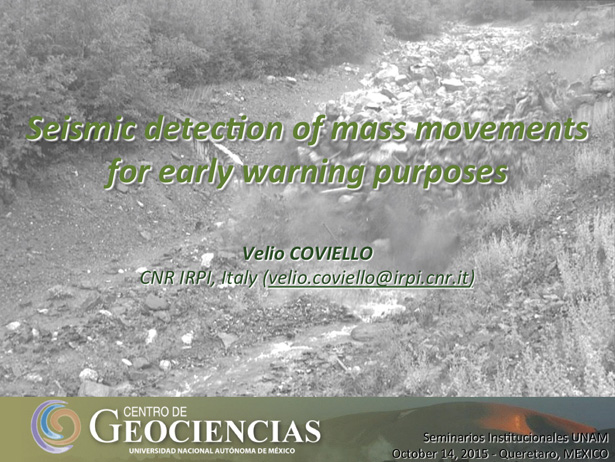
Seismic detection of mass movements for early warning purposes
Il 14 ottobre scorso Velio Coviello, ricercatore presso l’IRPI-CNR, in visita al Centro de Geociencias dell’UNAM (Universidad Nacional Autónoma de México), ha tenuto la lezione dal titolo “Seismic detection of mass movements for early warning purposes” nell’ambito del ciclo di ‘Seminarios Institucionales’ dell’UNAM.
The CNR IRPI Hydrogeomorphology group, together with the Free University of Bozen/Bolzano and the University of Padova will carry out an IPEC (Intensive Post Event Campaign) in Piacenza province
The CNR IRPI Hydrogeomorphology group, together with the Free University of Bozen/Bolzano and the University of Padova will carry out an IPEC (Intensive Post Event Campaign), to reconstruct the dynamic of the extreme weather event that hit several catchments in Piacenza province, causing a severe flash flood and some casualties. First surveys will be carried out in cooperation with technical staff belonging to regional environmental agency (ARPA) and Po river management authority (AIPO).
The survey is carried out as part of Hymex program (http://www.hymex.org/) that aims to a better understanding of the hydrological cycle in the Mediterranean region, with a special focus on extreme events.
Firmati due nuovi Protocolli d’Intesa
Dopo la recente visita di una delegazione del “Korea Institute of Geoscience and Mineral Resources” – KIGAM, a cui è seguita la firma di un Memorandum of Understanding fra i due Istituti, oggi 5 ottobre 2015 è la volta dell’ “Universidad Nacional de Salta” (Argentina) e dell’ “Alexandru Ioan Cuza University of Iași” (UAIC) (Romania), con le quali è stato firmato rispettivamente un Protocollo d’Intesa. Per la durata di tre anni gli Istituti si impegnano così nella cooperazione accademica, scientifica e tecnologica.
Tutti gli accordi sono visualizzabili al seguente link »
Memorandum of Understanding signature between KIGAM (Korea Institute of Geoscience and Mineral Resources) and IRPI (Istituto di Ricerca per la Protezione Idrogeologica)
Today a delegation from KIGAM, the Korea Institute of Geoscience and Mineral Resources, headed by President Dr. Kyu Huan Kim, visited today IRPI, in Perugia. During the visit, a Memorandum of Understanding between the two Institutes was signed. The Memorandum establishes a common framework for the two institutes cooperation, both active in research and technological development on natural hazards and their impact on the natural and anthropic environment, and population.
IRPI wants to thank Professor Francesco Canganella, Scientific Attache’ at the Italian Embassy in Korea – Seoul, for his support in the achievement of the result.
We would like to thank Professor Francesco Canganella, scientific attache’ at the italian embassy in Korea, for the support provided in the achievement of the memorandum.
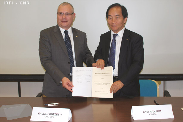
Signature Ceremony of the Memorandum of Understanding, CNR IRPI – KIGAM
SCOPE OF THE MEETING
To sign a Memorandum of Understanding between the Korea Institute of Geoscience and Mineral Resources – KIGAM, and the Istituto di Ricerca per la Protezione Idrogeologica of the Italian Consiglio Nazionale delle Ricerche – CNR IRPI.
The objective of this Memorandum of Understanding (MoU) is to establish a collaborative framework between the Parties, to facilitate the design, the proposal, and the executions of joint R&D activities, and to promote and support cooperation between qualified scientists in the areas of interest covered by the MoU.
To discuss posssible joint research and development activities between KIGAM and CNR IRPI.
FOCUS: a new section of the Web site is now online
It is now online the new section “FOCUS” of our web site. The section publishes short articles to illustrate to a large audience the main activities and some of the most significant results of our research efforts.
Signed a Memorandum of Understanding with the Instituto Geológico y Minero de España
We signed a Memorandum of Understanding with the Instituto Geológico y Minero de España, the Spanish Geological Survey. The three-year agreement is to foster the design and execution of joint research and development activities, and to promote cooperation between researchers of both institutions. More information on the MoU can be found here.
Global research trends in landslides during 1991–2014: a bibliometric analysis
Comunicato tratto dalla Società Geologica Italiana che cita Fausto Guzzeti, Direttore dell’Istituto di Ricerca per la Protezione Idrogeologica, come l’autore più produttivo per quanto riguarda articoli di ricerca pubblicati su riviste di alta qualità, nel periodo compreso tra il 1991 e il 2014.
L’Italia e il CNR ai vertici della ricerca sulle frane
La rivista “Landslides”, una delle principali riviste internazionali nel settore della ricerca sul rischio geo-idrologico in generale, e sulle frane in particolare, ha recentemente (16 agosto 2015) pubblicato on line i risultati di un’analisi bibliometrica sulla ricerca internazionale sulle frane [Wu et al., 20105, Global research trends in landslides during 1991–2014: a bibliometric analysis, Landslides, DOI 10.1007/s10346-015-0624-z, http://link.springer.com/article/10.1007/s10346-015-0624-z].
Lo studio, condotto da quattro ricercatori cinesi guidati da Xueling Wu, ha preso in esame 10.567 articoli scientifici sul vasto tema della ricerca sulle frane pubblicati fra il 1991 e il 2014, e censiti nei database Science Citation Index-Expanded e Social Sciences Citation Index, due delle principali fonti di informazioni bibliometriche esistenti al mondo.
Buone notizie per l’Italia, e per il CNR. Dalla ricerca emerge che l’Italia è il secondo paese (dopo gli USA) nel ranking delle nazioni più produttive nelle ricerche sui dissesti, e che il Consiglio Nazionale delle Ricerche è la terza istituzione al mondo (dopo l’Accademia delle Scienze Cinese – CAS, e il Servizio Geologico Statunitense – US Geological Survey) in termini di produttività scientifica sulle frane nei 24 anni considerati dalla ricerca (1991–2014). Secondo la ricerca, è del CNR l’autore con gli articoli considerati di maggior qualità nel periodo considerato.
New project for the development of an operational flood forecasting system in India for index-based flood insurance implementation
On July, 1, IRPI CNR started a new project in collaboration with the the International Water Management Institute (IWMI) aimed at the development of an operational flood forecasting system in India (Bihar) for index-based flood insurance implementation. The project aims to integrate hi-tech modelling and satellite imagery with other data to predetermine flood thresholds, which could lead to effective compensation payout schemes for low-income, flood-prone communities.
Accordo di Cooperazione tra l’IRPI-CNR e il Sustainable Energy And Water Conservation Unit (SEWCU) del Ministry for Energy and Health (MEH) della Repubblica di Malta
Valorizzando l’esperienza pluridecennale del Gruppo di Idrogeologia (http://hydrogeology.ba.irpi.cnr.it/ ) dell’Istituto di Ricerca per la Protezione idrogeologica nello studio degli acquiferi carsici costieri e dell’intrusione marina, il Sustainable Energy And Water Conservation Unit (SEWCU) del Ministry for Energy and Health (MEH) della Repubblica di Malta ha sottoscritto con l’Irpi-Cnr l’Accordo di Cooperazione “Formulation of a framework to guide the development of a numerical groundwater model to estimate the sustainable yield of the mean sea level aquifer system”.
Lo scopo finale della collaborazione è l’ultimazione di uno studio accurato delle risorse idriche sotterranee maltesi e la definizione dello safe yield, ovvero delle modalità per il prelievo della massima quantità di risorsa nel rispetto duraturo dei requisiti qualitativi, tenuto conto dei futuri scenari di cambiamento climatico, che comportano condizioni di maggiore rischio per il futuro. Scopi questi che saranno perseguiti dallo staff italiano infine mediante la modellazione idrogeologica numerica dell’acquifero costiero maltese.
Per informazioni:
Maurizio Polemio
CNR – Istituto di ricerca per la protezione idrogeologica
Via Amendola 122/I – 70125 Bari
m.polemio (at) ba.irpi.cnr.it
3356154860
Vedi anche:
On line il nuovo numero (3/2015) di Ecoscienza
Ecoscienza è una pubblicazione multimediale, a cura dell’Arpa Emilia-Romagna, costituita da un volume cartaceo bimestrale, che è possibile ricevere in abbonamento a pagamento, e un sito internet (Arpaweb/Ecoscienza) nel quale, oltre alla pubblicazione integrale della rivista, sono disponibili notizie e aggiornamenti di attualità.
In questo numero sono presenti, tra gli altri, i seguenti articoli:
- pag 12 – Frane e alluvioni, una lunga storia italiana (Fausto Guzzetti – CNR IRPI)
- pag 16 – Statistica e modellistica per valutare il rischio frane (Fausto Guzzetti – CNR IRPI)
- pag 18 – Previsione operativa delle frane: il Sistema SANF (Fausto Guzzetti – CNR IRPI)
- pag 82 – Competenze e responsabilità: un problema aperto (Fausto Guzzetti – CNR IRPI)
- pag 113 – L’informazione storica e il catalogo alluvioni (Paola Salvati – CNR IRPI)
New project for the development of an integrated satellite rainfall-soil moisture product over Europe
On June, 15, IRPI CNR started a new project the framework of the EUMETSAT SAF in support to Hydrology (H-SAF) with the subject “Integration of PR-OBS-5 and SM-OBS-1 products through SM2RAIN algorithm for improving rainfall estimate”. The main purpose of the project is the development, testing and validation of a new cumulated rainfall product (over 12 and 24 hours) that integrates satellite rainfall and soil moisture (through SM2RAIN) H-SAF datasets throughout Europe.
POLARIS – Pubblicato il rapporto Primo semestre 2015
È disponibile nel sito POLARIS (Popolazione a Rischio da Frana e da Inondazione in Italia) il Rapporto Periodico sul Rischio posto alla Popolazione italiana da Frane e Inondazioni – Primo Semestre 2015.
Il report è consultabile al seguente link: http://polaris.irpi.cnr.it/pubblicato-il-rapporto-primo-semestre-2015/


