News
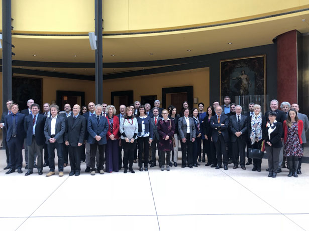
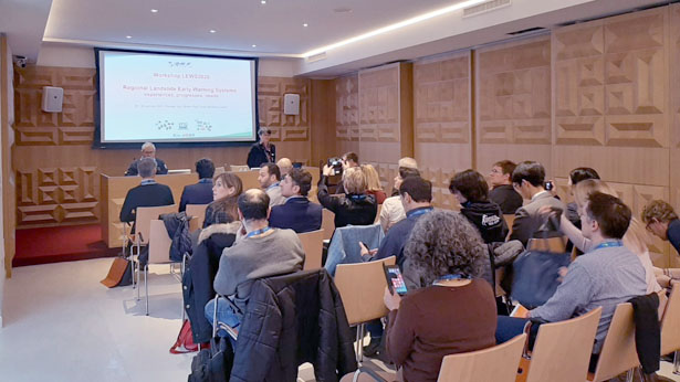
Workshop “Regional Landslide Early Warning Systems experiences, progresses, needs – LEWS2020” in Perugia.

CNR IRPI – together with the British Geological Survey, the Norwegian Water Resources and Energy Directorate, the Swiss Federal Institute for Forest, Snow and Landscape Research, and the University of Salerno, Italy – organize a 3-day workshop on Regional Landslide Early Warning Systems experiences, progresses, needs – LEWS2020.
The workshop follows a previous meeting entitled “Regional early warning systems for rainfall- and snowmelt-induced landslides”, held in Oslo, Norway, on 26-28 October 2016.
The main aims of the initiative are: to collect experiences from worldwide invited experts involved in the design, the development, the operation or the analysis of LEWS, and to exchange knowledge, experiences, challenges and best practices.
Un articolo firmato IRPI citato nello Special Report on Climate Change and Land, presentato oggi dall’IPCC alla COP25 di Madrid

L’articolo “Landslides in a changing climate” di Stefano Luigi Gariano e Fausto Guzzetti pubblicato sulla rivista Earth-Science Reviews nel 2016 è stato citato nello Special Report on Climate Change and Land #SRCCL presentato ufficialmente oggi dall’IPCC – Intergovernmental Panel on Climate Change alla conferenza delle Nazioni Unite sui cambiamenti climatici COP25 di Madrid.
Link allo Special Report on Climate Change and Land »
Fausto Guzzetti lascia la direzione dell’Istituto, Alessandro Pasuto nominato direttore facente funzione

Il 30 novembre, con tre mesi di anticipo rispetto la scadenza prevista, Fausto Guzzetti lascia l’incarico di Direttore dell’Istituto di Ricerca per la Protezione Idrogeologica del Cnr, per assumere un nuovo incarico presso il Dipartimento della Protezione Civile.
Il Presidente del Cnr ha indicato Alessandro Pasuto, della sede di Padova, quale Direttore f.f. dell’Istituto.
Workshop “Stato dell’arte e prospettive nella prevedibilità degli eventi naturali”

Aula Marconi, Consiglio Nazionale delle Ricerche, Roma
26-27 novembre 2019
La Commissione nazionale CNR-IUGG (Consiglio Nazionale delle Ricerche – International Union of Geodesy and Geophysics), presieduta dal direttore del CNR-IRPI Fausto Guzzetti, organizza in Aula Marconi, al CNR, a Roma, il 26 e 27 novembre 2019, il workshop “Stato dell’arte e prospettive nella prevedibilità degli eventi naturali”.
Il workshop ha l’obiettivo di far discutere esperti che si occupano a vario titolo di previsione di eventi e rischi naturali, per capire le differenze negli approcci, per parlare di terminologia, e per valutare se e quanto gli sforzi che ciascuno fa nei propri settori siano confrontabili con quanto viene fatto da altri in altri settori. Il confronto potrà essere particolarmente utile in un contesto di “multi-pericolo/multi-rischio”, di cui si parla molto e che è spesso poco fondato dal punto di vista del rigore scientifico, o poco utile dal punto di vista applicativo.
L’evento si articola in due giornate con 16 presentazioni mirate a esporre lo “stato dell’arte” delle capacità previsionali in vari settori, intervallate da periodi di discussione e confronto collegiale. I 16 relatori sono stati scelti dai rappresentanti del CNR presso le 8 associazioni internazionali che costituiscono la IUGG.
Le presentazioni, ciascuna di 25 minuti, incluse le domande e risposte, saranno intervallate da periodi di discussione collegiale sulle attuali capacità e le prospettive nella prevedibilità degli eventi naturali considerati. Questi momenti collegiali sono lo scopo principale del workshop: gli esperti invitati – insieme ai relatori – discuteranno individuando problemi, somiglianze e differenze con quanto viene comunemente fatto nei vari campi di interesse, proponendo soluzioni, percorsi e visioni alternative rispetto a quelle proposte dai relatori.
Comitato Scientifico
Fausto Guzzetti – rappresentante del CNR presso IUGG e presidente Commissione CNR-IUGG (coordinatore)
Mattia Crespi – rappresentante del CNR presso IAG/IUGG
Giuseppe De Natale – rappresentante del CNR presso IAVCEI/IUGG
Warner Marzocchi – rappresentante del CNR presso IASPEI/IUGG
Marcello Miglietta – rappresentante del CNR presso IAMAS/IUGG
Alberto Montanari – rappresentante del CNR presso IAHS/IUGG
Katrin Schroeder – rappresentante del CNR presso IAPSO/IUGG
Barbara Stenni – rappresentante del CNR presso IACS/IUGG
Umberto Villante – rappresentante del CNR presso IAGA/IUGG
Comitato Organizzativo
Fausto Guzzetti (CNR IRPI)
Frida Clerissi (CNR IRPI)
Stefano Luigi Gariano (CNR IRPI)
Cecilia Lalle (CNR REI)
Maria Elena Martinotti (CNR DSSTTA)
Luigi Mazari Villanova (CNR DSSTTA)
A new geo-lithological map of Central Europe (Geo-LiM) has been published in Journal of Maps

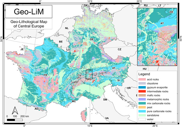
A new geo-lithological map of Central Europe (Geo-LiM) has been published in Journal of Maps. The paper, produced by CNR-IRPI of Perugia and the Department of Physics and Geology of the University of Perugia, was elaborated taking into account the chemical and mineralogical composition of the outcropping rocks. In particular, metamorphic rocks have been classified according to the chemical composition of protoliths. The map was then used to estimate the atmospheric CO2 consumed by the chemical dissolution of carbonate and silicate rocks. Geo-LiM is available in vector format together with the original maps and the computer codes used to classify the different lithologies (https://zenodo.org/record/3530257). In this way, following the Open Science concept, the product can be replicated or modified by users. The complete article can be downloaded at the following address: https://doi.org/10.1080/17445647.2019.1692082.
Luca Brocca, named as Highly Cited Researcher 2019

We are delighted to announce that Luca Brocca, Director of Research at CNR IRPI in Perugia, has been one of the five CNR researchers named as Highly Cited Researcher in 2019 by Web of Science.
Highly Cited Researchers are the world’s most influential researchers of the past decade, demonstrated by the production of multiple highly-cited papers that rank in the top 1% by citations for field and year in Web of Science.
See the full list here https://t.co/D2N2A5QK4a

CNR IRPI at Photonic Sensors and Instrumentation 2 Workshop

Luca Schenato of the Padova branch, attended the first workshop of Photonic Sensors and Instrumentation SINFOTON 2 in Alcalá de Henares (Spain) on Oct. 24, 2019, with an invited talk ” Distributed Optical Fiber Sensing for Geo- Hazards monitoring” where he illustrated the activity of the Geo-Risks Management group about fiber optic sensing.
Progetto Università di Bari, CNR-IRPI e Università Milano-Bicocca si aggiudica finanziamento del Ministero dell’Ambiente

Il finanziamento, bandito dalla Direzione generale per la salvaguardia del territorio e delle acque del Ministero dell’ambiente e della tutela del territorio e del mare, è stato assegnato al progetto di ricerca ‘Progetto integrato di mitigazione del rischio da sprofondamento di cavità’.
Il progetto presentato dalla cordata formata da Università di Bari, CNR-IRPI e Università Milano-Bicocca, nell’ambito dell’area strategica ‘Tecniche e metodologie per l’individuazione, il dimensionamento, l’analisi di stabilità e la messa in sicurezza di cavità sotterranee in aree urbane’, si propone di avanzare le conoscenze scientifiche e di sviluppare una serie di tecniche e metodologie per l’individuazione, l’analisi tipologica e la modellazione dei meccanismi evolutivi delle cavità sotterranee, orientate all’analisi di stabilità e la messa in sicurezza delle stesse.
L’Unità Operativa è composta da ricercatori del Dipartimento di Scienze della Terra dell’Università degli Studi di Bari (Resp: prof. Mario Parise), dell’Istituto di Ricerca per la Protezione Idrogeologica (Resp: dr. Piernicola Lollino) e del Dipartimento di Scienze dell’Ambiente e della Terra – Università Milano Bicocca (Resp: prof. Riccardo Castellanza).
Il progetto propone un approccio innovativo multi-disciplinare, finalizzato alla corretta valutazione dei rischi connessi all’instabilità di vuoti sotterranei in diversi contesti urbani, che tenga conto delle peculiarità intrinseche delle cavità, ma anche delle interazioni delle stesse con l’ambiente urbanizzato nel quadro delle variazioni delle condizioni al contorno indotte dalle attività antropiche.
Lo scopo finale è predisporre una metodologia articolata su due diverse scale, analisi alla MACROSCALA (intero ambito urbano) e alla MESOSCALA (singole cavità), che consenta di individuare le situazioni di maggiore criticità connesse alla presenza di cavità nei centri urbani, di definire le analisi più idonee alla valutazione della stabilità, di procedere con indicazioni riguardanti la messa in sicurezza delle cavità e di definire possibili percorsi di valorizzazione delle stesse.
Per informazioni:
Piernicola Lollino
CNR – Istituto di ricerca per la protezione idrogeologica
piernicola.lollino@irpi.cnr.it
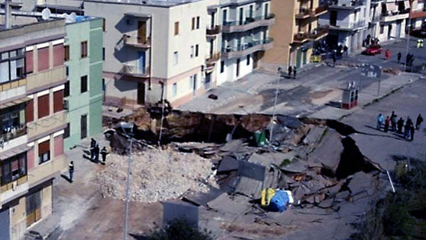
Sprofondamento di una cavità sotterranea
Research meets students: the geo-hydrological risk in high-school internship activities, an opportunity for knowledge and awareness for young people

The event, organized by the Research Institute for Hydrogeological Protection of the National Research Council (CNR-IRPI) and by the Technical Institute “Alessandro Volta” (ITTS) of Perugia, will be held on Thursday 17 October in Perugia at the Sala dei Notari.
Representatives of the National Department of Civil Protection, of the Civil Protection of the Umbria Region, and of the Municipality of Perugia will participate in the event and will illustrate the roles, functions and activities on the territory implemented by the various components of Civil Protection system. The event is part of the program of the “National Civil Protection Week”, established by the President of the Council of Ministers on April 1, 2019. Several events, both national and local, are planned for this first edition. “What we organize in Perugia is aimed at young people, high school students”, explains dr. Fausto Guzzetti, director of the CNR-IRPI. “The main theme of the meeting will be precisely the geo-hydrological risk, from event forecasting activities to mitigation of the effects. These were topics that we have been dealing with for a few years with the students participating in the high school internship”.
The managers of the Regional School Office and Dr. Rita Coccia, director of the ITTS will give their talk on the relevance of involving high schol students for a better knowledge of natural risks, and to raise awareness of the issue of civil protection.
Eventually, researchers from CNR-IRPI will briefly illustrate the scientific activities supporting the National Civil Protection Service, and high school students participating in the internship program will showcase the activities carried out at CNR-IRPI.
Science for Civil Protection: research, training, internationalization, technological innovation in Calabria
Science for Civil Protection, activities and the importance of Centers of Competence

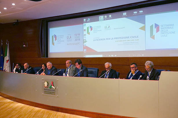
The theme “Science for Civil Protection” was the subject of the debate that took place on October 14, 2019 at the Auditorium Elio Di Cicco, the headquarters of the National Department of Civil Protection in Rome. The event is part of the wide program of the “National Civil Protection Week”, established by the President of the Council of Ministers on April 1, 2019. On October 13 of each year, scheduled events, both national and local, will take place on the date of the International Day, declared by the United Nations, for the reduction of natural disasters.
During the debate, dedicated to the numerous important activities that the scientific community carries out, within the framework of the National Civil Protection Service, a round table on the theme “Support of the various Centers of Competence for Civil Protection activities relating to the whole risk cycle” was held. The Presidents / Directors of the scientific competence centers represented in the Major Risks National Committee (Camilab, CIMA, CNR, CPC-UniFi, EUCENTRE, INGV, ISPRA, PLINIUS, PoliMI-LABMOT, ReLUIS) participated in the round table. Representing CNR was Dr. Fausto Guzzetti, director of the Institute. During the round table, the value of the scientific contribution for the realization of the fundamental activities in the risk cycle: prevention, preparation, management, and overcoming of emergencies was underlined. At the end, the head of the Civil Protection Department, Dr. Angelo Borrelli, read a conclusive declaration shared between the participants. The declaration can be found at the link of the Final Declaration of the day.
Progetto Cnr Irpi, Igag e Irea si aggiudica finanziamento del Ministero dell’ambiente

Il finanziamento, bandito dalla Direzione generale per la salvaguardia del territorio e delle acque del Ministero dell’ambiente e della tutela del territorio e del mare, è stato assegnato al progetto di ricerca ‘Metodologie integrate multi-scala per la zonazione della pericolosità da frana sismo-indotta in Italia’.
Il progetto presentato dalla cordata Cnr nell’ambito dell’area strategica ‘Proposte metodologiche per la mappatura della pericolosità da frana connessa a eventi sismici (frane sismo-indotte), sviluppate anche sulla base di verifiche geomorfologiche dirette e di processi di back analysis’, si propone di avanzare le conoscenze scientifiche e le capacità di prevedere le frane sismo-indotte.
L’Unità Operativa composta dai ricercatori dei tre istituti del Cnr – Istituto di ricerca per la protezione idrogeologica (Irpi), Istituto di geologia ambientale e geoingegneria (Igag), e Istituto per il rilevamento elettromagnetico dell’ambiente (Irea) – è coordinata dal dott. Fausto Guzzetti, direttore del Cnr-Irpi.
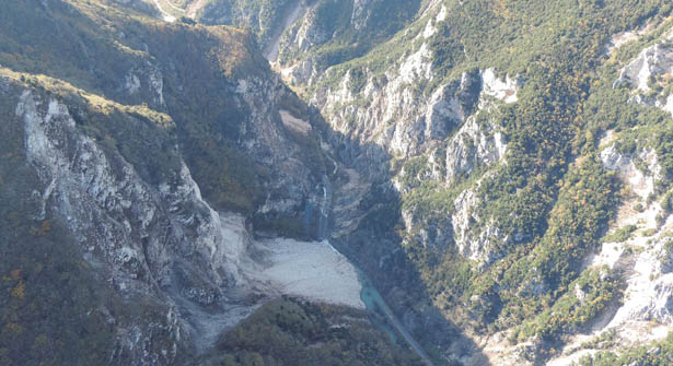
Frana in roccia sismo indotta
Alla base del progetto c’è l’idea che la franosità sismo-indotta sia un fenomeno complesso che debba essere investigato a scale spaziali e temporali diverse. Il progetto implementa l’idea sviluppando e verificando un quadro metodologico unico e un insieme coerente di strumenti modellistici, interpretativi e previsionali per la valutazione e la zonazione della pericolosità da frana sismo-indotta.
Il problema della franosità sismo-indotta è affrontato a tre scale geografiche – la scala sinottica nazionale, la mesoscala regionale e la scala locale – e a due scale temporali – la scala della pianificazione territoriale e della difesa del suolo (pre-evento) e la scala dell’emergenza sismica e della risposta rapida di protezione civile (post-evento), considerando le caratteristiche della franosità sismo-indotta nei principali contesti geologici, geomorfologici e sismo-tettonici italiani.
“Ci aspettiamo – afferma il dott. Guzzetti – che le conoscenze scientifiche acquisite e le metodologie sperimentate nel territorio italiano possano essere applicate ad altre aree geografiche e in contesti geologici e sismo-tettonici simili”.
Per informazioni:
Fausto Guzzetti
CNR – Istituto di ricerca per la protezione idrogeologica
fausto.guzzetti@irpi.cnr.it
ll CNR di Padova partecipa a Veneto Night 2019

In occasione della Notte Europea dei Ricercatori, il CNR di Padova partecipa a Veneto Night 2019 presso Palazzo del Bo, via VIII Febbraio 35135 Padova. Venerdì 27 settembre 2019 dalle ore 17.00 alle ore 23.00 il CNR di Padova ed i ricercatori dell’IRPI incontreranno il pubblico, portando nel centro di Padova i loro esperimenti e parlando di come si riescano ad osservare impercettibili deformazioni della crosta terrestre dallo spazio, di cosa si cela nel sottosuolo e dello studio dei rischi naturali.
IRPI has joined CNIT

IRPI has joined CNIT (National, Inter-University Consortium for Telecommunications, www.cnit.it) which is a non-profit consortium, established in 1995, bringing together 37 public Italian universities to perform research, innovation and education/training activities in the field of the Information and Communication Technology.
CNIT operates 44 Research Units, one for each member university, plus seven other units belonging to institutes of the National Research Council (CNR, the largest public research institution in Italy) that reached a cooperation agreement with CNIT. CNIT also operates five National Laboratories: Photonic Networks & Technologies (located in Pisa); Radar & Surveillance Systems (located in Pisa); Multimedia Communications (located in Napoli); Smart, Sustainable and Secure Internet Technologies and Infrastructures (located in Genova). The innovation and technology transfer of research results towards end-users and industry is a primary mission for CNIT. CNIT also promotes the collaboration between member universities and other educational institutes as well as technical and scientific collaborations with national and international research institutes and industries.
IRPI is listed in INNOVENETO web portal

IRPI is listed in INNOVENETO web portal as a supplier of Basic, Industrial/Applied and Experimental research.
Innoveneto is the web portal devised by the Veneto Region to promote innovation, technology transfer and internationalization processes of Veneto companies and institutions and provided, for each of these areas, a mapping of the actors operating in the supply-chain of innovation.
A new collaboration agreement between OGS and CNR IRPI on landslide studies

On August 1st, the President of the National Institute of Oceanography and Experimental Geophysics, OGS, Prof. Cristina Pedicchio, and the Director of the Institute, Dr. Fausto Guzzetti, signed a three-year agreement of technical and scientific collaboration to execute research and technological development activities of common interest. The research topics covered by the agreement include the monitoring of landslide phenomena, the assessment of landslide risk for the population, marine instability and geomorphology, landslide susceptibility in submarine areas, the assessment of landslide vulnerability along linear infrastructures, and the use of remote sensing, optical and radar techniques.
L’ IRPI all’ International Symposium on Gully Erosion

Si sta tenendo a Townsville (21 – 27 luglio 2019), nei pressi della Grande barriera corallina, l’ottavo International Symposium on Gully Erosion, il primo dell’emisfero australe. Il precedente ISGE si è tenuto a maggio 2016 alla Purdue University nell’Indiana, negli Stati Uniti e prima ancora gli eventi sono stati in Belgio (2000), Cina (2002), Stati Uniti (2004), Spagna (2007), Polonia (2010) e Romania (2013).
La tematica principale affrontata riguarda la Gully Erosion, riconosciuta in tutto il mondo scientifico come causa significativa dei rischi naturali connessi ai fenomeni erosivi. In particolare i punti salienti discussi, relativi a tale erosione, riguardano: l’influenza delle condizioni climatiche e l’uso del suolo; le tecniche sperimentali di misura; la modellistica, la valutazione e la previsione; la gestione e la prevenzione, inclusi aspetti sociali ed economici.
In tale contesto, Mauro Rossi – ricercatore presso l’IRPI CNR di Perugia, Italia – esporrà due contributi dal titolo “Dynamic distributed gully erosion modelling and validation” e “Gully head modelling in Mediterranean badland areas”.
IPROMO 2019 Summer School: Landscape approach for enhancing mountain resilience

The 12th edition of the IPROMO (International Programme on Research and Training on Sustainable Management of Mountain Areas) Summer School was completed successfully. It was organized by Mountain Partnership Secretariat of the Food and Agriculture Organization of the United Nations (FAO-MP), Università degli Studi di Torino and Università degli Studi della Tuscia. The whole Summer School was chaired, and organized, by Dr. Danilo Godone (National Research Council – Research Institute for Hydrogeological Prevention and Protection; CNR-IRPI).
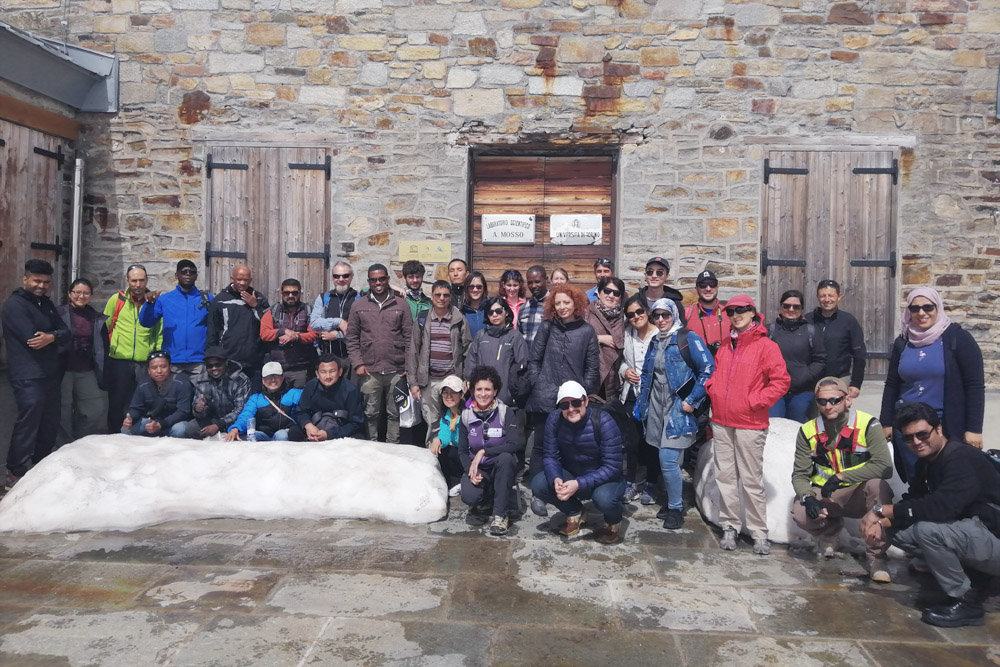
The 2019 Summer School took place, from 2 to 18 July in Pieve Tesino (Trento Province) and Ormea (Cuneo province) where class and field lectures were held.
In cooperation with Institut Agricole Régional (Aosta), two field trips were organized in Aosta Valley, too. This year course hosted several lecturers from Universities and research bodies, FAO and government/private agencies.
The Summer School was attended by 31 participants from 23 different countries all over the World.
Link: http://www.fao.org//forestry/news/96023/en/
Photo credits: Michele Freppaz
Commemorazione per il 10° anniversario della scomparsa del dott. Mario Govi

Il dott. Mario Govi è stato direttore del CNR IRPI di Torino per 22 anni, poi successivamente per brevi periodi anche dell’IRPI di Padova e di Cosenza. Chi ha avuto la fortuna di conoscerlo gli ha sempre riconosciuto un altissimo profilo scientifico e grandi doti umane. È stato incolmabile il vuoto lasciato nella comunità scientifica, soprattutto nel campo degli studi sulla prevenzione dei rischi naturali per eventi alluvionali e frane.
A dieci anni dalla sua scomparsa, avvenuta il 12 luglio 2009, i colleghi di Torino hanno pensato di onorarlo con un ricordo scritto.
Nel PDF scaricabile è condensata la sua lunga e produttiva carriera di ricercatore. Dopo il Curriculum Vitae ed alcune testimonianze di persone che a lui furono molto vicine, sono elencati tutti i lavori di cui si ha traccia nell’archivio del CNR IRPI di Torino. Successivamente, i lavori ritenuti più interessanti, sono stati scanditi e riprodotti integralmente.
Scarica qui il PDF tramite sito ftp »
Il download necessita di autenticazione tramite le seguenti credenziali
Utente: Public_FTP
Password: Public_FTP_IRPI
Tutto l’IRPI si stringe alla famiglia Frigerio e alla sede secondaria di Padova

Nei giorni scorsi è prematuramente scomparso Simone Frigerio, ricercatore presso l’IRPI CNR, valido collega e caro amico per tanti che lo hanno conosciuto e apprezzato. Il direttore Fausto Guzzetti e tutto il personale dell’Istituto si stringono intorno alla famiglia Frigerio e ai colleghi della sede secondaria di Padova, dove Simone ha operato per molti anni. Mercoledì i funerali.
Training Programmes on streamflow monitoring by using advanced no-contact technologies

In the framework of the Memomorandum of Understanding (MoU) between the Indian Institute of Technology Roorkee (IIT Roorkee) and the Research Institute for Geo-Hydrological Protection (CNR IRPI), three training programmes on the subject of non-contact river discharge estimation techniques were organized from June 3 to 14, at Department of Hydrology, IIT Roorkee. These programmes are sponsored mainly by the Ministry of Water Resources and Ganga Rejuvenation, Government of India through its two important World Bank assisted project schemes, viz., The National Hydrology Project (NHP), and the Dam Rehabilitation and lmprovement Project (DRIP). The participants of the training programmes are mainly the river engineers and hydrologists working in Central and State Governments river engineering organisations. MoU paves way for further strengthening the research collaboration between CNR IRPI and IIT Roorkee for research activities on Natural Risks that the Indian and Italian Governments are promoting and that mainly concern the hydrometeorological monitoring (ground and satellite), flash floods and flood phenomena, drought, landslides, groundwater, fusion of glaciers, water resources management, climate change, research and technological innovation. For the latter, CNR IRPI will collaborate with IIT Roorkee in the framework of a project on the monitoring of discharge with no-contact radar technology for the identification of pilot sites in the Godavari and Khrisha river systems.
Rischio sociale da frana: Italia a macchia di leopardo

Uno studio dell’Istituto di ricerca per la protezione idrogeologica del Cnr, pubblicato da Earth-Science Reviews, utilizzando i dati di 1.017 frane fatali avvenute tra il 1861 e il 2015, propone un approccio innovativo per quantificare in termini probabilistici distribuzione spazio-temporale, tempo di ritorno e impatto atteso sulla popolazione di questi eventi calamitosi. Lo studio stima valori di rischio sociale elevato con tempi di ritorno bassi nelle Alpi centrali, del nord-est, occidentali e in Campania; intermedi nelle Alpi Nord-Occidentali, in Liguria, nella zona di transizione Alpi-Appennini, in Calabria e nella Sicilia Nord-Occidentale
Un nuovo studio dell’Istituto di ricerca per la protezione idrogeologica del Consiglio nazionale delle ricerche (Cnr-Irpi), pubblicato sulla rivista Earth-Science Reviews, propone un approccio innovativo per quantificare il rischio sociale da frana in Italia, ossia il rischio che questi eventi calamitosi pongono alla popolazione e alla società. L’approccio proposto permette di valutare in termini probabilistici la distribuzione spaziale e temporale del rischio utilizzando i dati di intensità e frequenza di oltre mille frane con vittime, avvenute dall’unità d’Italia a oggi. I risultati dello studio, oltre a migliorare la zonazione del rischio a scala sinottica, per la prima volta permettono una valutazione del tempo di ritorno delle frane fatali e dell’impatto atteso sulla popolazione.
“L’approccio innovativo proposto utilizza dati storici relativi a un dettagliato catalogo per eventi dei quali sono disponibili informazioni accurate, sulla localizzazione e sul numero delle vittime, in base al quale si è quantificata la magnitudo dell’evento franoso”, spiega Mauro Rossi del Cnr-Irpi e ideatore dello studio. “Utilizzando i dati di 1.017 frane fatali, avvenute tra il 1861 e il 2015, è stata applicata una distribuzione di probabilità per modellare il rischio sociale e stimare, per la prima volta, il tempo di ritorno delle frane in funzione dell’impatto atteso sulla popolazione”.
I risultati confermano che il rischio sociale da frana in Italia varia largamente ed è funzione della combinazione di tre parametri: “L’evento con il più alto numero di vittime registrato (F), il numero totale di frane con vittime (E) e l’esponente della distribuzione di probabilità adottata (s), cioè la proporzione tra frane con bassa e alta magnitudo”, prosegue Rossi. “Le tre variabili sono state calcolate su una griglia con celle di 10 km di lato per consentire una valutazione regolare ed uniforme del rischio sociale sull’intero territorio nazionale”.
“Lo studio ha permesso di stimare valori di rischio sociale elevato con tempi di ritorno bassi (inferiore ai 30 anni) per diverse porzioni delle Alpi centrali e del nord-est, delle Alpi occidentali e della Campania. Valori intermedi sono osservabili nel settore nord-occidentale delle Alpi e in Liguria, e in aree limitate della zona di transizione Alpi-Appennini, in Calabria e nel settore nord-occidentale della Sicilia”, sostiene Fausto Guzzetti, direttore del Cnr-Irpi. “I risultati di questa ricerca forniscono nuove informazioni sulle variazioni spazio-temporali del rischio sociale da frana in Italia, contribuendo a migliorare le zonazioni esistenti, a promuovere l’efficacia dei sistemi di allertamento nazionale e regionali, a progettare e implementare efficaci strategie di comunicazione, mitigazione e adattamento”.
L’approccio fornisce una rappresentazione coerente e realistica e può essere applicato anche in contesti geografici al di fuori del territorio nazionale, dove le frane rappresentano un pericolo esteso e talvolta sottovalutato. “Il catalogo dal quale sono state ottenute queste analisi rappresenta un’unicità italiana, sia per l’estensione temporale sia per il contenuto informativo”, conclude Paola Salvati del Cnr-Irpi e coautrice del lavoro, “ma il nostro approccio può essere applicato ad altre tipologie di rischi naturali e non, per i quali siano noti i dati di frequenza e di magnitudo”. Il modello proposto conferma la difficoltà nella modellazione di set di dati di tipo sparso, quanto sia complesso definire in modo univoco il rischio e come non sia sufficiente un solo parametro per definirlo correttamente. Il lavoro ribadisce l’importanza delle attività di raccolta e gestione di banche dati relative a eventi naturali, fondamentali per una corretta valutazione dei rischi anche se finora non riconosciute a sufficienza.
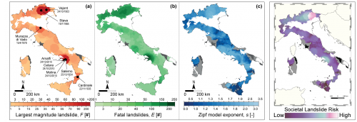
Rappresentazione della variabilità geografica dei tre parametri E, F, s, singola (a-b-c) e combinata in falso colore (d), usati per la stima del rischio sociale da frana
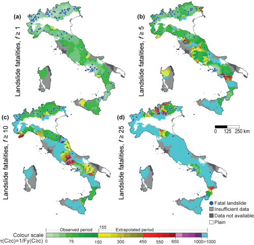
Rappresentazione della variabilità geografica dei tempi di ritorno delle frane in funzione dell’impatto atteso sulla popolazione, espresso dal numero di morti (fatalities)
Second Meeting under the Agreement on Scientific Cooperation between CNR and the University of Malta (UoM)

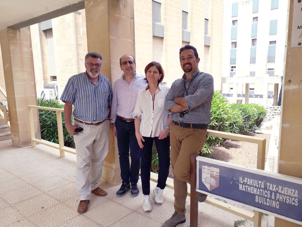
From 5 to 9 June 2019 the second meeting of the Research Project funded under the Agreement on Scientific Cooperation between CNR and the University of Malta (UoM) – Biennial Programme 2018/2019 was held in Msida (Malta). This meeting involved Loredana Antronico and Roberto Coscarelli both of CNR-IRPI and Prof. Anton Micaleff and Dr. Sebastiano D’Amico of the Institute of Earth Systems and the Department of Geosciences of the University of Malta, respectively.
New book about monitoring and prediction of hydro-meteorological extremes through the use of remote sensing

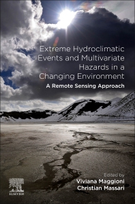
The book Extreme “Hydroclimatic Events and Multivariate Hazards in a Changing Environment: A Remote Sensing Approach” is now avaialble on the Elsevier store . The book, edited by Christian Massari from the IRPI-CNR and Dr. Viviana Maggioni from George Mason University, provides a detailed overview of remotely sensed observations, current and future satellite missions useful for hydrologic studies and water resources engineering, and a review of hydroclimatic hazards. It covers both short and long-term predictions from earth observations, along with long-term climate dynamics and models and is intended for hydrologists, agronomists, geologists and water resource scientists focusing on climate change, sustainability, risk-assessment, and risk reduction.
Atelier di formazione alla ricerca in alta quota

Nell’ambito del progetto RiST2, cofinanziato dalla Fondazione CRT, dal 2 al 6 settembre 2019 nel bacino glaciale della Bessanese (Balme, TO) si svolgerà un “Atelier di formazione alla ricerca in alta quota”. L’iniziativa è finalizzata all’introduzione di studenti universitari di atenei piemontesi ai metodi della ricerca scientifica ed alle loro dirette applicazioni in campo. Gli studenti saranno i veri protagonisti dell’Atelier: definiranno obiettivi e metodi del proprio progetto ricerca, raccoglieranno ed analizzeranno dati, e presenteranno infine i risultati del loro lavoro. Ricercatori del CNR-IRPI e dell’INRiM seguiranno tutto il percorso formativo degli studenti, stimolandoli e coinvolgendoli mediante l’applicazione di un approccio collaborativo e condiviso. La base logistica per le attività in campo sarà il Rifugio Gastaldi.
Per informazioni:
marta.chiarle@irpi.cnr.it
Allegati:
locandina
L’IRPI ha partecipato al ‘Mistral Hackathon’

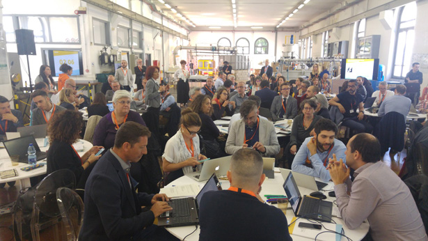
Il 30 maggio 2019 Paola Reichenbach (ricercatrice presso il CNR IRPI di Perugia) ha partecipato, presso il Dipartimento di Ingegneria Civile e Ambientale del Politecnico di Milano, all’evento ”Mistral Hackathon”. Si tratta di una giornata di confronto per raccogliere le esigenze di potenziali fruitori del nascente portale della meteorologia italiana Mistral, al fine di progettare e implementare le modalità di visualizzazione ed esposizione dei dataset e dei metadati, adattati ai bisogni dell’utente. La giornata si è svolta con discussioni (per esempio, dati misurati da stazione, dati radar e satellite, modellistica e servizi meteorologici personalizzati) in tavoli settoriali (trasporti, media, energia, sport/eventi, istituzioni, agricoltura, assicurazioni, provider di servizi meteo, ricerca). I risultati delle discussioni tra i componenti dei tavoli tematici saranno utilizzati per definire i requisiti del portale meteo nazionale in via di costruzione.
I canali social dedicati all’evento sono:
Twitter
https://twitter.com/Mistral_hack19
Nickname: @Mistral_hack19
Nome: Mistral Hackathon 2019
Linkedin
Link: https://www.linkedin.com/in/mistral-hackathon-6a5927187/
Nome: Mistral Hackathon
YouTube
Canale dedicato all’evento
Hashtag
#mistralhackathon #mistralhackathon2019
Workshop on climate and tourism for the INDECIS project

On Tuesday 30 May a Workshop on “Realizzazione e Comunicazione di Servizi Climatici per il Settore Turistico del Parco Nazionale della Sila nell’ambito del Progetto INDECIS” has been organized by CNR-IRPI – office of Cosenza -, Ente Parco Nazionale della Sila and University “Rovira i Virgili” of Tarragona (Spain). The Workshop, that will be held in the “Centro Visita Cupone” of the Parco Nazionale della Sila, is part of the European INDECIS Project (Integrated approach for the development across Europe of user oriented climate indicators for GFCS high-priority sectors: agriculture, disaster risk reduction, energy, health, water and tourism). The project, coordinated by Enric Aguillar of the University Rovira i Virgili/Center for Climate Change (C3) of Tarragona – Spain, has a partnership composed by researchers of Institutes and Universities coming from 12 EU Countries. Roberto Coscarelli (CNR-IRPI – Office of Cosenza) is one of the Principal Investigators.
The Sila Park has been chosen as study Area in the Project for the tourism sector. The Workshop includes two sessions: the first one having relations of experts in the climate and tourism sectors (project participants and from the Centro Funzionale Multirischi of ARPACAL) and a second one based on the focus groups. Each focus group will be composed by local tourism stakeholders (parks, hotel owners, tourism associations and agencies, etc.) and by climate experts. In this way, the stakeholders will put in evidence, based on their needs and knowledge, their expectations relatively to the climate services that are the aims of the INDECIS Project.
For information: roberto.coscarelli@irpi.cnr.it
Attached: programma
Sistema SANF: laboratorio tra IRPI e DPC

Nella giornata di oggi 22 maggio 2019 sì è svolto, presso il Dipartimento della Protezione Civile a Roma, una giornata di incontro e formazione tecnica per i Centri Funzionali Decentrati regionali sul sistema di allertamento per frane pluvioindotte SANF.
Un laboratorio in cui i ricercatori dell’IRPI CNR della sede di Perugia hanno messo a disposizione le loro competenze per discutere di alcuni strumenti a supporto delle valutazioni del rischio idrogeologico.
Per approfondimenti sul sistema innovativo SANF si veda:
https://www.irpi.cnr.it/product-service/sanf/
https://www.irpi.cnr.it/project/sanf-rfi/
https://www.irpi.cnr.it/project/sanf-liguria/
Alcuni scatti della giornata
Geosciences for disaster risk reduction: problems solutions and perspective

Invitiamo tutti gli interessati a presentare contributi alla sessione Geosciences for disaster risk reduction: problems solutions and perspective organizzata nell’ambito del prossimo Congresso Nazionale SGI che si terrà Parma, dal 16 al 19 settembre 2019.
Per sottomettere gli abstract è necessario registrarsi nel sito del convegno: http://parma2019.socminpet.it/index.php
Per informazioni: Fausto.Guzzetti@irpi.cnr.it
Giulia Bossi alla Ruhr-Universität

Giulia Bossi, assegnista all’Istituto di ricerca per la protezione idrogeologica nella sede di Padova, terrà oggi un seminario alla Ruhr-Universität a Bochum, in Germania.
La ricercatrice IRPI è stata invitata dal prof. Tobias Backers a tenere una lezione per studenti e ricercatori del dipartimento dal titolo: “Methods for the calibration of geotechnical models”. Nel talk verranno affrontate tematiche riguardanti l’incertezza nella definizione di modelli geotecnici e la loro calibrazione automatica su dati di monitoraggio.
The CNR IRPI is now certificated by ENAC as SAPR OPERATOR and CONSTRUCTOR

Our institute, after a long work in collaboration between ENAC (National Entity of Civil Aviation – www.enac.gov.it) and CNR Working Team nominated by the CNR General Director, obtained official certification as RPAS Operator and constructor with consequent authorization to carry out critical and non critical flight operations.
The WT has the following objectives:
- Census and mapping of CNR UAV’s activities;
- Definition of administrative procedures for new operators and drone registration;
- Definition of guidelines for CNR UAV’s fleet managing including operators and pilots safety; data management and security.
This acknowledgment implies the fulfillment of all legal obligations concerning census of pilots; flight operations and aircraft maintenances.
CNR IRPI UAV’s fleet:
At today, UAV’s fleet registered to ENAC is composed by various commercial and self made aircfraft, located over two secondary IRPI officies:
CNR IRPI s.s of TURIN (4 enabled pilots):
- ENAC No. 36408: DJI PHANTOM 4 PRO – non critical and critical scenarios S01/S04/S06
- ENAC No. 36406: SENSFLY EXOM – non critical and critical scenarios S01/S04/S06
- ENAC No. 36405: DJI PHANTOM 4 – non critical and critical scenarios S01/S04/S06
Self made fixed wings:
- ENAC No. 36404: CNR-IRPI-GMG-M1 – non critical and critical scenarios S01/S04/S06
- ENAC No. 36403: CNR-IRPI-GMG-T1 – non critical and critical scenarios S01/S04/S06 – (https://www.irpi.cnr.it/en/nuovo-drone-ad-ala-fissa-per-il-rilevamento-del-territorio/) – (https://www.irpi.cnr.it/en/uav-fixed-wing-cnr-irpi-gmg-t1/)
CNR IRPI s.s di COSENZA (2 enabled pilots):
- ENAC 36407: DJI PHANTOM 4 PLUS – non critical scenarios
Soon, a dedicated web section will be prepared to assist and regulate registration and manegement of new drones according to official ENAC aerial regulation.
More info at: Marco Baldo (marco.baldo@irpi.cnr.it)
Premio Florisa Melone 2019

È stato bandito dalla Società Idrologica Italiana il Premio Florisa Melone 2019, un tributo alla memoria e alle numerose attività che la Dott.ssa Florisa Melone – già socia della SII – ha svolto nel corso della sua vita: dal monitoraggio dei bacini idrografici allo studio dei processi e alla gestione della risorsa idrica, dalla previsione delle piene al rischio alluvione in un contesto di cambiamenti globali.
Il premio intende assegnare un supporto economico di 5000 euro a progetti di ricerca svolti da GRUPPI di giovani ricercatori (tra cui dottorandi e postdoc), iscritti alla Società Idrologica Italiana, che hanno conseguito la laurea magistrale e che hanno un’età non superiore a 35 anni con la finalità di incoraggiare l’autonomia di ricerca di giovani soci e stimolare nuove idee nel campo idrologico.
Maggiori informazioni ed iscrizione »
Students speakers at EGU 2019: success of the school-work exchange program at CNR-IRPI

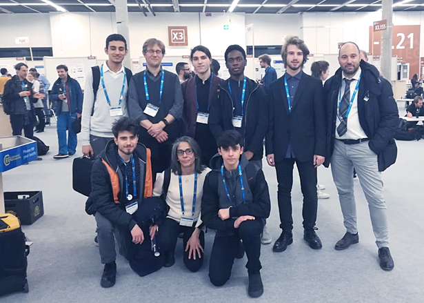
The collaboration between academia and public school has allowed to achieve an important goal. The synergy developed within the school-work exchange program between researchers of the Research Institute for Hydrogeological Protection (IRPI) of CNR and the students and teachers of the Istituto Tecnico Tecnologico Statale A. Volta (ITTS) of Perugia has produced results of high technological quality. Results were presented at the International European Geoscience Union (EGU) General Assembly 2019 conference, which took place in Vienna last week.
Six information technology students from ITTS presented, on 12/04/2019, the results of the activities carried out during their stay at the IRPI Institute in Perugia. The work, developed independently by the students with the supervision of the researchers, resulted in the development of different software applications that can be used from computers, tablets and smartphones. These are two innovative products useful for the validation of software developed in-house by IRPI for the temporal forecast of the triggering of landslides (SANF). The first product is an automatic system that, through the use of deep semantic learning libraries, allows detection, filtering, classification and geolocation on web maps of tweets containing information related to the word ‘landslide’. The second product is a web service to present landslide forecasting (SANF) maps combined with the location of landslides obtained from tweets.
In addition to the strictly technological aspects, the continued collaboration with IRPI researchers, allowed students and teaching staff to increase their knowledge of landslides and floods characteristics, their impact on the population and the environment, and to learn about recommended self-protection actions before, during and after geo-hydrological events.
The figure below shows the young speakers with Cnr-Irpi professors and researchers.
Cooperation agreement on landslide prediction with the British Geological Survey

The British Geological Survey (BGS) and the Research Institute for Geo-Hydrological Protection (IRPI) of the Italian National Research Council (CNR) have signed a Memorandum of Understanding (MoU) aimed at fostering common research activities in the fields of geomorphology and engineering geology, with emphasis on:
• multi-scale geomorphological and geological mapping and modelling,
• development of systems for the operational forecasting of landslides,
• geo-hydrological risk assessment in a multi-risk context, and
• impacts of global, climatic and environmental changes on geo-hydrological instability phenomena.
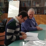
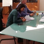
The formal exchange of documents between Helen Reeves, Scientific Director for Applied Geology and Geoengineering of the BGS, and Fausto Guzzetti, Director of the CNR-IRPI, shown in the photo [Photo 1], took place at the General Assembly of the European Geoscience Union (EGU) underway in Vienna, Austria.
La Scienza al Voto – Comunicato stampa

Si riporta di seguito il comunicato stampa emesso nella giornata di ieri 27 marzo 2019 dal comitato ‘La Scienza al Voto’.
E’ stata pubblicata oggi sul sito de ‘La Stampa’ la lettera aperta degli scienziati dei cambiamenti climatici agli studenti che stanno scioperando per il clima (questo il link).
Gli scienziati, raccolti nel Comitato scientifico “La Scienza al Voto”, che unisce 19 tra i maggiori studiosi italiani di cambiamenti climatici e ambiente, sono coordinati dal climatologo del CNR Antonello Pasini.
“Abbiamo sentito il bisogno di rivolgerci agli studenti che ogni venerdì scendono in piazza per il clima per gratitudine”, spiega Pasini: “il movimento Fridays For Future, cominciato da Greta Thunberg in Svezia ma che oggi coinvolge più di 125 paesi nel mondo e che vede in Italia mobilitate più di 200 città, nasce perché i politici – e l’opinione pubblica – ascoltino finalmente l’allarme lanciato dalla scienza, il rischio concreto che il nostro mondo diventi non più ospitale, che le risorse a nostra disposizione diminuiscano grandemente; e perché ascoltino le soluzioni che la scienza mostra come corrette, con tecnologie già a nostra disposizione e per adottare le quali serve solo la volontà politica”.
“Abbiamo allora scritto questa lettera aperta”, aggiunge Pasini, “per offrire il nostro sostegno ai ragazzi, che dopo il grande successo del loro ‘sciopero globale per il futuro’ del 15 marzo sono stati oggetto di attacchi ingiusti e inaccettabili tentativi di negare l’origine umana dei cambiamenti climatici e la loro enorme pericolosità; e per proporre loro di affiancarci, se lo credono, nella nostra ricerca di un lavoro comune con la classe politica, che deve essere all’altezza della sfida e portare a risultati urgenti e adeguati alla gravità della crisi climatica”.
“Infine, con questa lettera abbiamo voluto sottolineare”, conclude Pasini, “che un ruolo decisivo lo hanno gli insegnanti e i giornalisti, in quanto formatori di coscienze e di opinioni, cui spetta un dovere speciale di raggiungere una consapevolezza in materia di manomissione del clima e possibili soluzioni alla crisi – così, nel ringraziare ‘La Stampa’ per la pubblicazione della nostra lettera, speriamo che il suo contenuto sia ripreso e divulgato anche da altri media”.
Comunicato Stampa con lettera aperta »
XIV Convegno Nazionale GIT – Geosciences and Information Technologies

Il XIV Convegno Nazionale della Sezione “GIT-Geosciences and Information Technologies” della Società Geologica Italiana si svolgerà nei giorni 17-19 giugno 2019, presso il Castello normanno-svevo di Melfi (Pz).
Il Convegno, che si avvale del supporto scientifico dell’IRPI, ha ottenuto il Patrocinio da “Fondazione Matera Basilicata 2019 – Capitale Europea della Cultura”.
I giorni 17-18 giugno saranno dedicati alle sessioni scientifiche (orali e poster) e ai workshop (se verranno promossi dalle aziende partecipanti) mentre il giorno 19 giugno sarà dedicato ai corsi formativi e al field trip a Matera.
Alcune novità in corso di finalizzazione:
- un pre-field trip nella giornata di domenica pomeriggio, 16 giugno 2019, nel Complesso Vulcanico del Vulture;
- un momento di incontro, durante il Wine Poster di lunedì, con gli studenti delle Scuole Medie Superiori sul tema della conoscenza/consapevolezza dei rischi dal titolo: “La Scienza incontra il Cittadino del Futuro: gli studenti tra tecnologia e consapevolezza dei rischi”. Gli studenti presenteranno i loro lavori/idee circa la comunicazione dei rischi mediante le moderne tecnologie ICT. L’incontro proseguirà anche nel pomeriggio di martedì 18 giugno, al termine dei lavori congressuali. Chiunque sia interessato a far partecipare una o più classi all’incontro è pregato di contattare la Segreteria del Convegno.
La Call for abstract è disponibile al seguente link »
La deadline per l’invio degli abstract è fissata per martedì 30 Aprile 2019. Gli abstract dovranno essere inviati esclusivamente a segreteria@gitonline.eu secondo le modalità e le preferenze indicate nella Scheda di Iscrizione.
Maggiori informazioni al link »
The new version of SM2RAIN-ASCAT global rainfall dataset is online!

12-year (2007-2018) of global daily rainfall (12km resolution) freely available at: https://zenodo.org/record/2591215
The SM2RAIN-ASCAT dataset is particularly good in data scarce regions, i.e., in Africa and South America. In these areas we expect the larger benefits in using SM2RAIN-ASCAT for hydrological, meteorological and agricultural applications.
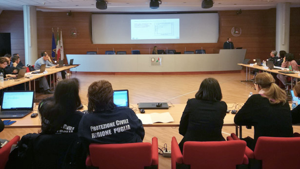
Riunione generale del progetto POR e formazione del CNR IRPI al DPC Regione Puglia

Si svolge oggi, presso la sede del CNR IRPI di Bari, la riunione generale del progetto “Valutazione integrata di dissesti geo-ideologici nel territorio della Regione Puglia, modelli interpretativi dei fenomeni e definizione di soglie di pioggia per il possibile innesco di frane superficiali” finanziato dal P.O.R. Puglia 2014-2020.
L’incontro vede coinvolto il personale di tutte le sedi dell’Istituto che contribuiscono alle attività di progetto: la sede di Bari, quella di Perugia e la sede di Torino.
Il progetto, che è stato avviato nel Dicembre 2016 e terminerà le proprie attività nel Dicembre 2020, nasce dall’interazione tra la Protezione Civile della Regione Puglia e il CNR IRPI e intende offrire avanzamenti nel processo di mappatura dei fenomeni di instabilità, nelle procedure di valutazione del rischio associato, nella definizione delle relative condizioni di innesco e nella interpretazione dei meccanismi di generazione delle fenomenologie di dissesto nel territorio regionale.
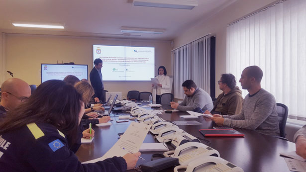
Nella giornata di ieri, 5 Febbraio, si è svolta una giornata di formazione rivolta al personale della Protezione Civile della Regione Puglia dal tema “Previsione operativa delle frane”.
La sessione di formazione continuerà nella giornata di domani, 7 Febbraio, affrontando il tema “Carte inventario delle frane e Valutazione geomorfologica del rischio da frana. Esempi nel Sub-Appennino Dauno”.
New online volume “Natural Hazards and Disaster Risk Reduction Policies”

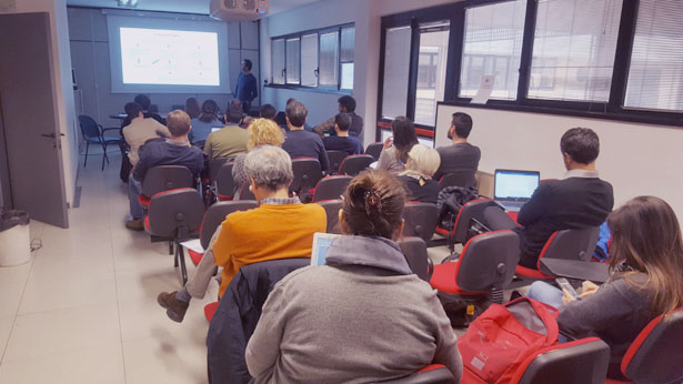
Natural Hazards and Disaster Risk Reduction Policies (Editors: Loredana Antronico (CNR-IRPI) and Fausto Marincioni (UNIVPM)) is a volume of the Open Access and peer-reviewed series “Geographies of the Anthropocene” (Il Sileno Edizioni), ISSN 2611-3171.
The purpose of the Book is to document a number of case studies from different regions of the World pursuing disaster risk reduction through preparedness, mitigation, emergency response, and recovery activities. The volume contains 14 chapters divided into three sections: 1) disaster risk perception, 2) disaster planning and management, and 3) disaster mitigation and preparedness. The book chapters contribute to the current scientific debate on disaster ecology, exploring strategies and ability of local communities to adjust to hazard and disasters. Common thread among the different case studies is the need for Homo sapiens to define its rights and responsibilities in environmental dynamics, including extreme events and disasters. In the end, the choice of how to deal with hazard, vulnerability and disasters, highlights the ethical nature of disaster risk reduction; control of nature or adaptation to its cycles?
The Book is available at the following link »
Anche l’IRPI CNR parteciperà al convegno “Strategie resilienti di contrasto al dissesto idrogeologico”

La Regione Puglia, l’Ufficio del Commissario di Governo per il dissesto idrogeologico ed ASSET, in collaborazione con il Consiglio Nazionale degli Ingegneri, l’Ordine dei Geologi della Puglia e l’Ordine degli Architetti della Provincia di Bari, organizzano il convegno dal titolo “Strategie resilienti di contrasto al dissesto idrogeologico” che si terrà il giorno 18 gennaio 2019, ore 9:00 – 18:00, presso l’Aula Magna “Attilio Alto” del Politecnico di Bari – Via Orabona 4.
Nella sessione pomeridiana Piernicola Lollino ricercatore presso l’IRPI CNR di Bari farà un intervento dal titolo ‘‘Analisi della suscettibilità al collasso di falesie costiere in roccia e cavità sotterranee.’’
L’iniziativa nasce per promuovere la conoscenza e la diffusione dei criteri e degli indirizzi alla base della programmazione e progettazione degli interventi di difesa del suolo, attraverso l’analisi dei risultati ottenuti negli ultimi anni e il confronto tra le varie esperienze presentate.
La partecipazione è gratuita. L’evento è accreditato dagli Ordini professionali degli Architetti PPC (6 CFP), Geologi (7 CFP) e Ingegneri (3 CFP).
Con il Patrocinio di: Ministero dell’Ambiente, ISPRA – Istituto Superiore per la Protezione e la Ricerca Ambientale, Sistema Nazionale per la Protezione dell’Ambiente, Autorità di Bacino Distrettuale dell’Appennino Meridionale, Politecnico di Bari, Università degli Studi di Bari Aldo Moro, OIBA – Ordine degli Ingegneri della Provincia di Bari.
Rosa Mateos and Oded Katz, visiting scientists at IRPI Perugia

Rosa María Mateos Ruiz from the Geological Survey of Spain (IGME – Instituto Geológico y Minero de España), will spend in our Institute a mobility period of three months in the framework of the Salvador de Madariaga Spanish grant. Her stay in Perugia, beginning the 1st January 2019, will focus on the topic “Geohazards on urban settlements: landslides and rockfalls. New methodologies and applications”. The common and shared research activities will give continuity to the long-standing effective collaboration between our two institutions.
Oded Katz, from the Geological Survey of Israel, will spend 10 days in our Institute in the framework of the Short Term Mobility Program 2018, funded by CNR, starting from 9 January 2019. The objective of his staying is to evaluate and map the earthquake induced rock fall hazard along the Dead Sea western coast, by predicting sites of high hazards using computer modelling and if possible remotely sensed data and image analysis.
Tredicesima stabilizzazione all’IRPI, la prima ‘comma 2’

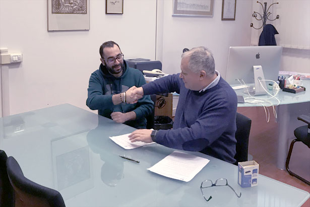
Nella mattina di oggi 28 dicembre 2018, il direttore dell’Istituto ha firmato il contratto per l’assunzione a tempo indeterminato di Luca Ciabatta, ricercatore del gruppo di idrologia dell’IRPI CNR di Perugia e vincitore di uno dei concorsi indetti per gli aventi i requisiti previsti dal D.Lgs. 75/2017, articolo 20, comma 2.
Si tratta del tredicesimo dipendente dell’Istituto a raggiungere questo importante traguardo, e va ad aggiungersi agli altri ricercatori e tecnici stabilizzati appena qualche giorno fa (si veda il seguente articolo »). A lui vanno le congratulazioni del direttore Fausto Guzzetti e di tutto il personale dell’Istituto, con l’auspicio che quanto prima anche gli altri colleghi presenti nelle varie graduatorie possano raggiungere lo stesso traguardo.
Seminario del prof. Daniele Penna all’IRPI di Perugia

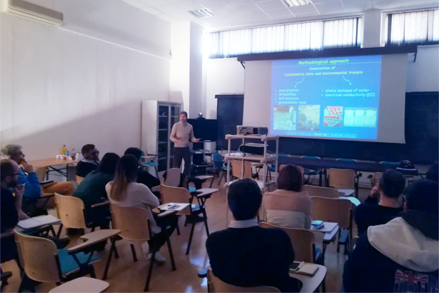
Il Prof. Daniele Penna dell’Università di Firenze – lunedì 17 dicembre – ha tenuto, presso la sede centrale dell’IRPI CNR, un seminario dal titolo “Tracing water in the critical zone: new applications of stable isotopes in hydrology and ecohydrology” sull’eco-idrologia e sull’uso degli isotopi. Tali tecniche permettono di sviluppare nuove ipotesi sul funzionamento dei processi idrologici e delle piante a diverse scale spaziali. Il seminario ha fornito diversi spunti di riflessione che saranno oggetto di collaborazione futura tra il Prof. Penna e i ricercatori dell’IRPI.
Si riporta di seguito l’abstract del seminario.
The increasing worldwide concern about water scarcity deriving from global warming stresses the necessity to adopt more sustainable strategies of water consumption for irrigation in agriculture, water supply in forestry, clean drinking water and water for domestic and industrial use. Achieving a more detailed description of processes controlling the amount and availability of water volumes cycling through different compartments of the environment is therefore of paramount importance for an effective management of water resources. Stable isotopes of oxygen and hydrogen as tracers have proved to be a robust and ubiquitous tool for the quantification of different components of the water cycle and the partitioning of water sources in the soil-plant-lower atmosphere continuum. In this talk, I will present new experimental cases leading to the advancement in understanding the spatio-temporal controls on the transport of water fluxes within and among different compartments of the water cycle. I will report examples of case studies spanning different spatial scales, from plots and catchments in Italy to analyses as the global scale.
(Foto del seminario)
36th International Geological Congress – Second Circular

The second circular of the 36th International Geological Congress has been published. Among other things, the 2nd circular contains a draft of the congress program. Of particular interest in the programme, is Theme 31 | Geohazards, coordinated by O.P. Mishra (India), Saibal Ghosh (India), and Fausto Guzzetti (Italy).
Twelve contracts signed for recruitment in the CNR

For the new recruits it is a goal achieved at the end of a long – for some very long – precarious path. To all of them go the congratulations of the Institute, and the Director.
Fifteen additional people who meet the requirements of Article 20, paragraph 2, of Legislative Decree 75/2017 currently operate in the Institute. The director hopes that even for these colleagues we can arrive in a reasonably short time to a permanent employment.
L’opuscolo “Che fare? Cosa fare (e non fare) prima durante e dopo un’alluvione” è da oggi disponibile per la consultazione e il download.

Presentato in occasione dell’evento “Le vie dell’acqua”, che si è tenuto dal 5 al 9 dicembre 2018 presso il ‘Convention Center La Nuvola’ di Roma nell’ambito di “Più libri più liberi”, l’opuscolo è stato realizzato allo scopo di sensibilizzare la popolazione sulle tematiche del rischio geo-idrologico del nostro paese e offre validi suggerimenti, utili per affrontare e superare le varie situazioni e criticità che possono presentarsi prima, durante e dopo gli eventi alluvionali.
Nella sezione ‘cosa facciamo’/’promozione’/’informazioni’ del nostro sito è possibile consultare tutto il materiale divulgativo rivolto alla popolazione a scopo anche ‘didattico’. A questo link è possibile effettuare il download dell’opuscolo, che riportiamo anche di seguito.
IRPI at the 2018 ICL-IPL Conference in Kyoto, Japan

From 1 to 4 December 2018, Fausto Guzzetti attended the 2018 ICL-IPL Conference, held in Kyoto, Japan. During the conference, the Italian regional network of the International Consortium of Landslides (ICL) was launched. In addition to our Institute, the National Institute for Environmental Protection and Research (ISPRA) and the Universities of Florence, Rome La Sapienza and Calabria are part of the national network. Other universities have started the process of joining the national network.
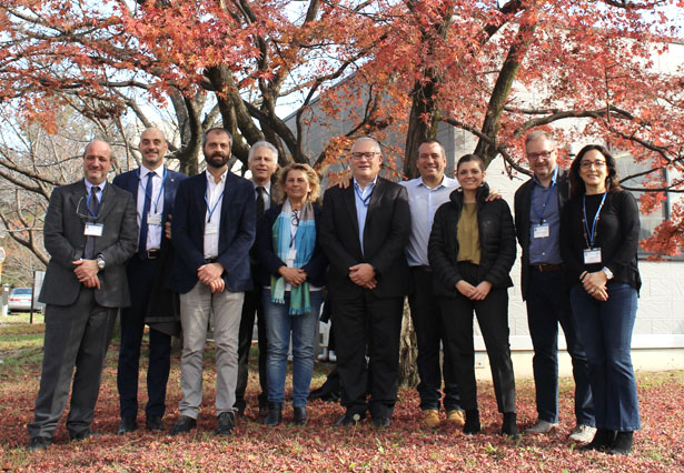
Italian participants at the 2018 ICL-IPL Conference, in Kyoto, Japan.
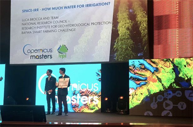
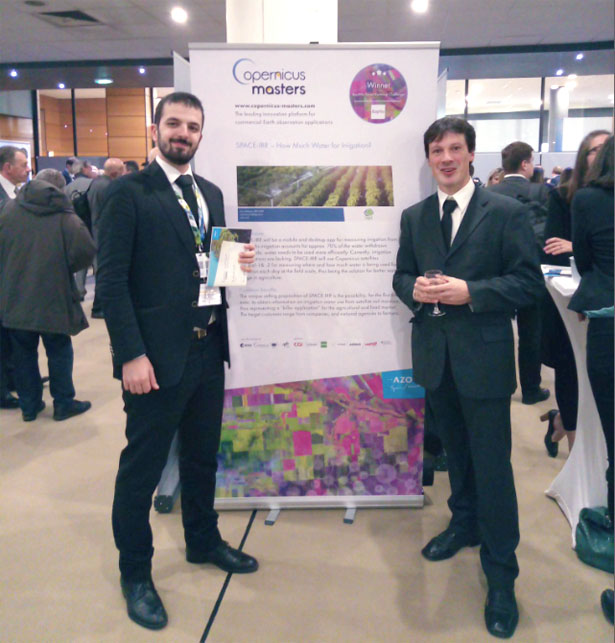
Hydrology Group of IRPI-CNR win the BayWa Smart Farming Challenge at the International Copernicus Master competition

On 3 December 2018, at the international competition “Copernicus Master”, the Hydrology group of IRPI-CNR was awarded in the “BayWa Smart Farming Challenge” with a work on the estimation of irrigation from space. The ceremony was attended by Luca Brocca and Paolo Filippucci representing the group. With this work, the Hydrology group will be able to develop the method over large areas thus allowing them to help people save and optimize water use for agriculture and other sectors. In the near future, it will be a must as we have to exploit water resources of our planet in a sustainable manner.
Collaboration ETH Zurich – CNR IRPI Bari

Given the interesting potential of the work carried out during the Short Term Mobility CNR 2018 on development of numerical models for the analysis of the run-out phase of submarine landslides, Nunzio Luciano Fazio (Research Fellow at CNR-IRPI of Bari) was invited as Visiting Scientist at ETH for a further one month period to continue the collaboration. The goal was to investigate the effects of landslide triggering conditions on run-out phase of submarine landslides. This research topic comes from the need to define suitable numerical techniques for assessing the stability conditions of submarine slopes and evaluating the associated risk.
IRPI at the ’13th US-Italy Joint Commission Meeting’

Yesterday, Thursday, December 6, at the Embassy of Washington, the 13th US-Italy Joint Commission Meeting in Science and Technology Cooperation took place. IRPI CNR was present thanks to the participation of its researchers Massimiliano Alvioli and Paola Reichenbach. For more details about the day you can consult the following link.
Group photo of the meeting participants.
