
News
The aerial LiDAR of CNR IRPI is now EASA MINOR approved

Our institute recenlty obtained the LoA (Letter of Autorization and Arrangement) for the certified installation of our aerial Lidar, according to the EASA (European Aviation Safety Agency) regulamentation, on 15 EUROCOPTER AS350 B1, B2 and B3.
Certification process, defined by the MINOR CHANGE approval standard, implied several EMI (ElectroMagnetic Interference) tests over flight avionics; a Flight Manual Supplement and an Installation Service Bulletin draw up and, lastly, a new management procedure of the instrumentation during the aerial survey processes.
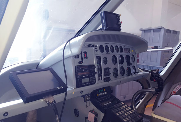
Figure 1: FMS (Flight Management System) display and LMS (Lidar Management System) display installed on a AS350 B2 cockpit.
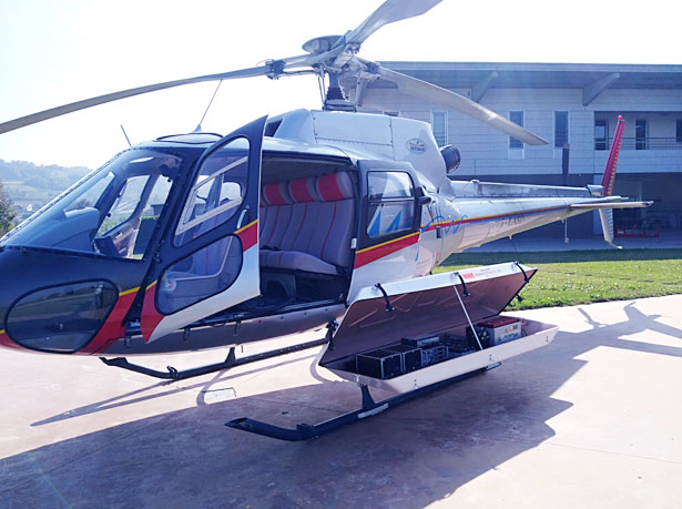
Figure 2: Certified POD installed on EUROCOPTER AS350B2
More info at: Marco Baldo (marco.baldo@irpi.cnr.it)
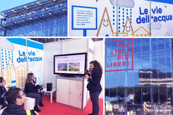
L’IRPI CNR a “Le vie dell’acqua”
Durante l’evento – che si terrà a Roma dal 5 al 9 dicembre presso il ‘Convention Center La Nuvola’ – ideato e promosso dal Consiglio Nazionale delle Ricerche, vari ricercatori del CNR stesso si alterneranno nella presentazione di varie tematiche inerenti l’argomento ‘acqua’. Incontri e laboratori ai quali alcuni dipendenti dell’IRPI CNR di Perugia hanno preso parte da questa mattina: la dott.ssa Paola Salvati (in foto) ha aperto alle ore 11 la sessione divulgativa con un incontro dal titolo “Il fiume: opportunità o minaccia?” che sarà ripetuto nella giornata odierna. L’esperienza dell’IRPI nell’affrontare argomenti connessi alla prevenzione del rischio idrogeologico, permetterà ai partecipanti di acquisire maggiore consapevolezza su come comportarsi in caso di pericoli connessi a frane e inondazioni. Maggiori informazioni sull’evento possono essere reperite a questo link.
UAV FIXED WING CNR-IRPI-GMG-T1: now equipped with FPV (First Person View) LTE video / telemetry transmission 4G and flight endurance up to 70 minutes
Our fixed wing UAV, designed by GMG (Geohazard Monitoring Group – http://gmg.irpi.cnr.it) of CNR IRPI was recently equipped with HD CAM live streaming through TCP/IP protocol.
Due to long distances covered by the aircraft, main target is to transmit at long distances (several kilometers) FPV video streaming with HUD telemetry, using a low cost smart device with a LTE SIM data connection.To do this, a completely free and open source hardware configuration was choosen.
Main hardware is composed by a Raspberry Pi who send data to one or more endpoint that can be reached by a Ground Control Station connected to internet.
The flight can so be followed and managed by a Ground Control Station and/or by video streaming (telemetry is HUD aviation compiliant) trough a Raspberry SSH tunneling for aerial navigation and settings modification.
In addition, video streaming is reachable from any location equipped with an internet conection (tablet and/or laptop).
Technical data of CNR-IRPI-GMG-T1 fixed wing UAV:
Body: V-tail high wing
Wingspan: 2000mm
TOW (Takeoff Weight): from 2500g to 4700g
Takeoff: hand launch
Landing: autoland
Motor: brushless 700 – 1200KV
Flight autonomy: 30 – 74 minutes (payload depending)
Payload: RGB Camera, FPV LTE realtime streaming; Multispectral Camera; actionCAM camera
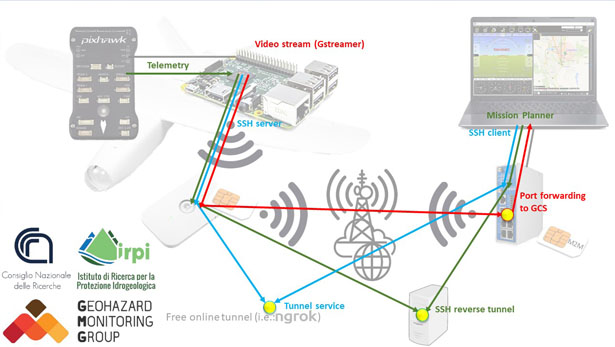
Figure 1: Hardware / software architecture connection of video / telemetry data streaming.
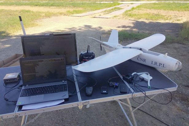
Figure 2: Ground Control Station and the GMG drone.
More info at:
marco.baldo@irpi.cnr.it
diego.guenzi@irpi.cnr.it
A Pechino premiata Giulia Bossi
Giulia Bossi, assegnista IRPI della sede di Padova, ha ricevuto il premio per “Young Oral-report Award for excellent presentation” al 2018 International Debris-Flow Workshop & Symposium on Silk Roads Disaster Mitigation, svoltosi a Pechino (Repubblica Popolare Cinese) il 5-6 novembre 2018. Il contributo presentava l’applicazione di una tecnica di ‘machine learning’ per caratterizzare gli spostamenti di una grande frana attraverso una procedura automatica; titolo contributo: “Agglomerative hierarchical cluster analysis to control and characterize the displacements of the source area of a large debris flow”
Master in strategie di sviluppo e rigenerazione post eventi catastrofici
L’Università di Camerino in collaborazione con Symbola – movimento culturale originale che mette in rete soggetti diversi fra loro – promuovono un bando per il Master Universitario di II Livello “AREE INTERNE – Strategie di sviluppo e rigenerazione post eventi catastrofici”. Il master si svolgerà nel corso dell’anno accademico 2018/2019, presso le sedi organizzate di Camerino e Ascoli Piceno per quanto concerne la didattica frontale. Sarà previsto uno stage da svolgersi presso enti pubblici o privati con competenze di gestione del territorio. Il termine della presentazione della domanda è il 20 dicembre 2018.
Multi-variate hazards in a non-stationary environment and their prediction
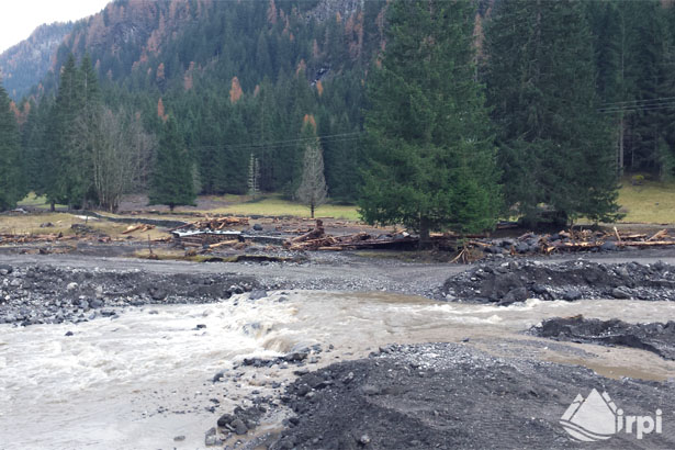
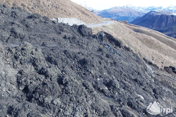
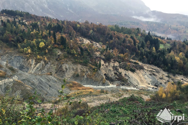
CNR IRPI studying the flood of October 2018 in northeastern Italy
CNR IRPI is involved in post-event surveys aimed at characterizing the flood response and mapping instability phenomena after the severe rainstorm that hit the mountain sector of northeastern Italy on 27-29 October 2018. These activities are carried on in collaboration with the University of Padova (Depts. TESAF and Geoscienze) and the Free University of Bolzano (Faculty of Science and Technology).
CNR IRPI has supported the Civil Protection Department of Veneto Region in managing the emergency caused by the reactivation of the Tessina landslide, which has been monitored by CNR IRPI since April 1992.
(Some images resulting from heavy rainfall)
Cnr-Irpi al convegno Agi-Ispra sulla mitigazione del rischio frana
Il Cnr-Irpi partecipa al convegno: “La progettazione e la realizzazione di interventi di mitigazione del rischio da frana”
Organizzato da Associazione Geotecnica Italiana, ISPRA e Ordine degli Ingegneri della Provincia Autonoma di Bolzano. Giulia Bossi, della sede secondaria Irpi di Padova, è stata invitata a presentare un contributo. Titolo della presentazione è “Una sistemazione di una frana auto-sostenibile”.
IRPI Hydrology Group to the International Remote Sensing School for Hydrological Applications 2018
In the context of the H SAF project funded by EUMETSAT, the Italian Civil Protection Department in close
collaboration with the Italian Air Force Meteorological Service Department, IRPI-CNR Hydrology Group, Cima Foundation, ECMWF and the Technical University of Vienna has organised the International Remote Sensing School for Hydrological Applications 2018. The course has been held from 13 to 16 November at Casa dell’Aviatore in Rome. The course has been addressed to students and professionals from all over the world and focuses on the use of satellite data of soil moisture for hydrological applications and for the mitigation of the natural hazards.
The “11th Japan-Italy Conference” organized by IRPI has started
The 11th Italy-Japan Conference on Sediment Disaster Prevention Technology will be held in Italy from 11 to 14 November and will include technical visits, meetings and a scientific session. The IRPI branch hosting the Conference will be Bari but some events will also carried out in Trento and Rome.
The cooperation between CNR-IRPI and MLIT (Ministry of Land, Infrastructure, Transport and Tourism) is one of the longest among those established at IRPI being started on 1998 soon after the disaster occurred in Sarno (Campania) and has been supported, among others, by Italian Ministry of Foreign Affairs.
Convegno GIT 2018: disponibili le presentazioni
Sono ora disponibili, nel sito del GIT – http://www.gitonline.org – i pdf delle presentazioni proposte al XIII Convegno Nazionale delle Sezioni “GIT-Geosciences and Information Technologies” e “SI-Sezione di Idrogeologia” della Società Geologica Italiana tenuto a Sarzana (SP) dal 11 al 13 giugno 2018. Un click sul titolo della presentazione permette l’apertura del pdf della presentazione.
Per il download selezionare “GIT 2018” e poi “Programmi e Contributi” o semplicemente cliccando a questo link: un click sul titolo della presentazione ne permetterà l’apertura.
“Io non rischio”, l’IRPI CNR tra i partner scientifici
L’11 ottobre scorso è stata presentata l’ottava edizione di “Io non rischio – Buone pratiche di protezione civile” presso la sede del Dipartimento della Protezione Civile (Roma). Questa campagna di sensibilizzazione nazionale sui rischi naturali legati a frane, inondazioni, terremoti e maremoti avrà luogo in circa 300 piazze italiane grazie a circa 3500 volontari durante il weekend dal 13 al 14 ottobre. L’elenco completo delle piazze italiane interessate dall’evento il prossimo 13 e 14 ottobre è disponibile sulla pagina web ufficiale della campagna dove è possibile trovare anche ulteriore materiale informativo.
I promotori dell’iniziativa sono: il dipartimento di Protezione Civile con ANPAS-Associazione Nazionale delle Pubbliche Assistenze, INGV-Istituto Nazionale di Geofisica e Vulcanologia e ReLUIS-Rete dei Laboratori Universitari di Ingegneria Sismica.
Inoltre i partner scientifici sono: ISPRA-Istituto Superiore per la Protezione e la Ricerca Ambientale, OGS-Istituto Nazionale di Oceanografia e Geofisica Sperimentale, AiPo-Agenzia Interregionale per il fiume Po, Arpa Emilia-Romagna, Autorità di Bacino del fiume Arno, CamiLab-Università della Calabria, Fondazione Cima e CNR-IRPI Istituto di Ricerca per la Protezione Idro-geologica del Consiglio Nazionale delle Ricerche.
IRPI is participating to OGRS 2018 symposium
Giuseppe Esposito (CNR IRPI) held a presentation, at the OGRS 2018 symposium, about ‘SAR-derived image segmentation for landslides detection’.
The extended abstract of the talk is available here: https://peerj.com/preprints/27212/
The work was done in the framework of the “STRESS project” (https://www.irpi.cnr.it/en/project/stress/#more-28973), supported by Cariplo Fundation.
IRPI at the 26th International Conference on Optical Fibre Sensors (OFS) in Lausanne, Switzerland
The 26th OFS, acknowledged as the world’s leading conference on all topics related to photonic sensing technologies, is taking place in Lausanne, Switzerland during this week. Luca Schenato from the Padova branch is attending the conference and has the honour to give an invited talk about “Distributed Sensing in Geotechnical and Hydrogeological applications”. Furthermore, he will present the results about a novel 3D-printed fiber optic pressure sensor with A. Pasuto and co-workers from the University of Padova.
Gruppo di Idrologia dell’IRPI tra i finalisti della competizione internazionale Copernicus Master
Il gruppo di Idrologia del CNR IRPI è tra i tre finalisti della competizione internazionale Copernicus Master (https://www.copernicus-masters.com/) ed in particolare per la sfida “BayWa Smart Farming Challenge” (https://www.copernicus-masters.com/prize/baywa-challenge/) indirizzata allo sviluppo di idee innovative per la sostenibilità dell’agricoltura. Maggiori informazioni si possono trovare nel comunicato stampa di BayWa e su Twitter.
Auguri al nostro gruppo per la vittoria finale!
L’IRPI partecipa al XIII IAEG Congress
Si sta svolgendo dal 15 settembre il tredicesimo IAEG Congress nella città di San Francisco in California e terminerà nella giornata del 23. Il meeting dal titolo Engineering Geology for a Sustainable World vede impegnati alcuni dei ricercatori dell’IRPI CNR, tra i quali lo stesso direttore Fasuto Guzzetti. Per maggiori informazioni sul programma in corso e sul tema in oggetto è possibile consultare la pagina ufficiale dell’evento https://www.aegannualmeeting.org/.
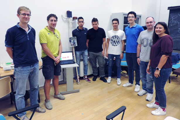
Un prototipo di stazione meteo realizzato dai ragazzi dell’ITT di Catiglione del Lago
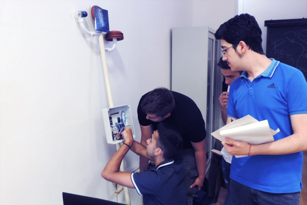
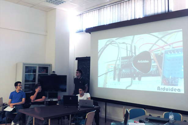
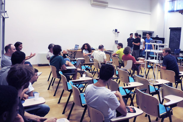
Si è concluso venerdì 14 il secondo stage, nel contesto dell’alternanza scuola lavoro, dei ragazzi dell’ITT di Castiglione del lago. I quattro studenti, al quinto anno del percorso di studi ad indirizzo informatico, nell’arco di tempo di due settimane hanno ideato e improntato un prototipo di stazione meteo per la rilevazione di temperatura, umidità dell’aria, umidità del suolo e velocità del vento. Utilizzando alcuni moduli elettronici ‘Arduino’ la stazione è in grado di immagazzinare ed inviare i dati misurati via rete wireless e di fornire ad un dispositivo ad essa connesso una visualizzazione grafica e tabellare via browser dei dati stessi. L’apparato, essendo alimentato da un pannello solare, risulta essere energeticamente autonomo e se verrà corredato in futuro di un’ interfaccia GSM potrebbe essere utilizzato da remoto in luoghi e territori anche non facilmente raggiungibili. Resta aperta la possibilità del proseguo della collaborazione dei ragazzi con l’IRPI per il completamento dello sviluppo del prototipo ai fini di renderlo totalmente operativo.
Di seguito le foto della giornata di venerdì 14 di presentazione a tutto l’Istituto dei lavori svolti.
I quattro studenti, da sinistra: Matteo Violi, Filippo Broccolini, Lorenzo Mencaroni, Lorenzo Bianciardi.
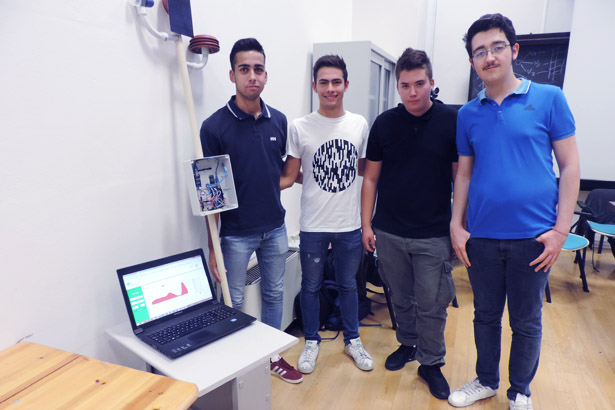
Foto di gruppo dei ragazzi coi professori Valentina Falucca e Pietro Palladino da destra e due dipendenti IRPI da sinistra, Ivan Marchesini (Tutor dei ragazzi) e Massimo Melillo (ricercatore).
Altre immagini della giornata.
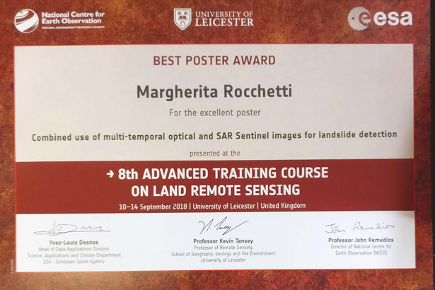
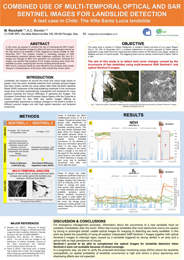
Al corso dell’ESA, Margherita Rocchetti premiata per il miglior poster
Nella giornata odierna – venerdì 14 settembre – Margherita Rocchetti, borsista presso l’IRPI CNR, ha vinto il premio relativo al miglior poster presentato all’evento organizzato dall’ESA; 8th Advanced Training Course on Land Remote Sensing con un lavoro dal titolo ‘Combined use of multi-temporal optical and SAR Sentinel images for landslide detection‘.
Di seguito il riconoscimento e il poster premiato.
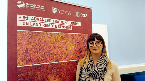
Researcher from IRPI is invited to present at the Land Remote Sensing Advanced Course
On Friday 14 September Angelica Tarpanelli, researcher at IRPI-CNR in Perugia, will contribute to the 8th ESA Land Remote Sensing Advanced Course 2018 with a lecture entitled: “River Discharge and Lake Volume Variation using Radar Altimetry and Imaging Sensors”. The course is organized by the European Space Agency and is held at the University of Leicester, UK from 10 to 14 September 2018. The aim of the course is training the next generation of Earth Observation (EO) scientists to exploit data from EO missions for science and applications development.
Special Issue lead by IRPI researchers on Remote Sensing
Special Issue lead by IRPI researchers on Remote Sensing about hydrological extremes and natural hazards has been announced. The Special Issue is co-edit by Christian Massari and Luca Ciabatta together with other researchers from international institutions (NASA, George Mason University and IMD). The deadline for submission is 30 Sept. 2019. Please find futher information at http://www.mdpi.com/journal/remotesensing/special_issues/hydrometeorological_extremes.
L’IRPI partecipa al corso avanzato di telerilevamento promosso dall’ESA
Margherita Rocchetti, borsista bresso il CNR IRPI di Perugia presenterà oggi – 11 settembre 2018 – il poster dal titolo ‘Combined use of multi-temporal optical and SAR sentinel images for landslide detection‘ al ‘8th ESA Land Remote Sensing Advanced Course 2018‘. Maggiori informazioni possono essere reperite al seguente link http://eoscience.esa.int/landtraining2018/.
Geo-hydrological processes in northern Italy
Il dott. Luino è stato invitato – il 10 settembre 2018 – dalla Fresno State University, nell’ambito di una collaborazione partita nel 2012, per un workshop durante il quale ha mostrato agli studenti e ai colleghi americani i più comuni fenomeni d’instabilità naturale (frane, debris flow ed inondazioni) che colpiscono annualmente il Nord Italia. Sono stati approfonditi alcuni casi studio quali la frana del Vajont, le frane delle Langhe, il disastro di Stava e le alluvioni lampo di Genova.
IPROMO 2018 Summer School: Bioeconomy in mountain areas – an opportunity for local development
The 11th edition of the IPROMO (International Programme on Research and Training on Sustainable Management of Mountain Areas) Summer School was completed successfully. It was organized by Mountain Partnership Secretariat of the Food and Agriculture Organization of the United Nations (FAO-MP), Università degli Studi di Torino and Università degli Studi della Tuscia. The whole Summer School was chaired, and organized, by Dr. Danilo Godone (National Research Council – Research Institute for Hydrogeological Prevention and Protection; CNR-IRPI).
The 2018 Summer School took place, from 18 June to 2 July in Pieve Tesino (Trento Province) and Ormea (Cuneo province) where class and field lectures were held. Moreover, in cooperation with Institut Agricole Régional (Aosta), two field trips were organized in Aosta Valley. This year course hosted 21 lecturers from several Universities and research bodies, FAO and government/private agencies.
The Summer School focused on several topics contributing to the management of mountain areas in the framework of bioeconomy, ranging from environmental conservation and water supply, to income generation and food security. It was attended by 33 participants from 17 different countries all over the World.
Photo credits: Rosalaura Romeo (FAO-MP)
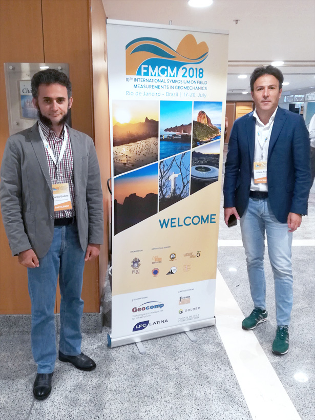
CNR-IRPI was at the 10th FMGM2018 in Rio de Janeiro
Paolo Allasia and Danilo Godone represented CNR – IRPI at the 10th International Symposium on Field Measurements in Geomechanics – FMGM2018 (July 17-20, 2018) in Rio de Janeiro (Brazil).
During the session “Slope Stability, Dam Safety and Civil Tunneling” the Robotized Inclinometer System was presented to the audience in a speech entitled “Deep Displacements Measured With a Robotized Inclinometer System”.
Link to web site of the event: http://fmgm2018.com
Summer School 2018: “Multi-Risk Assessment of Alpine Environment”, the case study of northern Piedmont (NW Italy)
The Summer School, which was held in Val d’Ossola (Piedmont), was dedicated to the study of natural risks in alpine environment. This school was organized by the CNR IRPI, the Doctoral School of Earth and Environmental Sciences of the University of Pavia and the CTTC (Center Tecnològic Telecommunication Catalunya of Barcelona, Spain).
The course took place from the 10th until 13th July 2018. It included two days of lectures and two full-day field trips, which goal was to illustrate the main geomorphological processes of this area, related risks and possible systems for monitoring and risk mitigation.
Thanks to the hospitality of the Aree Protette dell’ Ossola the lectures took place in friendly and well-equipped geological laboratory “Gian Battista Castiglioni”.
The main topics of the two field trips were a description of dynamics of high altitude zones by excursion to the Belvedere glacier (Macugnaga) and of large landslides by guided trip in order to discover a series of case studies along the path from Ponte Val Formazza to Sanctuary of the Madonna del Sasso (Orta Lake).
This Summer School attracted many PhD students, concluding in 22 participants from Italy, Switzerland, Greece and England.
PhD students had an opportunity to learn in detail various risks that may characterize this territory, such as avalanches or other phenomena of high mountains (rockslides, instabilities affecting glaciers and debris flows). In addition, they learnt about tools developed to study such phenomena and to reduce their impact on a society, such as dendrochronology, use of UAVs and satellite techniques.
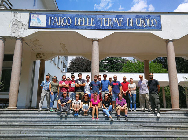
Group photo in front of Parco delle Terme di Crodo office
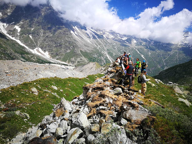
Field trip lesson on the moraine edge of Belvedere glacier
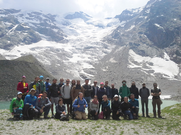
Belvedere glacier – Group photo with Locce Lake in the back
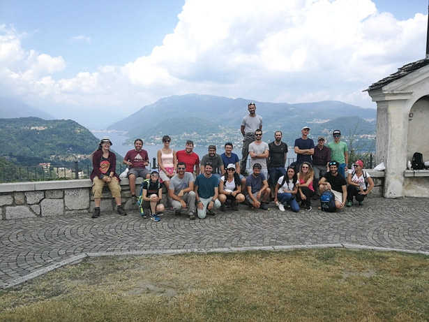
Madonna del Sasso – Group photo with Orta Lake in the back
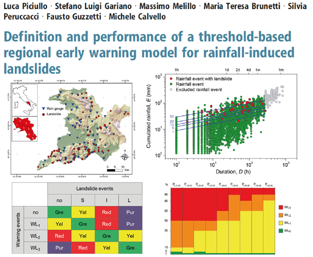
Un articolo firmato IRPI tra i più influenti del 2017 su ‘Landslides’
L’articolo “Definition and performance of a threshold-based regional early warning model for rainfall-induced landslides” di Stefano Luigi Gariano, Massimo Melillo, Maria Teresa Brunetti, Silvia Peruccacci e Fausto Guzzetti del CNR-IRPI e Luca Piciullo e Michele Calvello dell’Università di Salerno è fra i più influenti articoli del 2017 pubblicati sulla rivista Landslides.
La pubblicazione potrà essere scaricata gratuitamente fino al 31 agosto al seguente link: https://link.springer.com/article/10.1007/s10346-016-0750-2
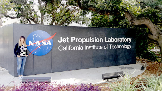
Angelica Tarpanelli, researcher at IRPI, is guest by the NASA JPL
From June 4 to August 17, Angelica Tarpanelli, researcher at the Research Institute for Geo-Hydrological Protection of Perugia, is invited by the Jet Propulsion Laboratory (JPL), NASA, in Pasadena, California (USA) to perform research on the estimation of river discharge through satellite remote sensing. The ongoing collaboration involves the development of algorithms for the use of the sensor on board the new Surface Water Ocean Topography (SWOT) satellite mission, specifically designed for monitoring inland waters, which will be launched in 2021.
Rainfall from space, we just published the new rainfall dataset SM2RAIN-CCI
A new and improved version of our satellite-based #SM2RAIN-CCI global rainfall dataset was just published on Zenodo.
18-year of daily rainfall at 0.25° resolution from 1998 to 2015. Available for free.
Here you can find the dataset »
Here the paper describing the dataset »
Here the use of the dataset for flood modelling in the Mediterranean Basin »
On Twitter the animation of annual rainfall from 1998 to 2015 »
CNR-IRPI attending IEEE I2MTC in Houston (Texas)
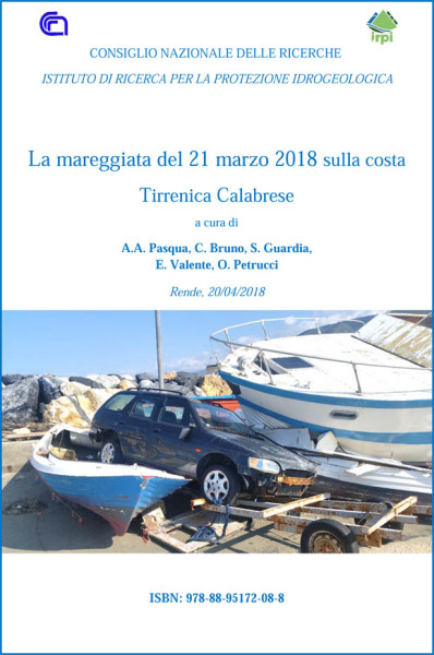
The sea storm of March 21, 2018 on the Calabrian Tyrrhenian coast
The report deals with the storm that on March 21, 2018 hit the Tyrrhenian coast of Calabria, with wind up 70 km/h causing sea waves 6 – 7 meters high. The first part of the report contains news from press and websites concerning damage caused by the sea. The second part contains the results of on-site surveys carried out by IRPI-Cosenza staff in the most affected placed.
The storm mainly damaged tourist and commercial structures. About 5 million euros of damage were estimated to cultivated fields, especially to the typical “Tropea onion”, cultivated between Lamezia Terme and Campora San Giovanni
The report is available at the following link »
Autors: Angela Aurora Pasqua, Claudia Bruno, Salvatore Guardia, Enzo Valente, Olga Petrucci
Marco Cavalli at the UACh – Valdivia (Chile)
From 17 to 27 April 2018, the IRPI researcher Marco Cavalli was hosted at the Universidad Austral de Chile (UACh), with which IRPI has signed a MoU, as part of the bilateral project Italy-Chile CONICYT / ITAL170004 “Volcanic eruption vs. human impact: a comparative analysis between natural and artificial morphological changes along gravel bed rivers in Chile and Italy. Learning from different impacts to better manage the affected riverine environments”.
The project, funded by the Italian Ministry of Foreign Affairs and the National Commission for Scientific and Technological Research of Chile (CONICYT), intends to study the morphological evolution of channels in basins affected by volcanic eruptions and anthropic impacts for a better understanding of sediment transport processes and related risk management.
The activity, carried out in collaboration with Prof. Andrés Iroumé of the Faculty of Forest Sciences and Natural Resources (UACh), Prof. Bruno Mazzorana of the Faculty of Sciences (UACh) and Dr. Lorenzo Picco of the University of Padua, conisted in field surveys in Chilean basins affected by volcanic eruptions and undergoing monitoring activities, and meetings aimed at planning joint research lines for the study of sediment dynamics through the application of geomorphometric techniques.
During the visit, Marco Cavalli held a seminar in the postgraduate course in Geomorfologia Fluvial Avanzada – CITI308 – curriculum of “Magister en Ciencias – Mencion Recursos Hidricos”.
An article containing an interview with Marco Cavalli has been published on the UACh website and can be viewed at the following link: http://noticias.uach.cl/principal.php?pag=noticia-externo&cod=115594
L’IRPI a Foligno alla Festa della Scienza e Filosofia
In occasione dell’ VIII Festa della Scienza e Filosofia, che si sta tenendo a Foligno, nella giornata di domani – sabato 28 aprile – alcuni rappresentanti dell’Istituto di Ricerca per la Protezione Idrogeologica saranno presenti presso lo stand del CNR, sito nel chiostro di Palazzo Trinci.
An IRPI paper among the top 100 read Earth sciences papers for Scientific Reports in 2017
The Research article ‘Distributed optical fibre sensing for early detection of shallow landslides triggering’ authored by Luca Schenato and Alessandro Pasuto from IRPI Padova and co-workers from the University of Padova, has been selected as one of the top 100 read Earth sciences papers for Scientific Reports in 2017. As specified in the honor communication, “Scientific Reports published more than 1500 Earth sciences papers in 2017, and so a position in the top 100 most highly read articles is an extraordinary achievement – your science is of real value to the research community.”
link1: https://www.nature.com/articles/s41598-017-12610-1 (link to the paper)
link2: https://www.nature.com/collections/zqnrvjdvqw (link to the Top 100 list)
IGCP Project 639 “Sea Level Change from Minutes to Millennia”
The 3rd Annual Meeting of IGCP 639 will be heald on 16-23 September 2018. The meeting comprises two days of scientific communications in Taranto and four days field trip crossing Southern Italy from the Ionian to Tyrrhenian sea and Sicily, visiting some interesting sites relating sea level changhes in the last millennia. The topics of the meeting include the impact of sea level changes on the coastal geomorphological systems.
The professor. Laronne will be a guest at IRPI in a month
Tuesday, April 3rd, 2018, Jonathan B. Laronne, professor emeritus of the Department of Geography and Environmental Development of the Ben-Gurion University of the Negev, in Israel, will be visiting our Institute.
Professor. Laronne will give a talk entitled “Automatic and continuous monitoring of bedload in gravel bed streams“.
The presentation will be held from 11:00 to 12:00, in the Institute’s lecture hall, in Via della Madonna Alta 126.
For more information, write to f.guzzetti@irpi.cnr.it
Tre nuovi ingressi nel gruppo di geomorfologia all’IRPI di Perugia
Nella giornata di ieri hanno preso servizio presso il nostro Istituto 2 borsiste Margherita Agostini e Margherita Rocchetti, e un assegnista Giuseppe Esposito. Lavoreranno per un periodo di tempo ai progetti SAPERE – Space Advanced Project for Excellence in Research and Enterprise – e STRESS – Strategies, Tools and new data for REsilient Smart Societies” – finanziato dalla Fondazione CARIPLO, per la tematica “Definizione e implementazione di una procedura, basata sulla raccolta e processamento di immagini satellitari, finalizzata alla individuazione di frane di evento e all’aggiornamento di inventari
di frana”. Notevole è l’impegno di tutto il personale IRPI nella partecipazione a progetti nazionali ed internazionali volti anche a promuovere nuove possibilità lavorative e formative.
IRPI participates to the Agreement on Scientific Cooperation between CNR and University of Malta
The Research Institute for Geo-Hydrological Protection is in one of the 4 Research Projects funded under the Agreement on Scientific Cooperation between CNR and the University of Malta (UoM) – Biennial Programme 2018/2019. The Project title is “From population risk perception to social vulnerability in coastal areas subject to climate change: a proposal for risk management strategies in two Mediterranean regions”. Loredana Antronico, Researcher of the IRPI Cosenza office (antronico@irpi.cnr.it), is the scientific responsible for the Italian group.
The principal objectives of the Project can be summarised in the following items: i) Identification of the population’s awareness, perception and preparation concerning the effects that climate change has on the environment and especially on coastal areas, by means of online questionnaires; ii) Proposal of a specific Index of Social Vulnerability, to be evaluated through the results of the online survey, as reducing/increasing factor of the exposure and the vulnerability of population living in coastal areas; iii) Proposing useful tools to local authorities and to responsible of territory planning and of risk prevision, prevention and management.
L’IRPI ha partecipato all’International Conference Sustainable Technologies for Intelligent Water Management
L’IRPI ha partecipato all’International Conference Sustainable Technologies for Intelligent Water Management (https://www.iitr.ac.in/stiwm/) con una keynote di Tommaso Moramarco su “Ground and Satellite Observations for Hydrological Applications”. Roorkee. Febbraio 16-19. Successivamente, a New Delhi dal 20 al 22 Febbraio, l’IRPI insieme a USGS e Centre for Ecology & Hydrology UK ha partecipato al Workshop: “Training-Cum-Workshop on State-of-the-Art Hydrometric Data Acquisition and transmission Networks: Measurements and Modelling” promosso dal National Hydrology Project e dalla Banca Mondiale. In tale contesto Tommaso Moramarco ha tenuto 3 ore di seminario sulle tecniche avanzate al suolo e da satellite per il monitoraggio della portata. Il Workshop è organizzato nell’ambito di una proposta progettuale per il ri-ammodernamento della rete idrometrica indiana supportato dalla Banca Mondiale e promosso dal National Hydrology Project con il contributo dell’Indian Central Water Commission e Indian Institute of Technology Roorkee. L’IRPI insieme a CEH-UK e USGS è stato individuato come un possibile partner scientifico del progetto.
John Laronne visits our headquarter
On April 3rd, 2018, Prof. John Laronne, Department of Geography and Environmental Development, Ben-Gurion University, Israel, visits our headquarter, in Perugia. On this occasion, Prof. Laronne will deliver a presentation on the main results of his research work.
For information: direttore@irpi.cnr.it
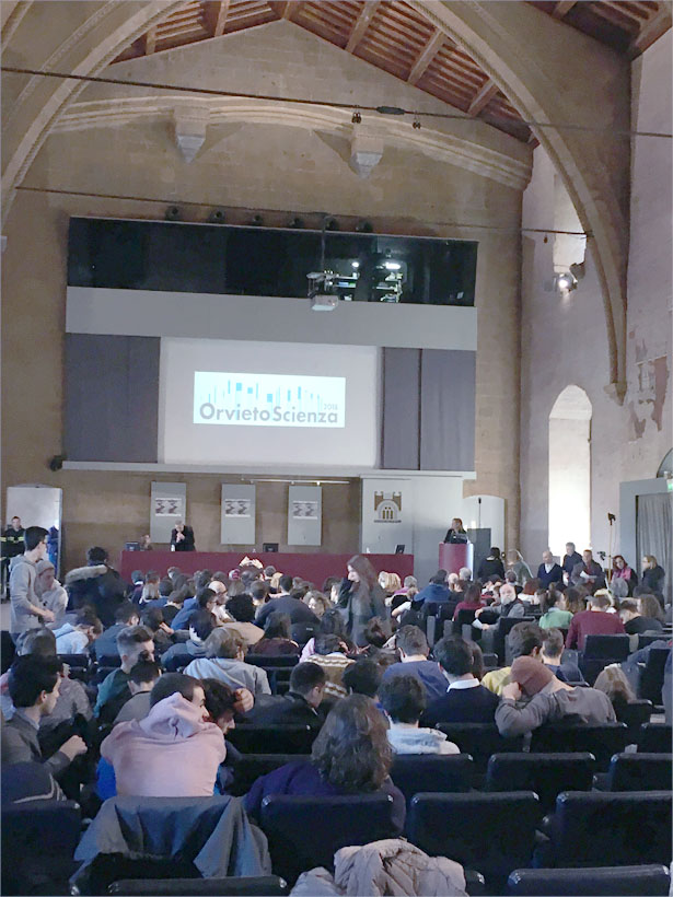
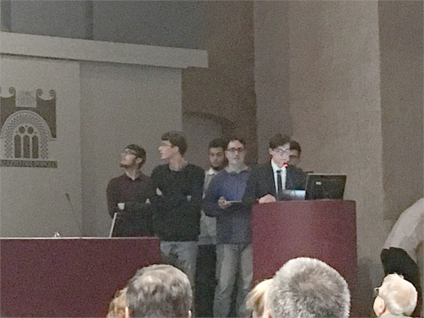
L’IRPI partecipa ad Orvieto Scienza 2018
Orvieto Scienza, evento arrivato alla sesta edizione, si svolgerà dal 16 e 17 febbraio 2018, presso le sale della sede storica del Palazzo del Capitano del Popolo ad Orvieto (vedi foto in basso).
Tale iniziativa ha l’obiettivo di far conoscere la scienza attraverso approfondimenti su tematiche di grande attualità.
Tutte le attività che accompagnano Orvieto Scienza sono attività didattiche che rappresentano una modalità diversa di fare scuola.
Quest’anno il tema riguarda il rischio del territorio: idrogeologico, sismico, vulcanico, dovuto al cambiamento climatico. Il rischio è dovuto al prodotto di fattori diversi quali la probabilità dell’evento, l’esposizione, la vulnerabilità, che possono ognuno assumere valori diversi in base al fenomeno, al luogo, alle azioni di prevenzione dell’uomo.
Fausto Guzzetti Direttore dell’IRPI CNR terrà un intervento dal titolo “Le frane in Italia: come difendersi?”.
I ragazzi dell’ITTS Alessandro Volta di Perugia, più volte in tirocinio presso la sede principale dell’IRPI CNR, che espongono il loro lavoro ad Orvieto Scienza.
Takashi Oguchi will be visiting IRPI
Prof. Takashi Oguchi, Professor at the University of Tokyo (Japan), Co-Editor in Chief of Geomorphology (Elsevier) and Chair of the IGU Commission on Hazard and Risk will be visiting tomorrow 15 February 2018 our Institute in Perugia. Alessandro Mondini will be presenting the activities of the Institute, looking for new cooperations in the framework of the IGU.
Some link regarding Takashi Oguchi:
https://www.k.u-tokyo.ac.jp/pros-e/person/takashi_oguchi/takashi_oguchi.htm
http://oguchaylab.csis.u-tokyo.ac.jp/IGU_Hazard/index.html
A PostDoc at German Research Centre for Geosciences
The Helmholtz Centre Potsdam – GFZ German Research Centre for Geosciences is the national research centre for Earth sciences in Germany. With approx. 1280 employees, the GFZ is conducting interdisciplinary research on the “System Earth” and the influence of humans on the planet. As a member of the Helmholtz Association, it is part of Germany’s largest science organization. For the group “Early warning and Impact Forecasting” (Section 2.6 / Department 2 “Geophysics”), it invite applications for a PostDoc (m/f) (Job Vacancy No. 0512).
The CATENA project, supported by the German Federal Ministry of Education and Research (BMBF), sets out to develop dynamic large-scale modeling schemes for landslide susceptibility, as well as consistent estimates of their potential impact on the exposed communities, within the context of Central Asia.
IRPI takes part in the conference “New Dimensions for Natural Hazards in Asia”
The conference New Dimension for Natural Hazards in Asia opened yesterday, February 5, 2018. The conference, organized jointly by AOGS and by the EGU is held in Tagaytay, the Philippines, on the edge of the crater of the Taal volcano.
Today, 6 February, Fausto Guzzetti, Director of the Institute, will hold an invited presentation entitled “Challenges for Operational Forecasting and Early Warning of Rainfall Induced Landslides”
On the day of tomorrow, 7 February, Alessandro Mondini, Researcher at the Institute, will hold a presentation entitled “Spatial Autocorrelation Changes in Multitemporal SAR Images for Automatic Event Landslides Detection, the LANDSLIP Project” and on 8 February another presentation entitled “A Framework for the National/Regional Warning System for Rainfall-Induced Landslides: Examples of Implementation in Italy”.
EGU General Assembly 2018
From 8 to 13 April 2018 the General Assembly of the European Geosciences Union – EGU will be held in Vienna, Austria. This is the most important geo-sciences conference in Europe.
Several Institute researcher scientists will contribute with oral presentations and posters at the conference. Our scientists also act as conveners or co-conveners of several scientific sessions.
Short-Term Mobility in Israel
Lorenzo Marchi, researcher at the CNR IRPI, is doing a research visit at the Ben-Gurion University of the Negev (GeoFluv Geomorphology and Fluvial Research Group) in Beer-Sheva (Israel). The visit (from 7 January to 28 February) is partly supported by the Short-Term Mobility 2017 program of CNR. The scientific mission is carried on in the frame of researches developed at the Ben-Gurion University on the morphological evolution of alluvial fans on the west bank of the Dead Sea, which are undergoing fast incision in response to base level fall.
The RIST2 project is starting
The researches at high-elevation sites continues, thanks to the RiST2 project (co-financed by Fondazione CRT of Torino). The study area is the Bessanese glacial basin. The main research activities consist in the continuation of studies on the relation between climate variability and morphodynamic processes, with particular reference to the role of temperature and the thermal properties of geological materials (e.g. rock, debris, water). The use of micro data logger metrologically referenced and with known uncertainty of measurements allows an innovative approach towards the studied topics.
Project web page at http://geoclimalp.irpi.cnr.it/
Research project to develop early landslip warning systems to be undertaken
Articolo web – del 20 dicembre 2017 – dal sito thehindu.com, inerente il progetto LANDSLIP (al quale partecipa anche l’IRPI CNR) e il secondo “Consortium meeting” svoltosi dall’11 al 15 dicembre 2107 in Coimbatore, India.
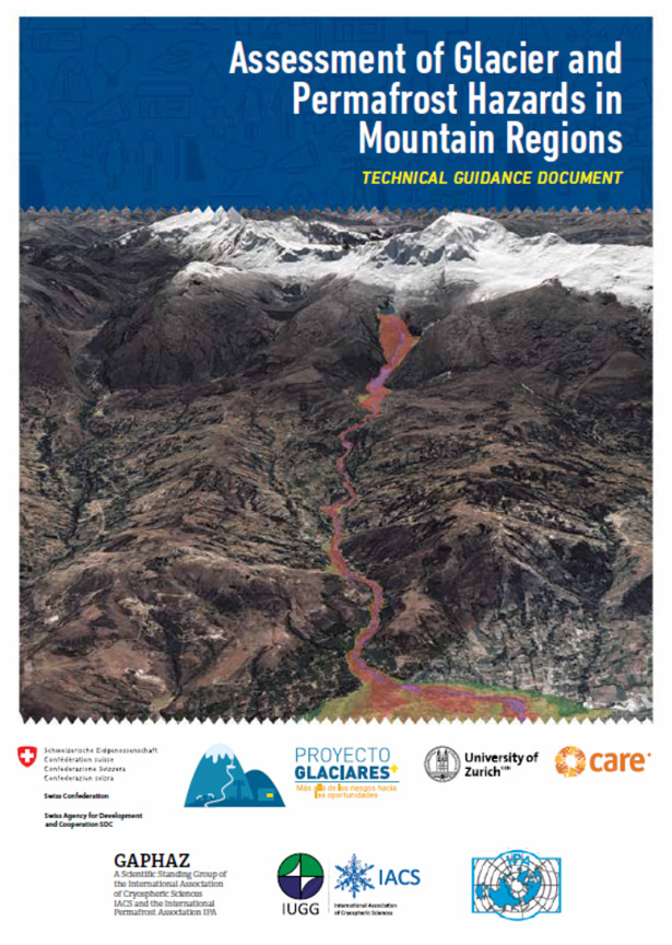
Published the technical guidance document on assessment of glacier and permafrost hazards
Published the technical guidance document on assessment of glacier and permafrost hazards in mountain regions. The document comes after an intensive process and effort within the GAPHAZ (Glacier and Permafrost Hazards in Mountains) scientific standing group of the International Association of Cryospheric Sciences (IACS) and the International Permafrost Association (IPA).
The IRPI researcher Marta Chiarle from the GeoClimAlp research group contributed to the drafting of the document.
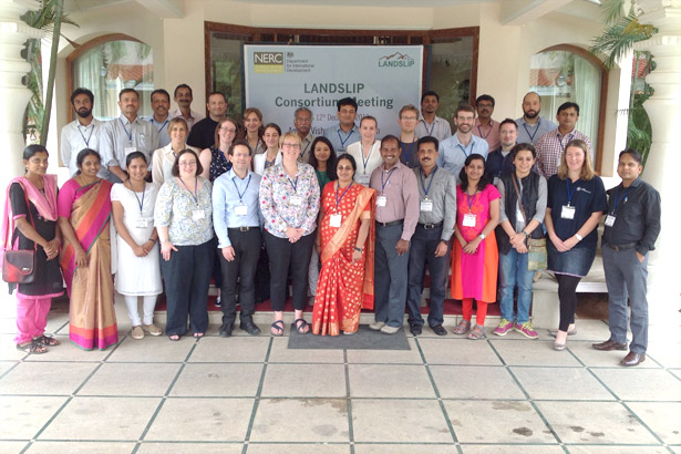
Al via LANDSLIP Consortium Meeting
Iniziato oggi, 11 dicembre 2017, in Coimbatore, India, il secondo “Consortium meeting” inerente il progetto LANDSLIP – Landslide multi-hazard risk assessment, preparedness and early warning in South Asia integrating meteorology, landscape and society – e proseguirà fino a domani. Tra i membri del gruppo di progetto partecipano i ricercatori dell’IRPI, Alessandro Mondini, Mauro Rossi, Maria Teresa Brunetti, Ivan Marchesini e Silvia Peruccacci. Questo incontro segna un passo ancora in avanti nella collaborazione dell’Istituto di Ricerca per la Protezione Idrogeologica con le varie realtà asiatiche e internazionali in materia di prevenzione dal rischio da frana.
Foto dei partecipanti al Meeting
UAV FIXED WING CNR IRPI: aerial RGB and multispectral survey of Ponzano landslide
The CNR IRPI Geohazard Monitoring Group (GMG) on june of present year carried out an aerial multipurpose survey of an area interested by a landslide reactivation phenomenon over the village of Ponzano (center Italy – Abruzzo district).
The activitiy was performed using an RPAS fixed wing developed by the GMG equipped with an RGB mirrorless camera and a 5-band multispectral sensor.
The survey; 4,2 square kilometres big; demonstrates the potential of this aircraft, which allows the simultaneous mapping of RGB and multispectral areas affected by instability, making it possible to characterize areas with high humidity index not detectable with optical images.
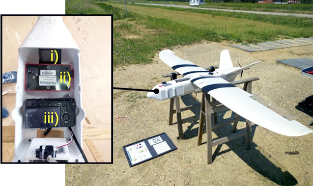
Figure 1: sensors bay and aircraft during multispectral calibration process.
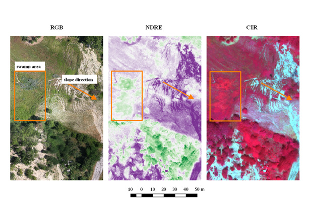
Figure 2: multiband image comparison of and area affected by an high humidity index.
For info:
Paolo.allasia@irpi.cnr.it
Marco.baldo@irpi.cnr.it
Danilo.godone@irpi.cnr.it


