SANF – Sistema di Allerta Nazionale per la previsione di Frane indotte dalla pioggia in Italia
Description
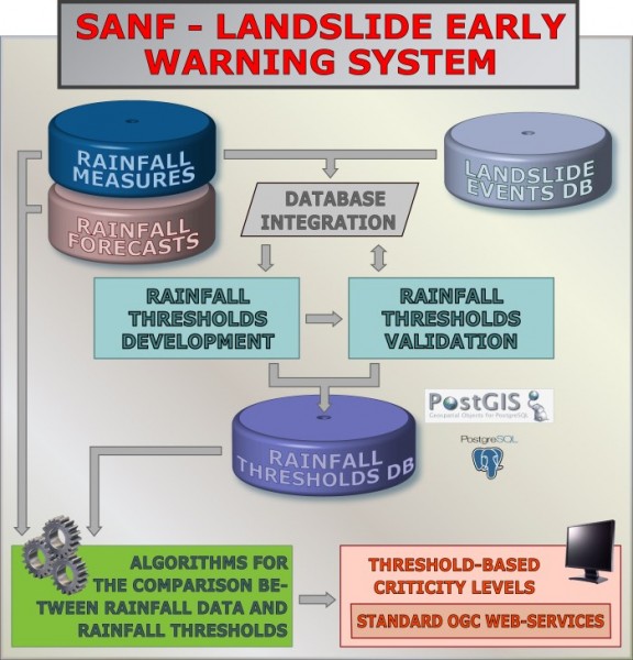
SANF is a landslide early warning system based on the comparison between rainfall measurements and forecasts and empirical rainfall thresholds. Specifically, the system consists of three components: (i) for rainfall and other data input and storage, (ii) for data processing and analysis, and (iii) for the production and delivery of the forecasts.Users/Purpose
Landslides are widespread phenomena that cause casualties and extensive damage. In Italy, intense or prolonged rainfall is the primary trigger of landslides. Determining the amount of rainfall necessary to trigger landslides is of scientific and social interest. In this context, the Italian National Department for Civil Protection (DPC) asked the CNR IRPI to design and implement an early-warning system to forecast the possible occurrence of rainfall-induced landslides in Italy. Following the request, CNR IRPI developed SANF.Methods and technologies
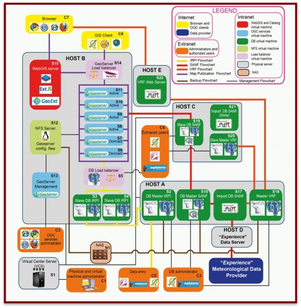
SANF consists of three main components. The first component (i) consists of a set of procedures to import rainfall measurements and quantitative rainfall forecasts. Every hour, rainfall measurements from a network of the Italian National Department for Civil Protection are imported, validated, and stored in the system. Three-day quantitative rainfall forecasts are generated twice a day using the Italian Local Area Model (LAMI), and stored in the system. The second component (ii) consists of procedures to compare the measured and/or forecasted rainfall amount with a set of rainfall thresholds, and to determine the probability of possible landslide occurrence. The third component (iii) consists of procedures to generate and deliver synoptic-scale forecast maps showing critical levels for the possible occurrence of rainfall-induced landslides. The forecast maps are delivered as digital web maps through OGC (Open Geospatial Consortium) Web services. SANF components exploit Open Source software.Products
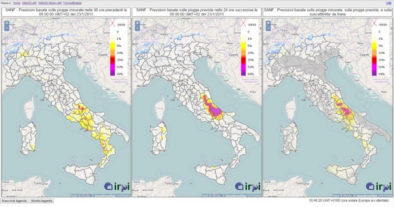
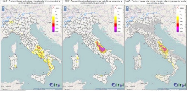
Synoptic-scale maps of exceedance probability levels for the possible occurrence of rainfall-induced landslides in Italy. Maps use (i) the measured rainfall in the past 96 hours, (ii) the rainfall forecasted for the next 24 hours, and (iii) the rainfall measurements and forecasts, modulated by a synoptic susceptibility zonation of Italy.
.