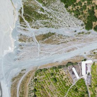
Alluvial fans are known to be areas of high geomorphic activity, where debris flows and flash floods caused by intense and prolonged rainfall are a major hazard. In Calabria, southern Italy, alluvial fans are numerous. The exact age of the alluvial fans is seldom known, but most of the fans in Calabria are considered recent in age (Holocene).
Due to the significant increase in urbanization in the last two centuries, many alluvial fans are ...
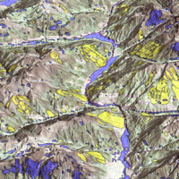
Landslide susceptibility is the propensity of a territory to generate landslides.
Many methods are available to determine landslide susceptibility, whereas only a few attempts were made to outline areas not likely to generate landslides i.e., non-susceptible landslide areas. This is surprising, because for planning purposes it is just as important (if not more important) to know where landslides are not expected than to know where landslides ...
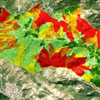
Landslide susceptibility is the likelihood of a landslide occurring in an area, given the local terrain conditions. It is the degree to which an area can be affected by future landslides i.e., an estimate of “where” landslides are more likely to occur.
Landslide susceptibility does not consider the temporal occurrence or the magnitude of the expected landslides. In mathematical language, landslide susceptibility can be expressed as the ...

The research activity aims at defining a coherent and unambiguous framework for the assessment and zonation of seismically induced landslides, at different geographical, temporal and management scales. To this end, the project works at the pre-event temporal scale, concerning spatial planning and soil protection and corresponding to years to decades time periods, and at the real-time or civil protection scale, corresponding to time periods ...
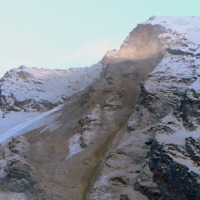
Climate change in the Greater Alpine Region is seriously affecting glacial and periglacial areas, especially for the presence of snow, glaciers and permafrost (cryosphere), with relevant consequences on slope stability. Cryosphere degradation, changes of the precipitation and temperature patterns and of the hydrological regimes, are some of the main terrestrial indicators of climatic change. Moreover, the increasing number of tourists and human ...
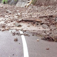
A trend of increasingly frequent intense rainfalls and changing rainfall patterns is causing a relevant number of landslides and floods affecting urban areas and engineering infrastructures such as roads, railways. Recently Transport networks across Europe experienced several failures the reasons of which are still poorly understood.. To improve the current situation, a step change in the way we design reliable and effective defence structures ...
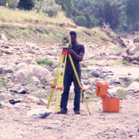
Flash floods occur in small to medium size river basins, and are characterised by fast temporal evolution. Because of their intensity and short warning times, flash floods often cause not only major economic damage, but also loss of lives.
An integrated approach to documentation and analysis of flash floods has to include the following issues:
post-flood observations aimed at estimating peak discharge and reconstructing temporal ...
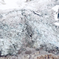
Glaciers are typical of the Alpine landscape, and an important source of water. Undoubtedly fascinating, glaciers are very complex and yet surprisingly poorly known. In the Alps, many studies focus on the volumetric changes of glaciers, proving their almost systematic reduction in the current climatic period. Little is known about the daily behaviour of Alpine glaciers. This is partly due to the inhospitable and not easily accessible ...
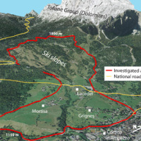
The study of the dynamics of large landslide is a heuristic process based on the integration of multiple investigation techniques: geological and geomorphological analysis, monitoring systems (traditional and innovative) and numerical models. Risk mitigation may require major interventions that call for detailed studies on the specific ...
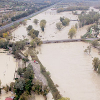
The project is focused on flood forecasting and hydraulic risk, i.e. the assessment of the effects of flooding in flood-prone areas also involving the vulnerability assessment of the hydraulic structures (dams, leaves, bridges, etc.).
The effects of flood events are not completely eliminated by structural measures, therefore it is necessary to develop complementary non-structural measures, such as real-time Flood Forecasting and Warning ...
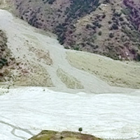
In international literature, it is now widely recognized that alluvial fans are areas of high geomorphic activity. Debris flows and flash floods occur episodically in these environments, and place many communities at high risk. Calabria (southern Italy) is a region where alluvial fans widely occur. In this region, the presence of mountain fronts/alluvial and/or coastal plain, or deep and narrow valleys debouching into larger valleys are key ...
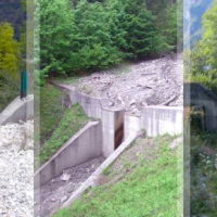
Some areas mapped in the Piani di Assetto Idrogeologico (Watershed Management Plan) of Piave, Brenta-Bacchiglione and Livenza Rivers require specific studies aimed at assigning a degree of hazard. Among the warning areas, there are numerous alluvial fans. The Soil Conservation Division of Veneto Region, in charge of the inquiry, identified the need to find an objective method for assessing the hazard of such ...
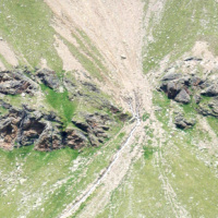
Italy has a tradition of scientific research and technological development on hazardous natural phenomena in general, and specifically on geo-hydrological hazards. Within the CNR, the “Progetti Finalizzati” Soil Conservation and Geodynamics (in the ’70s and ’80s), and GNDCI – the National Group for the Defence from Hydrogeological Disasters (in the ’80s and ’90s), have contributed to the advancement of knowledge ...
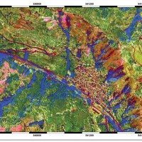
The exploitation of innovative methods of SAR and optical data processing, combined to the use of ancillary data, is able to provide useful products for the landslide and seismic hazard ...
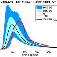
The project activities were carried out in two phases:
"dynamic scenarios of flood risk" identification through hydrologic-hydraulic modeling addressed to Civil Protection activities (2009-2011);
operational implementation of developed dynamic scenarios of flood risk and results dissemination trough web-GIS technologies, also within the context of Floods Directive 2007/60 /EC (2012-203); flood forecasting models implementation; ...
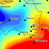
The project activities were carried out in two phases:
delineation of flooding-prone areas for many river reaches selected in the secondary hydrographic network of Tiber River basin (2009-2011);
analysis of the severe flood event that affected the Paglia river basin on November ...
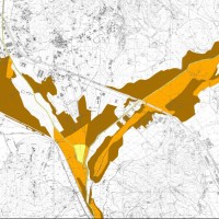
The activities of the project concern the delineation of hazard maps for return periods of 50, 100, 200 and 500 years for many reaches of interest identified in the secondary hydrographic network of Tiber ...
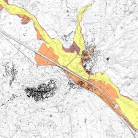
The Tiber River Basin Authority (ABT) and the Umbria Region (Service Water Resources and Hydraulic Risk), considering the verified underestimation of the flood-prone areas in the Paglia River basin provided by the Italian PAI (hydro-geological management plan) and the update of rating curves, decided to revise the hydrological study of the drainage basin in order to re-estimate the flood hazard maps for the Paglia River reach bounded upstream ...
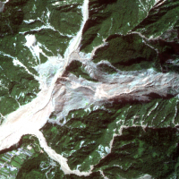
ESA Sentinels missions will provide enhanced capabilities in the revisit frequency, and the coverage. Their complete exploitation is in the combination of the two to advantage of a further increased revisiting time and in the use of different wavelenght domains. This reflects in the capabilities to detect features of changes induced by different factors including natural hazards and crop ...
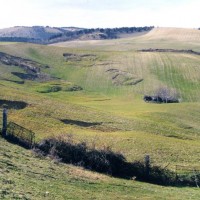
In Italy rainfall are among the main causes of trigger of shallow landslides, that yearly cause fatalities, damage, and severe economic losses. Identification of the amount of rainfall needed to trigger landslides, and the forecasting of rainfall-induced landslides, are of interest for the scientific community, as well as for the whole ...
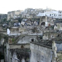
The territory of Ginosa was severely affected by flood and instability problems in October and in December 2013, as many other municipalities at the boundary between Apulia and Basilicata. In particular, on October 7, 2013, four fatalities and serious damage had to be registered. Following these events, other instabilities have occurred, including the collapse of a stretch of Via Matrice, above artificial cavities, on January 21, ...
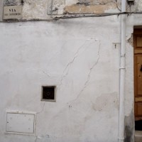
The instabilities that affected the historical part of Mesagne (Brindisi province, Apulia) since January 21, 2014, induced the local Authority to issue evacuation decrees for 18 families, corresponding to a total of 26 people. CNR IRPI was asked to provide scientific support for the identification of the processes at the origin of the ...
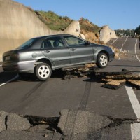
On December 3, 2013, a large landslide activated on the SW slope of Montescaglioso (Matera province, Basilicata), affecting an area with evidence of past instability. The landslide involved some 500 m of the main road to the village, and also interested several houses and other ...
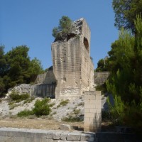
The Fantiano quarries at Grottaglie (Taranto province) are an ancient sector of extraction of the local calcarenite rock, that is now used for concerts and shows. The instability phenomena observed in the quarries forced the Municipality of Grottaglie to ask to CNR-IRPI to perform stability analyses in the ...
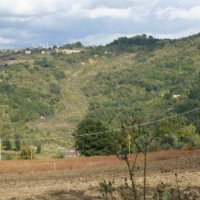
Castelfranci (Avellino, Campania) is located in the catchment of the Calore River, in correspondence of a N-S oriented stretch of the river. This territory is intensely affected by landslide development, which more than once was in the past at the origin of severe damage to the local community, and heavy losses to ...
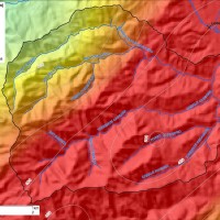
The occurrence of flash floods in mountainous catchments is often associated to relevant geomorphic effects, both in the channel network (channel changes and transport of large wood), and on the hillslopes (landslides and soil erosion). The concomitance of flash floods, channel changes and landslides enhances hazards and risk associated to individual ...
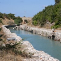
Sinkholes are in Apulia among the main geohazards, and are at the origin of severe interactions with the anthropogenic environment, and heavy losses to society. Since several years the territory of Marina di Lesina is diffusely affected by development of sinkholes (that have caused an emergency state to be declared), mostly concentrated near the Acquarotta Channel, linking the Lesina Lake to the Adriatic ...
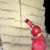
Among the most recent sinkhole events, registered in Apulia region, that occurred in Via Firenze at Gallipoli on March 29, 2007, greatly raised the attention by public opinion, having affected (likely, without causing any fatalities) the built-up areas of one of the largest towns in Salento. The event pointed out to the need to carry out detailed studies on the sinkholes related to artificial ...
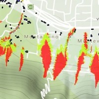
The European Commission has identified the need for adaptations in risk management as a consequence to climate and environmental changes in several documents. The implementation of risk management measures such as disaster preparedness programmes, land-use planning, regulatory zoning and early warning systems are considered essential. Further, multi-risk assessment approaches are not used in planning practice: risk indicators are hardly used ...
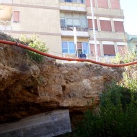
Sinkholes occur as sudden collapses of the ground, related to natural cavities produced by karst processes in soluble rocks, or to man-made cavities deriving from different types of human activities in different historical ages. Sinkholes are widespread all over the world, and the related hazard is extremely high, with very severe damage to built-up areas and human infrastructures, and heavy losses to the ...
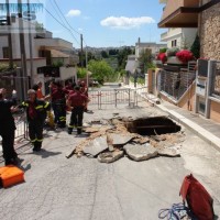
The widespread sinkholes that involve large sectors of the Apulian territory are related to natural cavities produced by karst processes in soluble rocks, or to man-made cavities deriving from different types of human activities in different historical ages. The related hazard is extremely high, with very severe damage to built-up areas and human infrastructures, and heavy losses to the ...
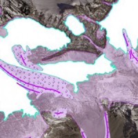
The project is included in Operative Program of the European cross-border territorial cooperation "Alcotra 2007-2013". It brings together specialized scientific expertise Italian and French that deal to study the mountain and its dangerousness. It is divided into a part of studies conducted on the entire framework of the Western Alps and in actions on the pilot sites identified by the ...
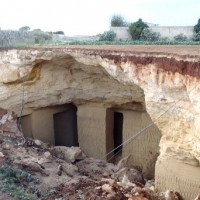
The high fragility of karst terrains, and the deriving vulnerability to a number of possible events, together with the presence of significant natural (first and foremost, groundwater), landscape and historical resources, are at the origin of the project activities, aimed at the safeguard of karst environments and the mitigation of the related ...
The territory of Calabria is affected by numerous landslides and, more generally, has a strong propensity to develop hydrogeological instability. A measure of this condition is provided by the data of the current PAI, limited to the examined areas (villages and households with more than 200 inhabitants), that identifies over 1700 high-risk situations and more than 700 at very high risk: a total of over 2,400 situations in which a hazard to the ...
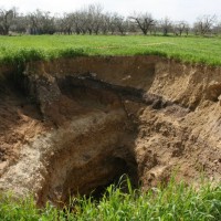
The widespread occurrence of sinkholes related to man-made cavities in Apulia highlights the need to perform a careful reconnaissance of the artificial caves over the whole region, and of their stability conditions. Knowledge of the presence and typology of artificial cavity, and of its main features, is a mandatory step for the mitigation of the sinkhole ...
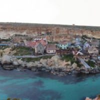
The research project can be included within the context of increasing hydrogeological instability also due to climate change and aims at investigating coastal instability in the island of Malta. This aspect has been until now slightly dealt with, despite significant risk issues, as evidenced from a series of accidents/damages recorded after landslide ...
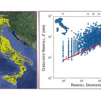
In Italy, slope failures occur every year, claiming lives, causing economic disruption, and producing different environmental problems. In Italy, intense or prolonged rainfall is the primary trigger of landslides. Predicting rainfall-induced slope failures is a challenging task of both scientific and societal interest. The forecast of single or multiple landslides triggered by rainfall in wide areas relies primarily on empirical rainfall ...
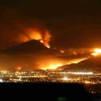
Wildfires can have profound effects on the hydrologic response of watersheds, and debris-flow activity is among the most destructive consequences of these effects. The continued high likelihood of catastrophic wildfires in Mediterranean climates has created the need to develop methods to identify and quantify potential debris flow hazards from burned ...
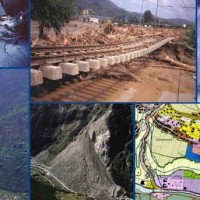
The observed increase in disastrous events over the last decades, associated with a low perception of risk by the communities involved, along with the lack of efficient, socially accepted and environmentally sound remedial measures are amongst the motivation behind this research project. The adaptation of a combined multi-risk-oriented analysis, in which the investigations focus more on the interdependence of events rather than on single event, ...
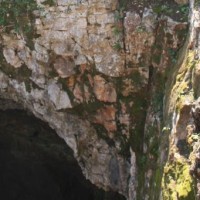
Evolution of cave and karst system occurs also by means of successive detachments of blocks from both the vault and the walls of the underground spaces. In show caves, this poses problems for the safety of visitors, and the issue must be carefully ...
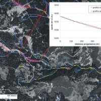
The assessment debris-flow hazard is of utmost importance in the management of alpine catchments. The analysis of morphometric variables of drainage basins and channels can contribute to preliminary assessment of debris-flow hazard at regional ...
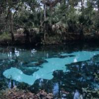
Sinkholes are among the main features of karst areas, and are extremely widespread in Florida, one of the sites most known for their occurrence and the likely interaction with the built-up environment. The Tampa area, in turn, shows an high frequency of events, which origin derives from different types of ...
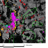
The focus on landslides results from the recognition that in many European countries slope instabilities affect urbanized areas and are a major threat to populations.
Through the integration of remotely sensed data with ground data we identify significant surface changes which are taking place on landslide susceptible slopes and this is used as input to the assessment of ...
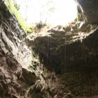
Evolution of cave and karst system occurs also by means of successive detachments of blocks from both the vault and the walls of the underground spaces. In show caves, this poses problems for the safety of visitors, and the issue must be carefully ...
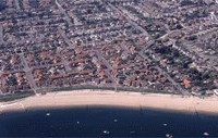
‘Response’ (or ‘Responding to the risks from climate change’) is a three-year Project supported by the LIFE financial instrument of the European Community, completed in December 2006. The Project provides a framework for understanding and preparing for the impacts of climate change around the European ...
 Alluvial fans are known to be areas of high geomorphic activity, where debris flows and flash floods caused by intense and prolonged rainfall are a major hazard. In Calabria, southern Italy, alluvial fans are numerous. The exact age of the alluvial fans is seldom known, but most of the fans in Calabria are considered recent in age (Holocene).
Due to the significant increase in urbanization in the last two centuries, many alluvial fans are ...
  A trend of increasingly frequent intense rainfalls and changing rainfall patterns is causing a relevant number of landslides and floods affecting urban areas and engineering infrastructures such as roads, railways. Recently Transport networks across Europe experienced several failures the reasons of which are still poorly understood.. To improve the current situation, a step change in the way we design reliable and effective defence structures ...
  Flash floods occur in small to medium size river basins, and are characterised by fast temporal evolution. Because of their intensity and short warning times, flash floods often cause not only major economic damage, but also loss of lives.
An integrated approach to documentation and analysis of flash floods has to include the following issues:
post-flood observations aimed at estimating peak discharge and reconstructing temporal ...
  Glaciers are typical of the Alpine landscape, and an important source of water. Undoubtedly fascinating, glaciers are very complex and yet surprisingly poorly known. In the Alps, many studies focus on the volumetric changes of glaciers, proving their almost systematic reduction in the current climatic period. Little is known about the daily behaviour of Alpine glaciers. This is partly due to the inhospitable and not easily accessible ...
  The project is focused on flood forecasting and hydraulic risk, i.e. the assessment of the effects of flooding in flood-prone areas also involving the vulnerability assessment of the hydraulic structures (dams, leaves, bridges, etc.).
The effects of flood events are not completely eliminated by structural measures, therefore it is necessary to develop complementary non-structural measures, such as real-time Flood Forecasting and Warning ...
  In international literature, it is now widely recognized that alluvial fans are areas of high geomorphic activity. Debris flows and flash floods occur episodically in these environments, and place many communities at high risk. Calabria (southern Italy) is a region where alluvial fans widely occur. In this region, the presence of mountain fronts/alluvial and/or coastal plain, or deep and narrow valleys debouching into larger valleys are key ...
  Some areas mapped in the Piani di Assetto Idrogeologico (Watershed Management Plan) of Piave, Brenta-Bacchiglione and Livenza Rivers require specific studies aimed at assigning a degree of hazard. Among the warning areas, there are numerous alluvial fans. The Soil Conservation Division of Veneto Region, in charge of the inquiry, identified the need to find an objective method for assessing the hazard of such ...
  The project activities were carried out in two phases:
"dynamic scenarios of flood risk" identification through hydrologic-hydraulic modeling addressed to Civil Protection activities (2009-2011);
operational implementation of developed dynamic scenarios of flood risk and results dissemination trough web-GIS technologies, also within the context of Floods Directive 2007/60 /EC (2012-203); flood forecasting models implementation; ...
  The Tiber River Basin Authority (ABT) and the Umbria Region (Service Water Resources and Hydraulic Risk), considering the verified underestimation of the flood-prone areas in the Paglia River basin provided by the Italian PAI (hydro-geological management plan) and the update of rating curves, decided to revise the hydrological study of the drainage basin in order to re-estimate the flood hazard maps for the Paglia River reach bounded upstream ...
  ESA Sentinels missions will provide enhanced capabilities in the revisit frequency, and the coverage. Their complete exploitation is in the combination of the two to advantage of a further increased revisiting time and in the use of different wavelenght domains. This reflects in the capabilities to detect features of changes induced by different factors including natural hazards and crop ...
  The territory of Ginosa was severely affected by flood and instability problems in October and in December 2013, as many other municipalities at the boundary between Apulia and Basilicata. In particular, on October 7, 2013, four fatalities and serious damage had to be registered. Following these events, other instabilities have occurred, including the collapse of a stretch of Via Matrice, above artificial cavities, on January 21, ...
  The Fantiano quarries at Grottaglie (Taranto province) are an ancient sector of extraction of the local calcarenite rock, that is now used for concerts and shows. The instability phenomena observed in the quarries forced the Municipality of Grottaglie to ask to CNR-IRPI to perform stability analyses in the ...
  Sinkholes are in Apulia among the main geohazards, and are at the origin of severe interactions with the anthropogenic environment, and heavy losses to society. Since several years the territory of Marina di Lesina is diffusely affected by development of sinkholes (that have caused an emergency state to be declared), mostly concentrated near the Acquarotta Channel, linking the Lesina Lake to the Adriatic ...
  Among the most recent sinkhole events, registered in Apulia region, that occurred in Via Firenze at Gallipoli on March 29, 2007, greatly raised the attention by public opinion, having affected (likely, without causing any fatalities) the built-up areas of one of the largest towns in Salento. The event pointed out to the need to carry out detailed studies on the sinkholes related to artificial ...
  The European Commission has identified the need for adaptations in risk management as a consequence to climate and environmental changes in several documents. The implementation of risk management measures such as disaster preparedness programmes, land-use planning, regulatory zoning and early warning systems are considered essential. Further, multi-risk assessment approaches are not used in planning practice: risk indicators are hardly used ...
  Sinkholes occur as sudden collapses of the ground, related to natural cavities produced by karst processes in soluble rocks, or to man-made cavities deriving from different types of human activities in different historical ages. Sinkholes are widespread all over the world, and the related hazard is extremely high, with very severe damage to built-up areas and human infrastructures, and heavy losses to the ...
  The widespread sinkholes that involve large sectors of the Apulian territory are related to natural cavities produced by karst processes in soluble rocks, or to man-made cavities deriving from different types of human activities in different historical ages. The related hazard is extremely high, with very severe damage to built-up areas and human infrastructures, and heavy losses to the ...
  The project is included in Operative Program of the European cross-border territorial cooperation "Alcotra 2007-2013". It brings together specialized scientific expertise Italian and French that deal to study the mountain and its dangerousness. It is divided into a part of studies conducted on the entire framework of the Western Alps and in actions on the pilot sites identified by the ...
  The high fragility of karst terrains, and the deriving vulnerability to a number of possible events, together with the presence of significant natural (first and foremost, groundwater), landscape and historical resources, are at the origin of the project activities, aimed at the safeguard of karst environments and the mitigation of the related ...
  The widespread occurrence of sinkholes related to man-made cavities in Apulia highlights the need to perform a careful reconnaissance of the artificial caves over the whole region, and of their stability conditions. Knowledge of the presence and typology of artificial cavity, and of its main features, is a mandatory step for the mitigation of the sinkhole ...
  Wildfires can have profound effects on the hydrologic response of watersheds, and debris-flow activity is among the most destructive consequences of these effects. The continued high likelihood of catastrophic wildfires in Mediterranean climates has created the need to develop methods to identify and quantify potential debris flow hazards from burned ...
  The observed increase in disastrous events over the last decades, associated with a low perception of risk by the communities involved, along with the lack of efficient, socially accepted and environmentally sound remedial measures are amongst the motivation behind this research project. The adaptation of a combined multi-risk-oriented analysis, in which the investigations focus more on the interdependence of events rather than on single event, ...
  Sinkholes are among the main features of karst areas, and are extremely widespread in Florida, one of the sites most known for their occurrence and the likely interaction with the built-up environment. The Tampa area, in turn, shows an high frequency of events, which origin derives from different types of ...


