In the World
The coloured circles represent the total number of activities (project, products and services, outreach, collaborations) that we have in the corresponding geographical zone
Map data: © OpenStreetMap contributors
Sentinel-3 Topography mission Assessment through Reference Techniques
 The Copernicus Sentinel-3 Surface Topography Mission (STM) provides extremely valuable surface elevation information over inland waters, sea ice and land ice, thanks to its SAR altimeter which retrieves high-resolution along-track elevation measurements, and to its orbit that covers high-latitude polar regions.
To ensure that these measurements can be used with confidence, and to maximize the return on investment of the Copernicus Sentinel-3 ...
 I-CHANGE project
 The documented effects of climate change and environmental degradation are a threat to human societies on European and global scales. Climate change may have an impact on water availability, may increase the threat of flooding and flash-floods, and will challenge coastal regions due to rising sea levels. All this will have impacts on the economy and society. The role of citizens and their skills become important both in limiting human impacts ...
 Detecting rainfall from the bottom up
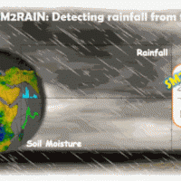 SM2RAIN is an innovative system for the estimation of the rainfall, based on measurements of the soil water content. SM2RAIN considers the soil as a natural rain gauge, and by measuring temporal variations of the soil water content, it estimates the rainfall falling on the soil, adopting a “bottom up” approach. Technically, SM2RAIN relies on the inversion of the soil water balance equation that computes the repartition of rainfall in ...
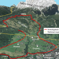
 Automatic delineation of Slope Units
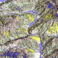
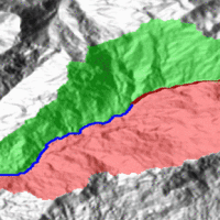 Quantitative geomorphological and environmental analysis requires the adoption of mapping units, well-defined spatial domains as basic mapping units which provide local boundaries to aggregate environmental and morphometric variables and to perform calculations. Grid cells, typically aligned with a digital elevation model, are the standard mapping unit choice. A wiser choice is represented by slope units, irregular terrain partitions delimited ...
 Rainfall estimate from space
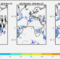 We have developed a new satellite rainfall product in near real-time. The product, called H64, is based on the integration of rainfall estimates obtained through two satellite sources. The developed algorithm combines estimates obtained by applying the SM2RAIN algorithm to satellite soil moisture data and those provided by a state-of-the-art product already operating on the full-disk area of the Meteosat satellites (60° West - 60° East, 60° ...
 SaTellite based Runoff Evaluation And Mapping
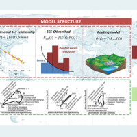 Water is at the centre of economic and social development; it is vital to maintain health, grow food, manage the environment, and create jobs. As well over half of the world’s potable water supply is extracted from rivers, either directly or from reservoirs, understanding the variability of the stored water on and below landmasses, i.e., total runoff, is of primary importance. In situ observations or land surface/hydrological models are ...
 Monitoraggio fluviale da rilevamento satellitare
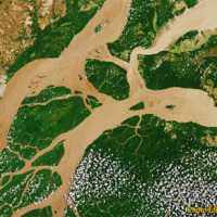 Although representing less than 1% of the total amount of water on Earth, the freshwater is essential for terrestrial life and human needs. Despite the existing in-situ gauging networks represent a tool for quantifying the instantaneous water volume in many river channels, we have surprisingly poor knowledge of the spatial and temporal dynamics of surface river discharge. Developing new procedures for river discharge estimation based on ...
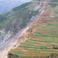
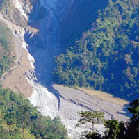
 Models of geo-hydrological processes
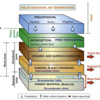 The area of interest specifically refers to the study of the following themes: extreme hydrological events and their interaction with slopes and watercourses; soil water erosion; debris flows; slope stability; triggering instability mechanisms; evolution of slope movements; monitoring systems for gravitational movements for the purpose of alerting for the mitigation of geo-hydrological risk. The activities proposed in the module are therefore ...
 A new independent GLOBAL rainfall product from ASCAT soil moisture observations through SM2RAIN
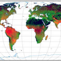 Accurate rainfall estimates are of paramount importance as rainfall plays a key-role in many fields as, to cite a few, natural hazard assessment (floods and landslides), drought management, weather forecasting, agriculture and diseases prevention. State-of-the-art rainfall products obtained by satellites are often the only way for measuring rainfall in remote areas of the ...
 Towards geohazards resilient infrastructure under changing climates
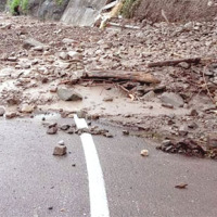 A trend of increasingly frequent intense rainfalls and changing rainfall patterns is causing a relevant number of landslides and floods affecting urban areas and engineering infrastructures such as roads, railways. Recently Transport networks across Europe experienced several failures the reasons of which are still poorly understood.. To improve the current situation, a step change in the way we design reliable and effective defence structures ...
 SMOS+RAINFALL II
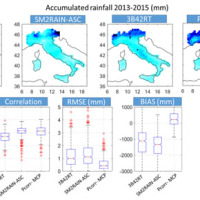 Quantitative information about precipitation is one vital input to meteorologists, hydrologic scientists, water resources managers, and environmental legislators. The past SMOS+Rainfall project addressed the improvement on a global scale of the current state-of-the-art satellite rainfall products through satellite soil moisture observations derived from the Soil Moisture and Ocean Salinity mission (SMOS) by means of three different techniques. ...
 STSE Water Cycle Multi-mission Observation Strategy – Irrigation
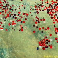 Irrigation is one of the greatest human intervention in the hydrological cycle. The knowledge of the distribution, the extent of irrigated areas and the amount of water used by irrigation is needed for different purposes: 1) modelling irrigation water requirements at the global scale, 2) assessing irrigated food production, 3) quantifying the impact of irrigation on climate, river discharge and groundwater depletion. Notwithstanding its ...
 India, Italy & UK join for study
Korea-Italy Bilateral Symposium on Landslide Prediction and Warning Technologies
STSE Water Cycle Multi-mission Observation Strategy for the Mediterranean
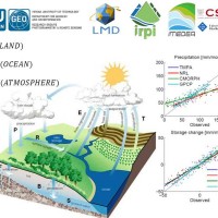 Monitoring the water cycle from satellite observations is one of the major goals of the EO community and closing the water budget has been a long-standing objective of international programs. After years of hard work, calibrating satellite data, improving inversion techniques, and facilitating the coherency of retrievals, it is admitted that the water cycle budget can now be ...
 SMOS+RAINFALL
 Quantitative information about precipitation is one vital input to meteorologists, hydrologic scientists, water resources managers, and environmental legislators. Yet, accurate measurement of precipitation over the relevant space and time scales remains a challenge. Soil moisture can be seen as the trace of the precipitation and, consequently, can be useful for providing a way to estimate rainfall accumulation or at least a new constrain to ...
 37 YEARS OF SOIL MOISUTRE DERIVED RAINFALL: application of SM2RAIN to the CCI soil moisture product, algorithm improvement and product validation
 Recently, IRPI-CNR has developed an innovative approach for estimating rainfall from satellite soil moisture data, named SM2RAIN. The ESA funded project “Climate Change Initiative - Soil Moisture“ (CCI-SM) offers a valuable opportunity for testing SM2RAIN algorithm to a continuous, homogenous, long-term (>30 years) soil moisture time series. Indeed, SM2RAIN has the chance to be tested not only for rainfall estimation but also as a ...
 Recommendations from the International SABO Symposium 2015 in Sendai, Japan
 The International SABO Symposium 2015 in Sendai was held on 18 March 2015 as one of the Public Forums related to the Third UN World Conference on Disaster Risk Reduction (WCDRR) with participation of approximately 280 persons of government officials, engineers and researchers in the field of SABO (sediment disaster risk reduction) from 16 countries and territories. Under the theme “Challenges to Reduce the Risk of Sediment Disasters Caused by ...
 Use of SMAP soil moisture products for operational flood forecasting: data assimilation and antecedent wetness conditions assessment
Hydro-meteorological Monitoring
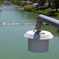 The hydro-meteorological monitoring is the operational tool for the measures of atmospheric, hydrologic ad hydraulic variables characterizing the hydrological cycle and it represents the grounds of IRPI’s research activities finalized to forecast, prevention and mitigation of natural hazards. Indeed, an accurate knowledge of processes at basis of natural phenomenon cannot disregard the direct measure of hydrological quantities, considering ...
 SM2RAIN dataset
ESA Climate Change Initiative Soil Moisture
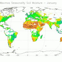 The CCI Programme wants to contribute to the data bases collecting ECVs required by GCOS (Global Climate Observing System) and other international parties. In particular, the Soil Moisture CCI will analyse the needs of the climate research community in terms of soil moisture data, adapt soil moisture satellite measurements for their use by the climate research community and create a long-term consistent soil moisture time series, based on ...


