
Sentinel-3 Topography mission Assessment through Reference Techniques
(St3TART)
Background
The Copernicus Sentinel-3 Surface Topography Mission (STM) provides extremely valuable surface elevation information over inland waters, sea ice and land ice, thanks to its SAR altimeter which retrieves high-resolution along-track elevation measurements, and to its orbit that covers high-latitude polar regions.
To ensure that these measurements can be used with confidence, and to maximize the return on investment of the Copernicus Sentinel-3 Surface Topography Mission, adequate validation of the geophysical retrieval methods, processing algorithms and corrections must be performed, considering independent observations as Reference Measurements.
The concept of Fiducial Reference Measurements (FRM) defines guidelines to answer these validation and traceability needs.
FRM are defined as:
“The suite of independent ground measurements that provide the maximum Science Return for a satellite mission by delivering, to users, the required confidence in data products, in the form of independent validation results and satellite measurement uncertainty estimation, over the entire end-to-end duration of a satellite mission.”
Purpose
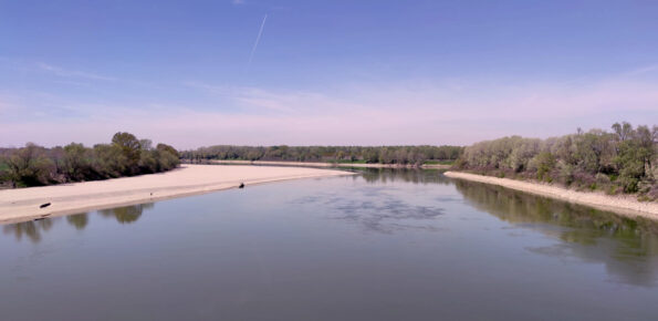
The St3TART project aims to provide a supply of fiducial reference measurements (FRMs) in support of the ESA Sentinel-3 (S3) Mission Cal/Val activities through the preparation of a roadmap and a preliminary proof of concept on terrestrial surfaces of interest, i.e. inland water bodies (lakes, reservoirs, rivers, including estuarine areas), sea ice and land ice areas (ice sheets, mountain glaciers).
Project activities will rely on different fields of expertise, both specific and transversal. The specific activities are divided into three thematic areas:
Hydrology: The primary parameter of interest is water level, and the verification of S3 products may also consider other derived parameters such as river flow and lake water storage variations (WP1).
Sea ice: the main parameters of interest are sea ice thickness and freeboard, as well as the depth of snow depth over sea ice (WP2).
Land ice: the parameter of interest is the land ice topography (WP3).
The transverse activities concern:
The development of the FRM data hub to disseminate the data to the various Cal/Val stakeholders of the S3 mission Performance Center and S3VT (WP4).
The development of the Super Cal/Val Site Identifier Tool (SCalSIT) tool to help interested stakeholders contribute to the selection of additional calibration sites and measurement opportunities for inland waters (WP5).
The promotion of the project (WP6).
The support in terms of general metrology approach to consolidate the error and uncertainty budgets (WP7).
The project management (WP8).
 Internal contact person: angelica tarpanelli -