Abruzzo
The coloured circles represent the total number of activities (project, products and services, outreach, collaborations) that we have in the corresponding geographical zone
Map data: © OpenStreetMap contributors
Automated Inclinometer System (AIS) for deep-seated ground deformation measurements
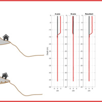 Our AIS (Automated Inclinometer System) allows for fully automatic inclinometer measurements in standard boreholes. The deep measurements have multiple applications, including (i) evaluating the rate of deep-seated ground deformation in landslide areas, (ii) evaluating the volume of deep-seated landslides, and (ii) assessing landslide hazards.
The AIS is composed of an electronic control manager, an inclinometer probe (with traditional ...
 Lazio, Abruzzo e Toscana contano i danni
I tecnici della Costa Concordia al lavoro per Ripe
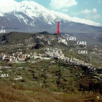
Ripe di Civitella, prosegue il monitoraggio della Frana
Civil Protection Competence Centre on Geo-Hydrological Risk
 In Italy landslides and floods are frequent, widespread and dangerous phenomena, that cause fatalities and serious economic damage. In our country, landslides and floods pose major problems of scientific interest and of social and economic relevance.
The Institute is a Competence Centre for the Italian national Civil Protection Department, an Office of the Prime Minister. For the Department of Civil Protection we execute research and ...
 Geothermal Atlas of Southern Italy Project
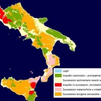 The Geothermal Atlas project is aimed at the characterization, classification and mapping of geothermal resources, conventional and unconventional types, for the production of electricity in the regions of Southern Italy. It also provides training and information stretched to increase the skills of the industry and the public's knowledge about the various aspects of geothermal energy, especially the unconventional, in order to promote the ...
 Continuous monitoring of the seismogenic Paganica fault (AQ) after the April 6 2009 L’Aquila earthquake
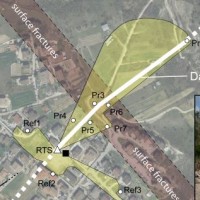 The L’Aquila earthquake occurred the 6th April 2009, causing several casualties and damages to a large number of buildings and infrastructures. The event was a 6.3 moment magnitude (Mw). In the days following the earthquake, several aftershocks with Mw>4 affected the same general area. In total, within an area of about 50 km radius from L’Aquila town, the seismic sequence counted ca. 2×10⁴ events in about one year. Among the severely ...


