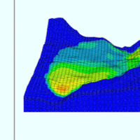
When soil behaviour is studied, whether landslide soils are concern, levee materials or foundations, the problem regarding how much and how reliable information about the soil properties we have available has to be addressed.
Understanding “what’s beneath” the visible surface is fundamental, yet complicated. Drillings are performed to analyse the stratigraphy of soils (the order and the thickness of the different soil levels) and ...
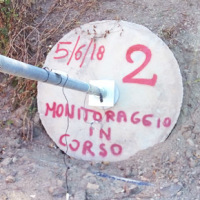
Geo-Hydrological risks are one of the main sources of economic losses for our country causing a huge number of victims and damages. From 1966 to 2015, landslides and floods caused 1948 casualties, 3524 injured and more than 412,000 displaced people. The Venetian mountain has always been subject to major landslides and, almost every year, new emergencies occur with the intensification of the autumn and spring rains, which are increasing due to ...
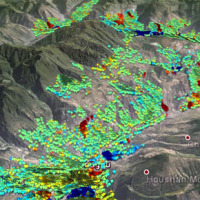
The urbanisation of seismically active areas, coupled with the ongoing change in climate patterns, require a shift in the approaches to land/infrastructure instability hazard assessment and risk reduction. This is particularly relevant in seismically active regions where the recurrent damage from landsliding, subsidence and ground deformations can be widespread. Geotechnical investigations and in situ monitoring of land prone to instability are ...
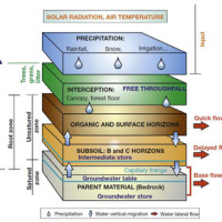
The area of interest specifically refers to the study of the following themes: extreme hydrological events and their interaction with slopes and watercourses; soil water erosion; debris flows; slope stability; triggering instability mechanisms; evolution of slope movements; monitoring systems for gravitational movements for the purpose of alerting for the mitigation of geo-hydrological risk. The activities proposed in the module are therefore ...
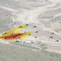
The 3DA software is a new procedure that allows retrieving in near-real-time 3D surface deformation models starting from data acquired via robotized total stations or others system that acquire the surface displacements. The measurements are first pre-processed and then implemented on 3D maps that include vector arrows representative of the intensities and of the real directions of motion in a given system of coordinates. The 3D surface ...
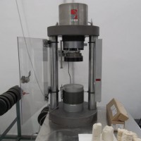
Laboratory for the measurement of the main physical and mechanical properties of soft rocks and ...
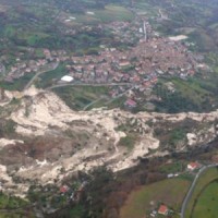
In the winter of 2009-2010, after the previous winter 2008-2009 when widespread hydrogeological instabilities had affected the whole of Calabria, the same area was still hardly hit by numerous and heavier instability phenomena, punctual and areal. In the context outlined it was ordered by the Italian Government to draft a "Plan excerpt for urgent action" which covered, in particular, the main city of the region, Catanzaro (Ianò district), and ...
 Geo-Hydrological risks are one of the main sources of economic losses for our country causing a huge number of victims and damages. From 1966 to 2015, landslides and floods caused 1948 casualties, 3524 injured and more than 412,000 displaced people. The Venetian mountain has always been subject to major landslides and, almost every year, new emergencies occur with the intensification of the autumn and spring rains, which are increasing due to ...
  The area of interest specifically refers to the study of the following themes: extreme hydrological events and their interaction with slopes and watercourses; soil water erosion; debris flows; slope stability; triggering instability mechanisms; evolution of slope movements; monitoring systems for gravitational movements for the purpose of alerting for the mitigation of geo-hydrological risk. The activities proposed in the module are therefore ...


