
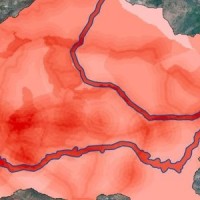
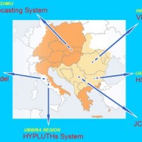
Greece
The coloured circles represent the total number of activities (project, products and services, outreach, collaborations) that we have in the corresponding geographical zone
Map data: © OpenStreetMap contributors
Where we should not expect landslides?
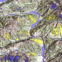 Landslide susceptibility is the propensity of a territory to generate landslides.
Many methods are available to determine landslide susceptibility, whereas only a few attempts were made to outline areas not likely to generate landslides i.e., non-susceptible landslide areas. This is surprising, because for planning purposes it is just as important (if not more important) to know where landslides are not expected than to know where landslides ...
Landslide susceptibility is the propensity of a territory to generate landslides.
Many methods are available to determine landslide susceptibility, whereas only a few attempts were made to outline areas not likely to generate landslides i.e., non-susceptible landslide areas. This is surprising, because for planning purposes it is just as important (if not more important) to know where landslides are not expected than to know where landslides ... MUltiHAzard framework for water related risks management
 The MUHA project is building upon the idea to address disaster management cycle consisting of preparedness-response-mitigation-rebuild components in the ADRION countries. It will connect the observed and modelled hazards and risks related to the integrated water cycle, by effectively join them with the existing and improved coping capacity developed by national, bilateral and EU Civil Protection ...
 STSE Water Cycle Multi-mission Observation Strategy for the Mediterranean
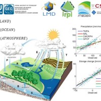 Monitoring the water cycle from satellite observations is one of the major goals of the EO community and closing the water budget has been a long-standing objective of international programs. After years of hard work, calibrating satellite data, improving inversion techniques, and facilitating the coherency of retrievals, it is admitted that the water cycle budget can now be ...
 Multi Scale and Multi Hazard MApping Space Solutions
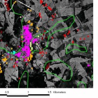
 The exploitation of innovative methods of SAR and optical data processing, combined to the use of ancillary data, is able to provide useful products for the landslide and seismic hazard ...
 Connecting European Connectivity Research
 Water and sediment connectivity has emerged in recent years as a significant conceptual framework for understanding the transfer of surface water and sediment through landscapes. Connectivity can be seen both as a driver of hydrological and geomorphic processes within a catchment and as an emergent catchment property that is the result of processes acting at different ...
 FLoods and fIre Risk assessment and managEment
 FLIRE is a demonstration project aiming to the development of an integrated Decision Support System (DSS) for both flash floods and forest fires risk assessment and management. The DSS tool will be designed by using state of art tools, technologies and methods and taking into account prevention, adaptation and interaction issues. The final model will be online available to key stakeholders and relevant authorities (local and national) for the ...
 Assessment of water Balances and Optimisation based Target setting across EU River Basins
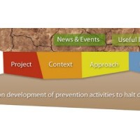 ABOT is one of the Pilot projects on Development of Prevention Activities to Halt Desertification in Europe, partly funded by DG Environment of the European Commission. The objective of the pilot projects is to support the development of concrete pilot initiatives on innovative technologies, techniques or practices in order to contribute to the exchanges of good practice and innovation for halting the desertification in ...
 Hydrometeorological data resources and technologies for effective flash flood forecasting
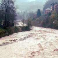 Flash-floods develop at space and time scales that conventional observation systems for rainfall and river discharge are not able to monitor. Consequently, the atmospheric and hydrological generating mechanisms of flash-floods are poorly understood, leading to highly uncertain forecasts of these ...
 Vulnerability maps for monitoring and management of groundwater resources in the Archimed area
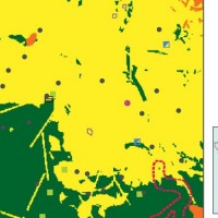 The project considered the strong demand of local institutions to select the best existing practices, in relation to different national and local characteristics, considering the regulatory ...
 Monitoring, Forecasting and Best Practices for FLOOD Mitigation & Prevention in the CADSES Region
 Hydrometeorological monitoring and flood forecasting are indispensable in preventing hydraulic hazard and ensuring civil protection. Implementing a sustainable plan to combat floods requires further activities, such as best practices for agricultural, forestry and land use management in flood risk areas. Methodologies must be developped within a transnational context, transending local ...
 Landslide Early Warning Integrated System
 The focus on landslides results from the recognition that in many European countries slope instabilities affect urbanized areas and are a major threat to populations.
Through the integration of remotely sensed data with ground data we identify significant surface changes which are taking place on landslide susceptible slopes and this is used as input to the assessment of ...
The focus on landslides results from the recognition that in many European countries slope instabilities affect urbanized areas and are a major threat to populations.
Through the integration of remotely sensed data with ground data we identify significant surface changes which are taking place on landslide susceptible slopes and this is used as input to the assessment of ... Prevention, Information and Early Warning pre-operational services to support the management of risks
 PREVIEW is an integrated project by the European Commission 6th Framework Programme, led by the EURORISK Consortium, a multi-disciplinary European Team of committing Actors of the domain: Civil Protections and Environmental Bodies; Scientific communities and Service operators, at national and regional level, for Meteorology, Hydrology, Seismology, Volcanology and GIS services based on Space data; and Industry. The project was organized around a ...