Triggering and evolution of the San Benedetto Ullano landslide
Background
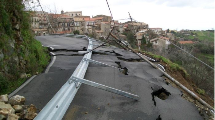
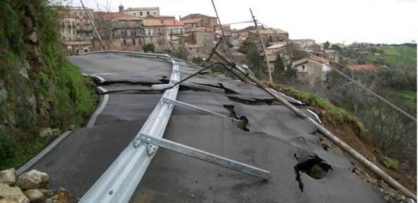
With reference to landslides, Italy is exposed to high-risk conditions (Guzzetti, 2000). The abundant and prolonged rains fallen in the 2008-2009 and 2009-2010 wet seasons triggered numerous landslides in Calabria, mostly in its northernmost sector. Such geo-hydrological crises were severe enough to induce the Italian government to declare the State of Emergency on both circumstances.
Purpose
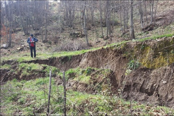
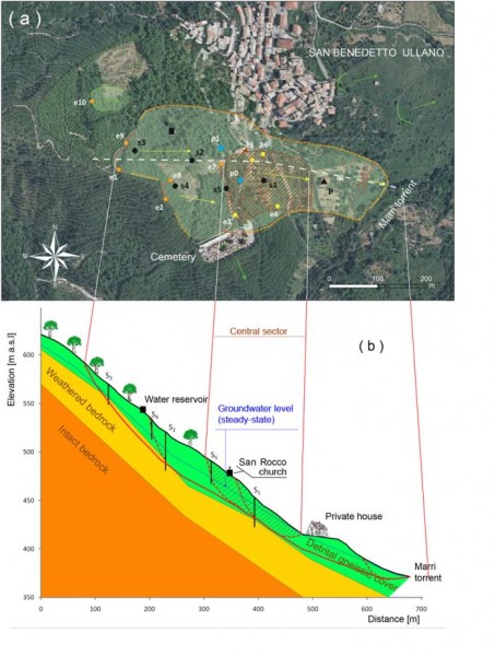
To study the triggering and evolution of the San Benedetto Ullano landslide, threatening the town of San Benedetto Ullano (CS). On January 2009 and February 2010, the landslide reactivated due to exceptional and prolonged rainfall. The study also aimed at supporting the municipal administration in emergency phases by an integrated early-warning system.
Methods
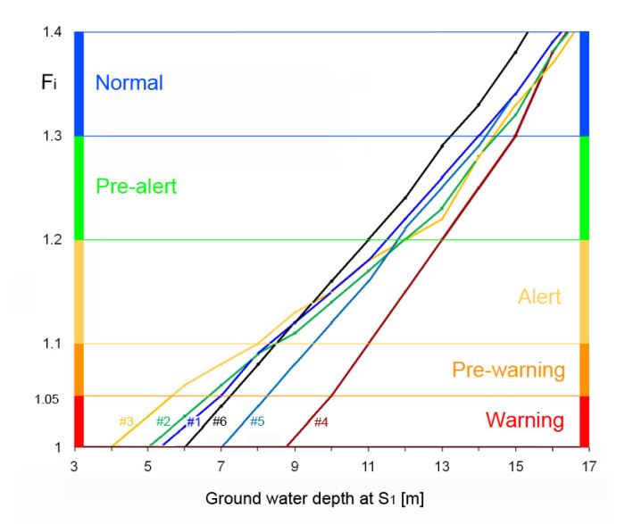
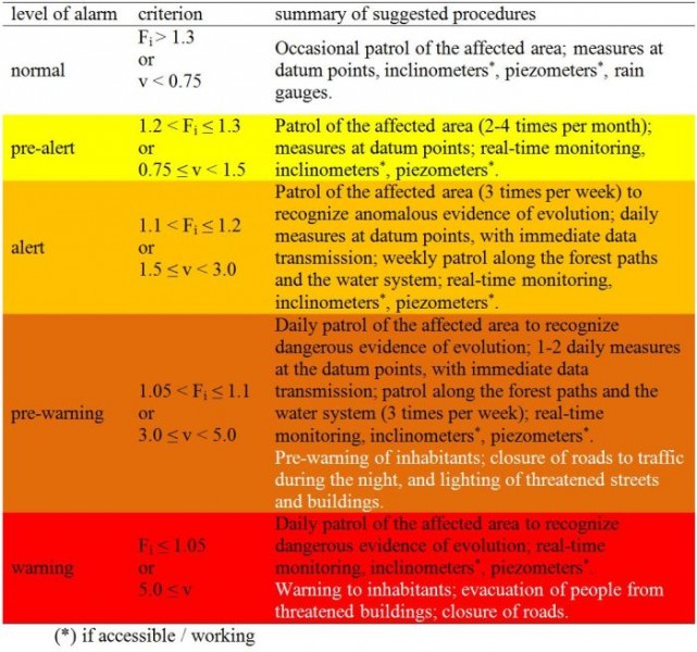
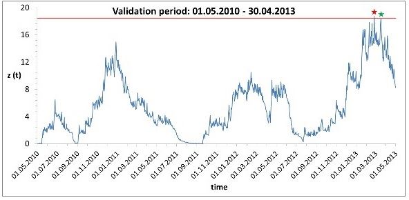
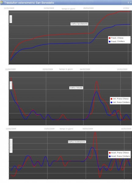
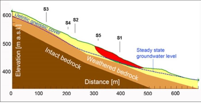
Automated, remote monitoring of physical parameters, with restitution in a WebGIS. Integration with occasional in situ measurements. Parametric stability analyses. Hydrological modelling (SAKe). Development of a decision support system (DSS) to be used in emergency phases.
Results
Integrated (automatic and manual measurements) monitoring system. Decision support system for the management of emergency phases. Technical reports and scientific papers.
Products
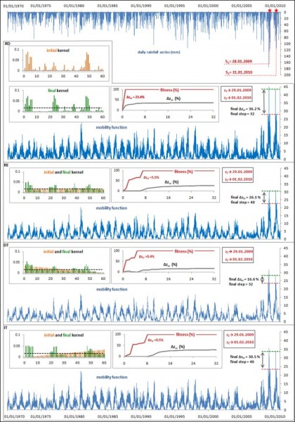
Application of the model SAKe. Refinement of the hydrological model for rainfall-induced landslides. Methods, knowledge and application results disseminated through technical reports, seminars and scientific papers.
Conclusions
The activities allowed to developing, and integrate in a decision support system, the potential of approaches based on: geomorphological surveys (field and remote sensing); traditional and remote monitoring, integrated in a Web-GIS environment; hydrological modelling of landslide triggering (SAKe); geotechnical modelling (parametric limit equilibrium analyses).