
United States
The coloured circles represent the total number of activities (project, products and services, outreach, collaborations) that we have in the corresponding geographical zone
Map data: © OpenStreetMap contributors
Sentinel-3 Topography mission Assessment through Reference Techniques
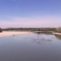 The Copernicus Sentinel-3 Surface Topography Mission (STM) provides extremely valuable surface elevation information over inland waters, sea ice and land ice, thanks to its SAR altimeter which retrieves high-resolution along-track elevation measurements, and to its orbit that covers high-latitude polar regions.
To ensure that these measurements can be used with confidence, and to maximize the return on investment of the Copernicus Sentinel-3 ...
The Copernicus Sentinel-3 Surface Topography Mission (STM) provides extremely valuable surface elevation information over inland waters, sea ice and land ice, thanks to its SAR altimeter which retrieves high-resolution along-track elevation measurements, and to its orbit that covers high-latitude polar regions.
To ensure that these measurements can be used with confidence, and to maximize the return on investment of the Copernicus Sentinel-3 ... Florida forecasts sinkhole burden
 Articolo pubblicato su NATURE, vol. 504, 12 december 2013, p. 196-197, in cui si cita il lavoro dell'IRPI sui sinkholes in ...
 Alarm and monitoring systems for debris and mud flows
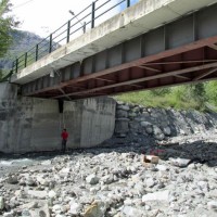 Monitoring of debris flows in instrumented areas is carried out since many years in different Countries worldwide. It is still missing, however, an adequate standardization of methodologies, instrumentations and procedures. The instrumented areas are also employed for testing warning systems. Even though these latter have been more and more employed, a systematic experimentation of these systems has not yet been carried ...
 Spatially distributed modelling of landslide phenomena
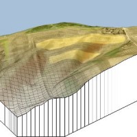 The application of distributed physically based models is possible on relatively small areas, typically hundreds or few thousands of km2. Distributed modelling of slope dynamics requires many sufficiently detailed information. Knowledge of geotechnical parameters and land use, digital terrain models, medium/high resolution cartography, temporal evolution of soil moisture conditions, are ...
 Karst sinkholes in urban areas in Florida
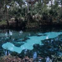 Sinkholes are among the main features of karst areas, and are extremely widespread in Florida, one of the sites most known for their occurrence and the likely interaction with the built-up environment. The Tampa area, in turn, shows an high frequency of events, which origin derives from different types of ...