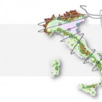
The coloured circles represent the total number of activities (project, products and services, outreach, collaborations) that we have in the corresponding geographical zone
Map data: © OpenStreetMap contributors
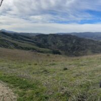
Italy is an extremely fragile territory, widely exposed to hydrogeological hazards affecting anthropic infrastructures and the natural environment. In this scenario, geomorphological maps, including the representation of the spatial distribution of landforms, have been used for a long time for the description of processes acting on the Earth’s surface. Geomorphological maps should represent the basic tool for the assessment of ...

The documented effects of climate change and environmental degradation are a threat to human societies on European and global scales. Climate change may have an impact on water availability, may increase the threat of flooding and flash-floods, and will challenge coastal regions due to rising sea levels. All this will have impacts on the economy and society. The role of citizens and their skills become important both in limiting human impacts ...
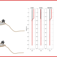
Our AIS (Automated Inclinometer System) allows for fully automatic inclinometer measurements in standard boreholes. The deep measurements have multiple applications, including (i) evaluating the rate of deep-seated ground deformation in landslide areas, (ii) evaluating the volume of deep-seated landslides, and (ii) assessing landslide hazards.
The AIS is composed of an electronic control manager, an inclinometer probe (with traditional ...
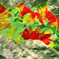
Landslide susceptibility is the likelihood of a landslide occurring in an area, given the local terrain conditions. It is the degree to which an area can be affected by future landslides i.e., an estimate of “where” landslides are more likely to occur.
Landslide susceptibility does not consider the temporal occurrence or the magnitude of the expected landslides. In mathematical language, landslide susceptibility can be expressed as the ...
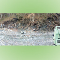
The aim of the geomorphometric analysis is to derive indices capable of characterizing the spatial variability of specific hydro-geomorphological processes (e.g., sediment connectivity, erosion and deposit). The growing availability of high-resolution topographic data has increased the interest in geomorphometry and its applications. Debris-flow monitoring in instrumented areas and flash-flood documentation are invaluable ways to gather field ...
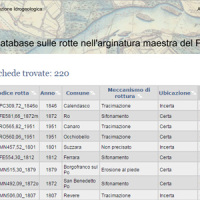
This is the web-based relational database on the main levee breaches of the Po River (Italy), which have occurred since the year 1800.
The database contains more than 200 fact sheets that show the information for each levee failure. For each fact sheet are attached documents and maps. The access is free of charge.
This database may provide a valid support in the design of defense interventions directed at the prevention and mitigation of ...
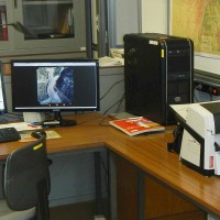
The CNR IRPI archive preserves 170.000 aerial photographs useful for stereoscopic applications. Most part of those photographs were taken during a number of surveys carried out between 1954 and 2005 in tha Padan Plain, Triveneto and Liguria (Northern Italy) but some examples date from the 1920s, 1930s and 1940s.
In this documentation the effects of many floods and landslides events can be observed. In particular, we would mention the aerial ...
Le frane sono eventi del tutto naturali nell’evoluzione di un territorio, in particolare in Italia. Esse pongono un problema e diventano un pericolo allorché interagiscono con l’uomo e l’ambiente antropico. I movimenti franosi presentano una grande varietà fenomenologia. Le notevoli differenze nella tipologia, dimensione, e velocità di spostamento delle frane, rendono difficile e complessa la definizione della loro pericolosità, per ...

Articolo di Noemi Bicchiarelli pubblicato su corrieredibologna.it il 22 maggio ...

Articolo pubblicato su bologna2000.com il 22 maggio ...

Articolo di Amelia Esposito pubblicato su corrieredibologna.it il 3 maggio ...

Articolo di David Marceddu pubblicato il 3 maggio 2012 su ilfattoquotidiano.it edizione ...

Articolo di Luigi Spezia pubblicato il 3 maggio 2012 su laRepubblica.it edizione di ...
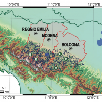
Extreme events are a key manifestation of complex systems, in both the natural and human world. Their economic and social consequences are a matter of enormous concern. Much of science has concentrated, until recently, on understanding the mean behaviour of physical, biological or social systems and their “normal” variability. Extreme events, due to their rarity, have been hard to study and even harder to predict. E2-C2 developed methods ...
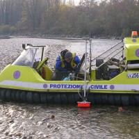
The study of the evolution of the watercourses is traditionally based on the use of historical maps and aerial photographs for the comprehension of the planimetric changes and on the use of topographical sections in order to have also the measure of the altimetric change occurred in the considered time interval.
Through this approach it is possible, for the Po basin, to have the first indications of the main watercourses evolution starting ...
 Italy is an extremely fragile territory, widely exposed to hydrogeological hazards affecting anthropic infrastructures and the natural environment. In this scenario, geomorphological maps, including the representation of the spatial distribution of landforms, have been used for a long time for the description of processes acting on the Earth’s surface. Geomorphological maps should represent the basic tool for the assessment of ...
  The documented effects of climate change and environmental degradation are a threat to human societies on European and global scales. Climate change may have an impact on water availability, may increase the threat of flooding and flash-floods, and will challenge coastal regions due to rising sea levels. All this will have impacts on the economy and society. The role of citizens and their skills become important both in limiting human impacts ...
  Our AIS (Automated Inclinometer System) allows for fully automatic inclinometer measurements in standard boreholes. The deep measurements have multiple applications, including (i) evaluating the rate of deep-seated ground deformation in landslide areas, (ii) evaluating the volume of deep-seated landslides, and (ii) assessing landslide hazards.
The AIS is composed of an electronic control manager, an inclinometer probe (with traditional ...
  Extreme events are a key manifestation of complex systems, in both the natural and human world. Their economic and social consequences are a matter of enormous concern. Much of science has concentrated, until recently, on understanding the mean behaviour of physical, biological or social systems and their “normal” variability. Extreme events, due to their rarity, have been hard to study and even harder to predict. E2-C2 developed methods ...


