
Belgium
The coloured circles represent the total number of activities (project, products and services, outreach, collaborations) that we have in the corresponding geographical zone
Map data: © OpenStreetMap contributors
Connecting European Connectivity Research
 Water and sediment connectivity has emerged in recent years as a significant conceptual framework for understanding the transfer of surface water and sediment through landscapes. Connectivity can be seen both as a driver of hydrological and geomorphic processes within a catchment and as an emergent catchment property that is the result of processes acting at different ...
 Spatially distributed modelling of landslide phenomena
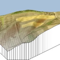 The application of distributed physically based models is possible on relatively small areas, typically hundreds or few thousands of km2. Distributed modelling of slope dynamics requires many sufficiently detailed information. Knowledge of geotechnical parameters and land use, digital terrain models, medium/high resolution cartography, temporal evolution of soil moisture conditions, are ...