Brazil
The coloured circles represent the total number of activities (project, products and services, outreach, collaborations) that we have in the corresponding geographical zone
Map data: © OpenStreetMap contributors
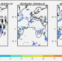
Rainfall estimate from space
 We have developed a new satellite rainfall product in near real-time. The product, called H64, is based on the integration of rainfall estimates obtained through two satellite sources. The developed algorithm combines estimates obtained by applying the SM2RAIN algorithm to satellite soil moisture data and those provided by a state-of-the-art product already operating on the full-disk area of the Meteosat satellites (60° West - 60° East, 60° ...

