
Theme: Optical image
We monitor the Planpincieux Glacier, along the Italian side of the Grandes Jorasses, Aosta Valley
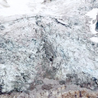 Glaciers are typical of the Alpine landscape, and an important source of water. Undoubtedly fascinating, glaciers are very complex and yet surprisingly poorly known. In the Alps, many studies focus on the volumetric changes of glaciers, proving their almost systematic reduction in the current climatic period. Little is known about the daily behaviour of Alpine glaciers. This is partly due to the inhospitable and not easily accessible ...
 Monitoring of the Gollone landslide, Acceglio (CN)
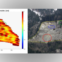 The landslide monitoring represents a strategic activity, especially for those phenomena for which it is not possible (for technical or financial reasons) to realize stabilization interventions of the landslide. Nevertheless, the data acquisition is only the first part of the project, to which it is necessary to couple an on line management of the processed data and to realize monitoring ...
 Kinematic of debris flows using Large Scale Particle Image Velocimetry (LSPIV)
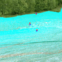 Usually the video cameras installed within a debris-flow monitoring site have the role of recording videos to better understand the behavior of the event for an improved interpretation of its dynamic. The use of such cameras for Image Velocimetry purpose is still nowadays a ...
 Threedimensional Displacement Analysis
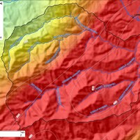
 The 3DA software is a new procedure that allows retrieving in near-real-time 3D surface deformation models starting from data acquired via robotized total stations or others system that acquire the surface displacements. The measurements are first pre-processed and then implemented on 3D maps that include vector arrows representative of the intensities and of the real directions of motion in a given system of coordinates. The 3D surface ...
 Hydrological-hydraulic validation of satellite data
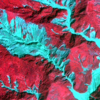
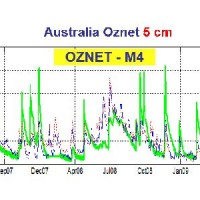 The service aims to assess the potential of different satellite products (from active and passive micro-waves, optical, SAR, spectroradiometers, radiometers sensors) in retrieving the main hydrological-hydraulic variables such as rainfall, soil moisture, water level, flow velocity and discharge. This is pursued through a comprehensive validation analysis by using in-situ observed or modelled data for several sited located ...
 Spectral signatures library for semi-automatic event landslide recognition and mapping
 Earthquakes and strong rainfall precipitations, cause worldwide landslide. Inventories of the ground effects of an event must be prepared in a few days or less for the residual risk management. Satellite images and image analysis techniques have started to back up traditional mapping methods. Purpose of this project is to increase the automatization of image ...
 Space advanced project for excellence in research and enterprise
The project SAPERE is an Industrial Research oriented project (PON and FAR funds) focused on promoting the competitiveness of the National Aerospace Technology Cluster. The participants to the project include 8 private firms of the Cluster (industrial component), with Thales Alenia Space Italia being the leader, as well as academic (University) and research (CNR-National Research Council) ...
Geo-hydrological hazards in the Pogliaschina catchment
 The occurrence of flash floods in mountainous catchments is often associated to relevant geomorphic effects, both in the channel network (channel changes and transport of large wood), and on the hillslopes (landslides and soil erosion). The concomitance of flash floods, channel changes and landslides enhances hazards and risk associated to individual ...