A landslide is the movement of a mass of rock, debris or earth along a slope under the influence of gravity.
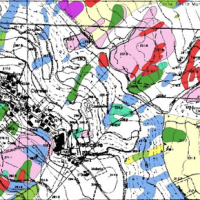
Landslides pose serious threats in many areas of the world, and knowing their location, distribution and classification is important for land use planning. Landslide identification and mapping is a fundamental activity for an effective defence from the damage caused by landslides to the population and to structures and the ...
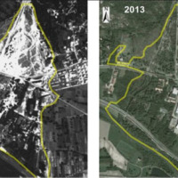
The IRPI Aerialphotografical archive consists of about 170000 aerial photographs of Northern Italy (1954-2005) useful for a stereoscopic vision. It also includes military flights (Royal Air Force) carried out during the Second World War. For some areas there are also rare aerial shots of the years 20, 30 and 40, often in diachronic form (5-10 years). The documentation refers to geo-hydrological events occurring on large areas and characterized ...
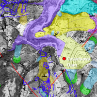
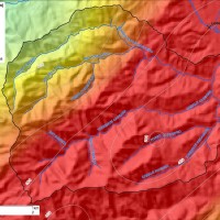
The reservoir of Casanuova on the Chiascio river, Central Umbria, occupies an area affected by numerous landslides, already identified in the regional cartographies. However, the potential interaction between the evolution of landslides and the reservoir is not evaluable because the available landslide inventories are not updated and do not contain information on the morphological evolution over time of the slopes that drain into the reservoir. ...
The CNR IRPI archive preserves 170.000 aerial photographs useful for stereoscopic applications. Most part of those photographs were taken during a number of surveys carried out between 1954 and 2005 in tha Padan Plain, Triveneto and Liguria (Northern Italy) but some examples date from the 1920s, 1930s and 1940s.
In this documentation the effects of many floods and landslides events can be observed. In particular, we would mention the aerial ...
The occurrence of flash floods in mountainous catchments is often associated to relevant geomorphic effects, both in the channel network (channel changes and transport of large wood), and on the hillslopes (landslides and soil erosion). The concomitance of flash floods, channel changes and landslides enhances hazards and risk associated to individual ...
