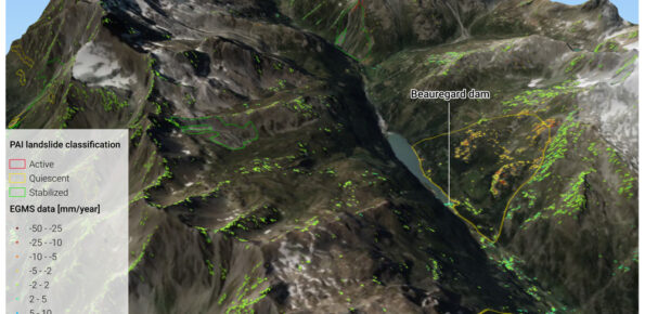
EGMS data in PAI planning tools
Scientific and technical investigation concerning the operational use of EGMS data in the PAI planning tools of the Po River District Basin Authority

Background
In recent decades, InSAR data has been extremely helpful in identifying and delineating active landslides, as well as enhancing our understanding of geo-hydrological instability. However, due to the complexity and limitations of interpreting InSAR data, there is a need for guidelines to facilitate its operational use in detecting slow landslide phenomena.
Purpose
The agreement’s objective is to develop an operational proposal for utilising the InSAR satellite interferometry data, recently published by the European Union under the Copernicus European Ground Motion Service (EGMS) program. This aims to update the data in the Hydrogeological Asset Plan (PAI) for the Po River Basin District.
Methods
The adopted methodology is structured around four key pillars: i) collection and organisation of EGMS data within the area of interest; ii) analysis of the EGMS data and comparison with interferometric data from other sources; iii) coding of the significance of EGMS data concerning to different landslide types; iv) proposal of procedures for updating PAI elaborations and reclassification of landslide phenomena based on the results obtained from the EGMS data analyses.


 Internal contact person: daniele giordan -