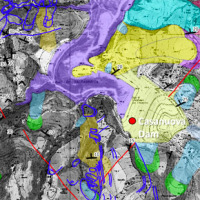
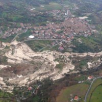
The reservoir of Casanuova on the Chiascio river, Central Umbria, occupies an area affected by numerous landslides, already identified in the regional cartographies. However, the potential interaction between the evolution of landslides and the reservoir is not evaluable because the available landslide inventories are not updated and do not contain information on the morphological evolution over time of the slopes that drain into the reservoir. ...
The project concerns the mitigation of natural hazards (mainly the effects on the territory and the anthropic environment caused by rains, earthquakes, volcanism, and Radon gas). The geological characterization is essential to frame the contexts and the expected phenomena. Numerical modeling and monitoring allow to predict the spatio-temporal evolution of the phenomena, and therefore to evaluate the risk for mitigation ...

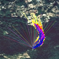
The 3DA software is a new procedure that allows retrieving in near-real-time 3D surface deformation models starting from data acquired via robotized total stations or others system that acquire the surface displacements. The measurements are first pre-processed and then implemented on 3D maps that include vector arrows representative of the intensities and of the real directions of motion in a given system of coordinates. The 3D surface ...
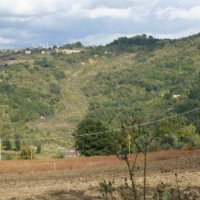
Castelfranci (Avellino, Campania) is located in the catchment of the Calore River, in correspondence of a N-S oriented stretch of the river. This territory is intensely affected by landslide development, which more than once was in the past at the origin of severe damage to the local community, and heavy losses to ...
Taiwan, an active orogenic belt with subtropical climate is characterized by a high uplift rate and several major typhoons each year. Italy is on one of the most seismically active regions in Europe because of the thrust of African plate on Eurasian continental one. Both experience numerous landslides along with earthquakes and intense rainfalls, causing heavy damages and casualties. The purpose of this project was to share scientific knowledge ...
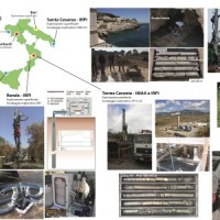
In the winter of 2009-2010, after the previous winter 2008-2009 when widespread hydrogeological instabilities had affected the whole of Calabria, the same area was still hardly hit by numerous and heavier instability phenomena, punctual and areal. In the context outlined it was ordered by the Italian Government to draft a "Plan excerpt for urgent action" which covered, in particular, the main city of the region, Catanzaro (Ianò district), and ...
VIGOR contributed to increasing knowledge in exploitation of geothermal resources. It was aimed at providing information useful to start exploration and utilization of geothermal energy, through reconnaissance, analyses and studies, valorise geothermal resources in Calabria, Campania, Puglia and Sicily.
In particular, geological and geothermal characterization were carried both at regional scale (i.e. maps of geothermal potential) and at the ...
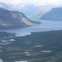
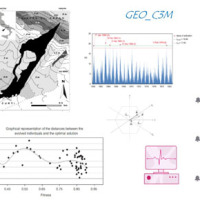
Fennoscandia bears witness of the Pleistocene glaciation in the form of a series of large geological faults. Pärvie which is the longest runs for 150 km. No information is available on its state of activity and no surface deformations data have ever been collected. The length of the fault and its location, make the traditional monitoring techniques unfeasible and ...
