The Copernicus Sentinel-3 Surface Topography Mission (STM) provides extremely valuable surface elevation information over inland waters, sea ice and land ice, thanks to its SAR altimeter which retrieves high-resolution along-track elevation measurements, and to its orbit that covers high-latitude polar regions.
To ensure that these measurements can be used with confidence, and to maximize the return on investment of the Copernicus Sentinel-3 ...

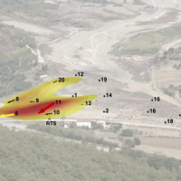
The 3DA software is a new procedure that allows retrieving in near-real-time 3D surface deformation models starting from data acquired via robotized total stations or others system that acquire the surface displacements. The measurements are first pre-processed and then implemented on 3D maps that include vector arrows representative of the intensities and of the real directions of motion in a given system of coordinates. The 3D surface ...

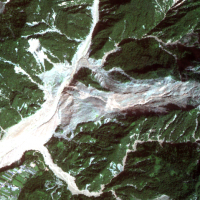
ESA Sentinels missions will provide enhanced capabilities in the revisit frequency, and the coverage. Their complete exploitation is in the combination of the two to advantage of a further increased revisiting time and in the use of different wavelenght domains. This reflects in the capabilities to detect features of changes induced by different factors including natural hazards and crop ...
 The Copernicus Sentinel-3 Surface Topography Mission (STM) provides extremely valuable surface elevation information over inland waters, sea ice and land ice, thanks to its SAR altimeter which retrieves high-resolution along-track elevation measurements, and to its orbit that covers high-latitude polar regions.
To ensure that these measurements can be used with confidence, and to maximize the return on investment of the Copernicus Sentinel-3 ...
  ESA Sentinels missions will provide enhanced capabilities in the revisit frequency, and the coverage. Their complete exploitation is in the combination of the two to advantage of a further increased revisiting time and in the use of different wavelenght domains. This reflects in the capabilities to detect features of changes induced by different factors including natural hazards and crop ...


