
Geodiversity refers to the variety of natural abiotic features, as the natural variety of geological (rocks, minerals), geomorphological (landforms, physical processes), hydrological and soil properties. The parameter “geomorphodiversity” is a measure of the dynamics of the Earth's surface and it has a key role in conservation of biodiversity and sustainability of ecosystems. Thus, it affects evolution of the biotic world and of human life. ...
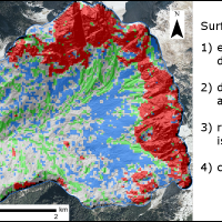
Geomorphometry complements the traditional qualitative description of landforms with a quantitative approach based on the analysis of Digital Terrain Models, which are numerical representations of the topography.
For the purpose, geomorphometry develops and exploits new algorithms in GIS (Geographical Information System) environments.
The scope of the analysis is to derive parameters (e.g., terrain slope, surface roughness), or ...
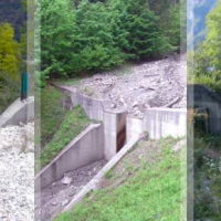
Mass wasting is a threat to residential areas and infrastructure, causing widespread destabilization in alpine stream channels, also in relation to ongoing climatic changes. Although hillslope sediment supply represents a critical factor for stream channel stability during heavy rainstorms, there is a general lack of procedures for quantifying sediment availability and composition. Moreover, we lack validated empirical models for estimating ...
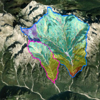
The aim of the geomorphometric analysis is to derive indices capable of characterizing the spatial variability of specific hydro-geomorphological processes (e.g., sediment connectivity, erosion and deposit). The growing availability of high-resolution topographic data has increased the interest in geomorphometry and its applications. Debris-flow monitoring in instrumented areas and flash-flood documentation are invaluable ways to gather field ...

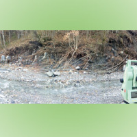
The 3DA software is a new procedure that allows retrieving in near-real-time 3D surface deformation models starting from data acquired via robotized total stations or others system that acquire the surface displacements. The measurements are first pre-processed and then implemented on 3D maps that include vector arrows representative of the intensities and of the real directions of motion in a given system of coordinates. The 3D surface ...
Some areas mapped in the Piani di Assetto Idrogeologico (Watershed Management Plan) of Piave, Brenta-Bacchiglione and Livenza Rivers require specific studies aimed at assigning a degree of hazard. Among the warning areas, there are numerous alluvial fans. The Soil Conservation Division of Veneto Region, in charge of the inquiry, identified the need to find an objective method for assessing the hazard of such ...
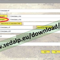
SedInConnect is a stand-alone application for the computation of the Sediment Connectivity Index (Cavalli et al., 2013, Crema et al., 2015).
The software has been developed in the frame of the SedAlp project, funded by the Alpine Space Programme (European Territorial Cooperation 2007-2013)
The output of the applied model is a topography-based index aiming at evaluating the potential connection between hillslopes and features acting as targets ...
