Geomorphometry complements the traditional qualitative description of landforms with a quantitative approach based on the analysis of Digital Terrain Models, which are numerical representations of the topography.
For the purpose, geomorphometry develops and exploits new algorithms in GIS (Geographical Information System) environments.
The scope of the analysis is to derive parameters (e.g., terrain slope, surface roughness), or ...
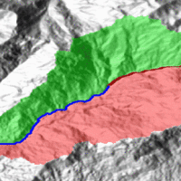
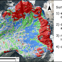
Quantitative geomorphological and environmental analysis requires the adoption of mapping units, well-defined spatial domains as basic mapping units which provide local boundaries to aggregate environmental and morphometric variables and to perform calculations. Grid cells, typically aligned with a digital elevation model, are the standard mapping unit choice. A wiser choice is represented by slope units, irregular terrain partitions delimited ...
Mass wasting is a threat to residential areas and infrastructure, causing widespread destabilization in alpine stream channels, also in relation to ongoing climatic changes. Although hillslope sediment supply represents a critical factor for stream channel stability during heavy rainstorms, there is a general lack of procedures for quantifying sediment availability and composition. Moreover, we lack validated empirical models for estimating ...
The aim of the geomorphometric analysis is to derive indices capable of characterizing the spatial variability of specific hydro-geomorphological processes (e.g., sediment connectivity, erosion and deposit). The growing availability of high-resolution topographic data has increased the interest in geomorphometry and its applications. Debris-flow monitoring in instrumented areas and flash-flood documentation are invaluable ways to gather field ...
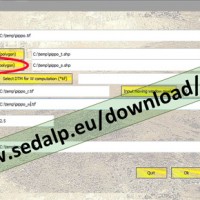
SedInConnect is a stand-alone application for the computation of the Sediment Connectivity Index (Cavalli et al., 2013, Crema et al., 2015).
The software has been developed in the frame of the SedAlp project, funded by the Alpine Space Programme (European Territorial Cooperation 2007-2013)
The output of the applied model is a topography-based index aiming at evaluating the potential connection between hillslopes and features acting as targets ...

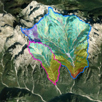
Water and sediment connectivity has emerged in recent years as a significant conceptual framework for understanding the transfer of surface water and sediment through landscapes. Connectivity can be seen both as a driver of hydrological and geomorphic processes within a catchment and as an emergent catchment property that is the result of processes acting at different ...
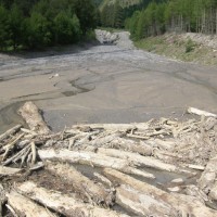
Sediment transport in small mountain catchments (drainage area < 10-20 km2) is a fundamental process for the equilibrium and the dynamics of the whole channel network. At the same time, sediment transport can create high-risk conditions due to the occurrence of extreme phenomena such as debris flow, hyperconcentrated flow, and flood with intense bedload, usually triggered by intense and short duration rainfall. In order to properly manage ...
