
STRESS
Strategies, Tools and new data for REsilient Smart Societies (STRESS)
Background
The STRESS project is intended to design, implement and test a prototype of a Spatial Information Infrastructure (SII) enabling the provision to spatial planners and risk managers of new data and tools to improve hydro-geological susceptibility, hazard and impact assessment as well as to experiment alternative decision making processes.
Purpose
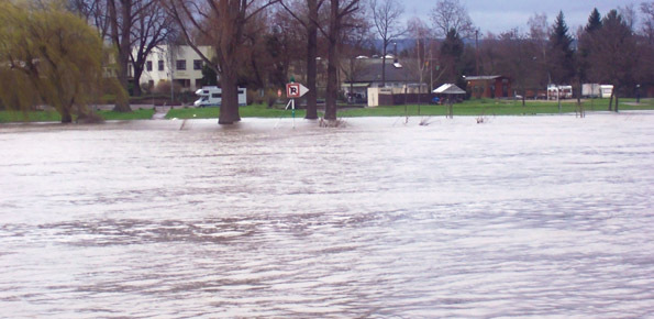
Currently, local operators of the regions, which are in charge of managing spatial planning and risk management activities, do not have at their disposal a SII which help operators to spatially monitor and analyze the susceptibility, hazard and impact maps of their territory, nor they are provided with information (in the form of dynamic maps) of the recent/ongoing effects/impacts of events such as landslides and floods, nor have tools that allow them to create/analyze VGI to communicate bi- directionally with citizens on specific environmental critical conditions.
STRESS intends to fill these gaps by designing a prototype of a SII, for spatial data sharing and analysis, based on the INSPIRE framework for SDI (Spatial Data Infrastructure) development, so as to provide access to integrated multi-source heterogeneous data to anyone equipped with a PC connected to the Internet through a Web browser. This will enable the optimization of current practices of preparedness, monitoring and mitigation actions.
Methods
The STRESS project will be carried out through the:
- design and implementation of a Spatial Data Infrastructure
- design and implementation of an automated procedure for the generation of the maps of the landslide class membership probability and water surface detection exploiting satellite data
- design and development of the Smart App to create VGI
- design and implementation of an automated procedure for landslide susceptibility modelling and for the rapid evaluation of the floods severity
- definition of ICT-based communication, education and dissemination strategies to increase risk awareness
Results
The STRESS project is intended to get to the following results:
- An interoperable SDI for sharing multisource data (Earth Observation data, VGI and thematic maps);
- A prototypal service from Sentinel Hub;
- A pre-processing and analysis module for remote sensing data generating maps of evidences (proxies)
- of floods and landslides;
- A Partnership Agreement among the scientific community, the public authorities and the citizens;
- A multi-disciplinary approach (Geosciences and Social Science-based) in order to analyze as many
- hydrogeological risk components as possible;
Products
Among the other strings the STRESS project will develop:
- a Smart App and back-end for VGI creation and storage on critical hydro-geological conditions;
- an updating algorithm of susceptibility, hazard and impact maps;
- a communication plan for awareness enhancement to disasters;
Conclusions
The scientific benefit of the STRESS project is straightforward and relies on (i) the communication research activities (effectiveness of the engagement techniques, quality of the provided data, efficacy of the communication activities on the increase of the awareness on hydro-geological hazards and risks); (ii) the analysis of the geo-hydrological outcomes of the STRESS project in terms of a successfully technological implementation of the SII and the scientific chain that starts from the acquisition of the Earth Observation data, passes through the VGI activities and comes to the update and validation of the
susceptibility, hazard and impact maps.
 Internal contact person: ivan marchesini -