Debris fall assessment in mountain catchments for local end users
DAMOCLES
Background
Debris flows and rockfalls are a familiar hazard in European mountain areas and regularly cause loss of life, livelihood and property. Hazard assessment is therefore increasingly required in land use planning. However, there are no standard techniques and existing operational techniques are qualitative.
DAMOCLES developed quantitative technologies for assessing the distribution of rapid slope failures and their hazard, for determining the physical impact of debris flows and, hence, for assessing the mitigating effects of torrent control works and land management. The project disseminated these technologies to end-users for application in land use planning. In order to achieve its goals, the project integrated research-based model development with the involvement of local planning and civil protection authorities as data suppliers, advisors and recipients of the project results.
Purpose
DAMOCLES:
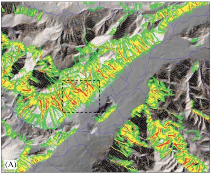
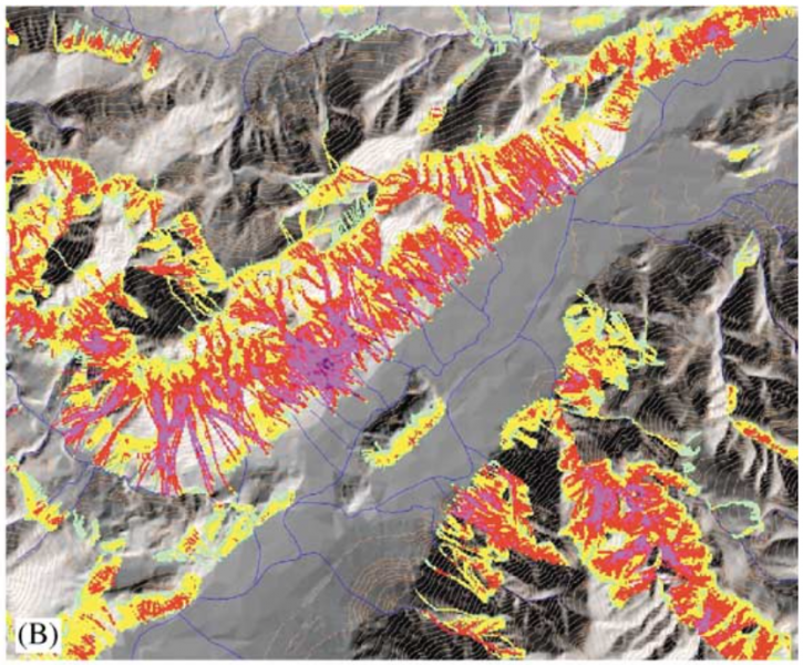
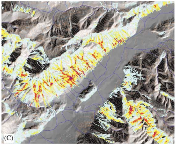
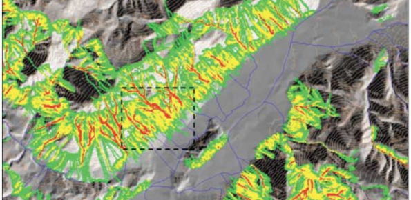
- Developed and applied advanced models for hazard assessment, impact prediction and mitigation studies relevant at local to regional scales: (i) a Geographical Information System (GIS) debris flow and rockfall hazard assessment model (STONE); (ii) a small basin (10 km2) debris flow impact model; and (iii) a basin scale (500 km2) landslide erosion and sediment yield model (SHETRAN).
- Conducted field surveys and assemble databases in support of model development for one region in the Spanish Pyrenees and two in the Italian Alps. Identified debris flow process relationships for insertion in the models.
- Transferred the technologies to end-users and make outcomes accessible through the public domain. Involved end-users in model applications, including assessment of possible future land use and climate change impacts.