Perugia office
![]() |
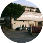
CNR IRPI Via Madonna Alta 126 06128 PerugiaTel. +39 075 5014 411 Fax +39 075 5014 420 Director: |
Research groups: Geomorphology, Hydrology
Number of projects per project-type and office
Number of presences per office, contract type and gender
- 37 YEARS OF SOIL MOISUTRE DERIVED RAINFALL: application of SM2RAIN to the CCI soil moisture product, algorithm improvement and product validation
- A new independent GLOBAL rainfall product from ASCAT soil moisture observations through SM2RAIN
- Accuracy of hydrological data for extreme events analysis and upgrade of Umbria Regional Hydrological Service’s platform
- Advanced and Integrated Monitoring of Earth DAMS
- Advanced Environment Monitoring System (SMAT) – F2
- Alarm and monitoring systems for debris and mud flows
- Albanian International Center on Marine Sciences
- Analysis and monitoring of Planpincieux Glacier, Monte Bianco massif (AO)
- Analysis of instabilities in the historical centre of Mesagne
- Analysis of the Mt. de La Saxe landslide
- Analysis, control and hydro-meteorological data processing – Rating curve estimate
- ARchivio TEMatico Immagini Aerofotografiche Di Eventi
- Assessing sediment connectivity and availability in several mountain catchments in the Veneto Region
- Assessment of water Balances and Optimisation based Target setting across EU River Basins
- Cartografia delle frane nell’area dell’invaso di Casanuova (PG)
- Cassini Extended Mission
- Changing Hydro-meteorological Risks as Analyzed by a New Generation of European Scientists
- Characterization, modelling and monitoring
- Civil Protection Competence Centre on Geo-Hydrological Risk
- Climate change on slope failures initiation in the Italian Alps
- Connecting European Connectivity Research
- Continuous monitoring of the seismogenic Paganica fault (AQ) after the April 6 2009 L’Aquila earthquake
- Cooperative Internet-of-Data Rural/Alpine Community Environment
- Cost of Natural Hazards in Italy
- Database of landslides in Calabria to be uploaded in the SyNaRMa computerized archives
- Database of post-wildfire debris-flow activity in Mediterranean ecosystems
- Debris fall assessment in mountain catchments for local end users
- Decision matrices for the assessment of fluvial processes in mountain streams
- Decree 473: early civil protection actions to cope with rainfall events that affected Calabria on November 2016 and January 2017
- Deep seated Gravitational Slope Deformation (DsGSD) analysis and criticalities assessment of the regional monitoring network of the landslides
- Design and restore underground
- Dikes and Debris Flows Monitoring by Novel Optical Fiber Sensors
- DInSAR techniques for the assessment of sinkhole hazard
- Dynamic flooding scenarios
- E-TECH New technologies for support and prevention of emergencies
- Earth observation and climate change
- ESA Climate Change Initiative Soil Moisture
- EUMETSAT Satellite Application Facility on Support to Operational Hydrology and Water Management
- Evaluating the geothermal potential in the Southern Regions of Italy
- Experimental Hydrological Database for Apennine Basins
- Extraterrestrial landslides
- Extreme Events Causes and Consequences
- Fiber optic sensors engineering for the monitoring of structural reinforcements on unstable slopes
- Flood forecasting and hydraulic risk
- Flooding-prone areas delineation
- Flooding-prone areas delineation for hydraulic risk assessment for river reaches of the secondary hydrographic network in Tiber river basin
- FLoods and fIre Risk assessment and managEment
- From population risk perception to social vulnerability in coastal areas subject to climate change: a proposal for risk management strategies in two Mediterranean regions
- Geo-hydrological hazards in the Pogliaschina catchment
- Geohazard impact assessment for urban areas
- Geological investigations in the catchment of the Rio Kortol
- Geomorphological studies on sectors of the Apulian territory
- Geomorphometry and sediment dynamics in mountain catchments
- Geothermal Atlas of Southern Italy Project
- Gestione dei Sedimenti Fluviali
- GIS technologies for managing sinkhole hazard
- Glacial hazards in the western Alps
- Ground Deformations Risk Scenarios: an advanced assessment service
- H-SAF and GPM: precipitation algorithm development and validation activity
- H-SAF AS: Integration of PR-OBS-5 and SM-OBS-1 products through SM2RAIN algorithm for improving rainfall estimate
- Hazard of alluvial fans
- Hazard posed by slope instability phenomena in Calabria
- Hazards in karst areas and mitigation strategies
- High pressure rheology
- Hydrogeological study for the risk analysis of a landfill.
- Hydrological and hydraulic studies to assess dam safety
- Hydrological monitoring and prediction of shallow landslides through remote sensing observations
- Hydrological study of the Paglia river basin
- Hydrometeorological data resources and technologies for effective flash flood forecasting
- Identification and estimation of the parameters for assessing the risk of desertification
- Identification of the channel network in the Autonomous Province of Trento
- Increasing Resilience through Earth Observation
- Innovative System for Monitoring and assessment of hIgh risk LANDslides
- Innovative technologies at high environmental sustainability in the forest-based sector
- Instability problems related to man-made cavities in the Municipality of Ginosa
- Integrated approach for the development across Europe of user oriented climate indicators for GFCS high-priority sectors: agriculture, disaster risk reduction, energy, health, water and tourism
- Integrated assessment of geo-hydrological instability phenomena in the Apulia region, interpretative models and definition of rainfall thresholds for landslide triggering
- Integration of hydrometric measurements for river discharge monitoring and channel roughness coefficients assessment
- IntEractions between hydrodyNamics and bioTic communities in fluvial Ecosystems: advancement in the knowledge and undeRstanding of PRocesses and ecosystem sustainability by the development of novel technologieS with fIeld monitoriNg and laboratory testinG
- Investigation of postglacial fault zones using DInSAR
- Investigation of the Montaguto Landslide
- Investigations for the mitigation of geo-hydrological risk along the railway “Eccellente - Rosarno”
- Investigations of the Ianò and Maierato landslides, Calabria, southern Italy
- ITALGAS service
- Karst ecosystems in Albania
- Karst sinkholes in urban areas in Florida
- Kinematic of debris flows using Large Scale Particle Image Velocimetry (LSPIV)
- La Ricerca ITaliana per il MARE
- Land cover change detection and monitoring methodologies based on the combined use of S1 and S2 for natural resources and hazard management
- Landslide Early Warning Integrated System
- Landslide hazard in coastal areas: the natural laboratory of the Malta island
- Landslide maps for the Castelfranci municipality
- Landslide Modelling and tools for vulnerability assessment Preparedness and REcovery management
- Landslide monitoring Innovative methods and instruments
- Landslide Multi-Hazard Risk Assessment, Preparedness and Early Warning in South Asia Integrating Meteorology, Landscape and Society
- Landslide risk and urban planning in small settlements in Daunia
- Landslide Smart Network
- Landslides investigation and mitigation at Passo della Morte (UD)
- Large landslides: Monitoring, Modelling and Mitigation
- Long-term Permafrost Monitoring Network
- Management of sediment transport in small mountain catchments
- Mappatura, Modellazione e Previsione Multiscala dei RIschi GEo-idroLogici
- Mediterranean Services Chain Based On Climate Predictions
- Methodologies for the analysis of alluvial fans
- Methodology for the estimation of environmental risk indicators, using satellite remote sensing techniques
- Metodologie integrate multi-scala per la zonazione della pericolosità da frana sismoindotta in Italia
- Micro-seismic network at the Carrel Hut on the Matterhorn
- Mobile Application for Emergency Response and Support
- Modelling for real-time flood forecasting
- Models of geo-hydrological processes
- Monitoraggio del Rischio da Frane con tecnologie EO
- Monitoraggio fluviale da rilevamento satellitare
- Monitoring and landslides risk in the Maierato area
- Monitoring of the Castellana Caves
- Monitoring of the Gollone landslide, Acceglio (CN)
- Monitoring system for the Hahnebaum test site
- Monitoring system in the framewok of the Interreg IV Project “Monitor II”
- Monitoring, Forecasting and Best Practices for FLOOD Mitigation & Prevention in the CADSES Region
- Mountain Risks: from prediction to management and governance
- Multi Scale and Multi Hazard MApping Space Solutions
- MUltiHAzard framework for water related risks management
- Partenariato di studio e documentazione a supporto dell'attività legislativa sugli Obiettivi di Sviluppo Sostenibile e focus sul geoscambio termico
- Pilot Project “Mitigation of the desertification processes in Calabria, in areas with a very high vulnerability”
- Prediction of rainfall-induced landslides and associated risk in Italy
- Preliminary analysis of the stability conditions in some sectors of the Castellana Caves
- Preliminary recognition of debris-flow hazard areas in Trentino
- Preserving the quality of the scientific information
- Prevention, Information and Early Warning pre-operational services to support the management of risks
- Preventive evaluation of land instability hazards
- Progetto ADAPT
- PRogetto IntegratO di mitigazione del RIschio da sprofondamento di caviTÀ
- Progetto PON Governance
- Progetto Presídi
- Qualitative and quantitative degradation risks of water resources and effects on human activities
- Radar remote sensing techniques for the detection and measurements of ground surface deformations
- Railways Meteo Security System
- Rainfall thresholds for the possible initiation of rainfall-induced landslides in Apulia
- Rainfall, seismicity, landslides and sediment discharge in mountain belts
- Real-time monitoring of the “San Lorenzo” tunnel, Passo della Morte
- Regenarating ECOsystems with Nature-based solutions for hydro-meteorological risk rEduCTion
- Register of the caves and artificial cavities of Apulia
- RelationsHips between meteo-climAtic paraMeters and ground surface deforMation time sEries in mountain enviRonments
- Research and development of optical fiber sensors for geotechnical and environmental monitoring
- Responding to the risks from climate change
- Rheology of geological processes
- Risk Management System (RMS)
- RISK-Advanced Weather forecasting system to Advice on Risk Events and management
- RiST project: Scientific and Technological research in the Bessanese glacial basin (Balme, NW Italian Alps)
- RiST2, the research go on
- RIVERbank Surveillance bAsed on Fiber optic sEnsors
- Role of climate change in the morphogenesis of glacial-periglacial environments and analysis of associated risks
- Safe Landscapes: prevention and adaptation strategies
- SANF Liguria
- SAR change detection methodologies for event landslide mapping
- SARF Liguria
- SARF Sardegna
- SaTellite based Runoff Evaluation And Mapping
- Sediment management in Alpine basins
- Sentinel for Geohazards regional monitoring and forecasting
- Sentinels for the Territory
- Siccità E Cambiamenti cLImatici
- Sinkholes in the Marina di Lesina area
- Sino-Italian Joint Laboratory on Geological and Hydrological Hazards
- Sistema di Allertamento Nazionale per la previsione del possibile innesco di fenomeni Franosi indotti da piogge lungo l’infrastruttura ferroviaria di RFI
- SLOPES
- Smart Monitoring of basins subject to high geohydrological risk
- SMOS+RAINFALL
- SMOS+RAINFALL II
- Space advanced project for excellence in research and enterprise
- Spatial-temporal evolution of glacial resources in the Italian Alps over the last 100 years
- Spatially distributed modelling of landslide phenomena
- Spectral signatures library for semi-automatic event landslide recognition and mapping
- Stability analysis in the Fantiano quarries
- STRESS
- STSE Water Cycle Multi-mission Observation Strategy for the Mediterranean
- STSE Water Cycle Multi-mission Observation Strategy – Irrigation
- Studio e monitoraggio dei processi idrologici
- Study and monitoring activities on Arzeno landslide - Municipality of Ne (GE)
- Study and monitoring of the Rotolon landslide
- Study of the riverbeds morphological evolution through the digital terrain models multi-temporal analysis
- Tessina and Lamosano Landslides Monitoring
- The 3 December 2013 Montescaglioso landslide
- The Via Firenze Sinkhole of in the Municipality of Gallipoli
- Time-Space prediction of high impact landslides under changing precipitation regimes
- Topographic monitoring of the Costa Concordia vessel wreck
- Towards geohazards resilient infrastructure under changing climates
- Triggering and evolution of the San Benedetto Ullano landslide
- Typify geo-hydrological events
- Updating the list of Apulian municipalities with presence of man-made cavities
- Upper-middle Tiber river basin: the flood event of 25-28 november 2005
- Use of SMAP soil moisture products for operational flood forecasting: data assimilation and antecedent wetness conditions assessment
- Valutazione del rischio idraulico finalizzata alla individuazione di interventi di mitigazione per la ricostruzione post-sisma
- Ventennale dell'Alluvione in Piemonte del 1994
- Vulnerability maps for monitoring and management of groundwater resources in the Archimed area
- Zonazione della suscettibilità da frana si scorrimento in Umbria

Research personnel
Director of Research
+39 075 5014404
tommaso.moramarco (at) irpi.cnr.it

Research personnel
Senior Researcher
+39 075 5014412
mauro.cardinali (at) irpi.cnr.it

Research personnel
Senior Researcher
+39 075 5014413
paola.reichenbach (at) irpi.cnr.it

Research personnel
Researcher
+39 075 5014429
massimiliano.alvioli (at) irpi.cnr.it

Research personnel
Researcher
+39 075 5014425
francesca.ardizzone (at) irpi.cnr.it

Research personnel
Researcher
+39 075 5014408
maria.teresa.brunetti (at) irpi.cnr.it

Research personnel
Researcher
+39 075 5014422
rosa.maria.cavalli (at) irpi.cnr.it

Research personnel
Researcher
+39 075 5014424
stefano.luigi.gariano (at) irpi.cnr.it

Research personnel
Researcher
+39 075 5014421
alessandro.cesare.mondini (at) irpi.cnr.it

Research personnel
Researcher
+39 075 5014412
michele.santangelo (at) irpi.cnr.it

Research personnel
Researcher
+39 075 5014426
angelica.tarpanelli (at) irpi.cnr.it

Technical personnel
Technical assistant
+39 075 5014429
vinicio.balducci (at) irpi.cnr.it

Administration
Administrative staff
+39 075 5014433
paola.cianchelli (at) irpi.cnr.it

Administration
Administrative staff
+39 075 5014400
giovanna.fagioli (at) irpi.cnr.it

Technical personnel
Technical assistant
+39 075 5014427
cinzia.bianchi (at) irpi.cnr.it

Administration
Administrative staff
+39 075 5014411
antonio.cirielli (at) irpi.cnr.it

Technical personnel
Technical assistant
+39 075 5014415
frida.clerissi (at) irpi.cnr.it

Technical personnel
Technical assistant
+39 075 5014419
cristiano.corradini (at) irpi.cnr.it

Technical personnel
Technical assistant
+39 075 5014429
federico.fugnoli (at) irpi.cnr.it

Technical personnel
Technical assistant
+39 075 5014401
massimo.guadagno (at) irpi.cnr.it

Administration
Administrative staff
+39 075 5014434
giuseppina.manfredi (at) irpi.cnr.it

Research personnel
Research associate
+39 075 5014417
rossella.belloni (at) irpi.cnr.it

Research personnel
Grant recipient
+39 075 5014407
paolo.filippucci (at) irpi.cnr.it
- Pubblica selezione per il conferimento di un Assegno di Ricerca, n. IRPI 001 2021 PG, prot. AMMCEN 0010146, scad. 05/03/2021
- Pubblica selezione per il conferimento di un Assegno di Ricerca, n. IRPI 002 2021 PG, prot. AMMCEN 0010157, scad. 05/03/2021
- Pubblica selezione per il conferimento di un Assegno di Ricerca, n. IRPI 004 2021 PG, prot. AMMCEN 0012463, scad. 16/03/2021