Analysis and monitoring of Planpincieux Glacier, Monte Bianco massif (AO)
Background
The Planpincieux Glacier is one of the glaciers that characterize the Italian side of the massif of the Grandes Jorasses. It is considered a temperate glacier and its front is currently located near a morphological step that determines a strong propensity to the activation of frequent ice falls in particular during the summer. These phenomena are typical of this glacier, but its particular asset may cause, as already occurred in the past, to the detachment and fall down of large portion of the frontal part of the glacier that can create an ice avalanche and menace the Planpincieux hamlet located in the bottom of the valley. Due to its high propensity to the activation of ice falls, the common monitoring system have been considered for not able to control its evolution.
Purpose
The main objective of the research project is the development of a monitoring system able to control the evolution of the ice front through the use of a remote monitoring station. The developed remote controlled station is able to produce displacement maps through the comparative analysis of images taken in the optical range.
The project has not purposes of civil protection. Its main goal is the development of a hardware/software system able to operate with low-cost instrumentation and acquire a series of images dataset. The available dataset is used to recognize and measure the ice mass changes. The research project would also increase, through a quantitative approach, the knowledge of the dynamics that characterized this glacier, and recognize critical evolutions.
Methods
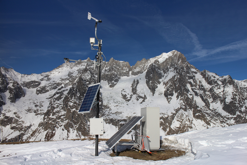
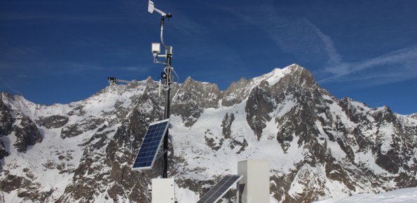
The system consists of two monitoring stations that acquire a set of images. The monitoring station is located on the crest of Mont de La Saxe (on the opposite side of the Ferret Valley) at a distance of about 3.5 Km from the target. The photogrammetric module of the monitoring station can achieve an average resolution of the monitored ice front of about 5 cm / pixel
The dataset of images is processed through techniques of pixels offset and change detection and a part of the images is available at: http://gmg.irpi.cnr.it
Campaigns with a Real Aperture Radar (RAR) and airborne LiDAR have also been conducted to obtain a three dimensional monitoring system.
Results
The research project has allowed us to acquire a continuous dataset of images starting from September 2013. Thanks to these data, we are for the first time able to study the evolution of the glacier and to measure its displacement rate that reach the 30-50 cm / day during the summer period. The project give also the opportunity to develop an automatic system of acquisition and processing of the image sequence and to generate automatically displacement maps.
The video shows the development of the glacier front in the period April – October 2014.
Products
Displacement and change detection maps of the glacier front are the two main products of the project. Besides them, the available dataset also allow a qualitative morphological analysis of the salient features of the morphological evolution of the glacier. By the integration of the LiDAR, RAR and optical measurements it is also possible to obtain a three-dimensional measurement of the movements of the glacier.
Conclusions
The project has allowed us to increase significantly the level of knowledge of the evolution of the front of the Planpincieux glacier that was considered not monitored with traditional detection techniques commonly employed. The installation of a prototypal low cost monitoring station has established how the images analysis can be considered one of the research fields with high margins of development.