
Advanced Environment Monitoring System (SMAT) – F2
(SMAT-F2)
Background
The environment monitoring has several purposes, including the prevention of geo-hydrogeological risks, forest fires, or prevention and suppression of illegal activities. The SMAT-F2 main objective is to define, design and develop an advanced monitoring system of the territory based on innovative unmanned air systems, coordinated by a supervision and coordination station (SSC). The first phase of the project, called SMAT-F1, finished at 31/12/2011, has successfully reached its objectives. The target of SMAT-F1 has been demonstrated, by a demo flight (30/09/2011), the use of three integrated UAVs controlled by a single SSC (Supervision and Coordination Station). SMAT-F2 is further developing systems to come up with solutions really operational.
Purpose
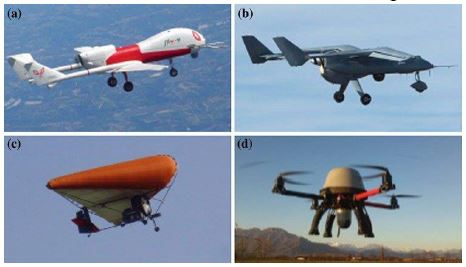
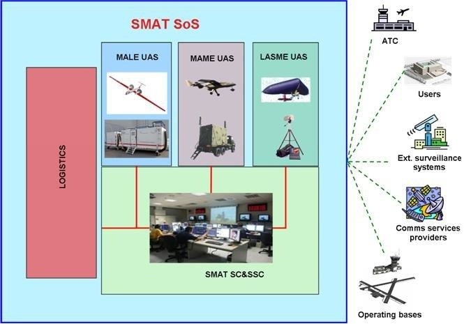
SMAT-F2 is focused on implementing a set of UAVs platforms; the fleet consists of: i) mini / micro UAVs, ii) Light UAV, iii) Male and iv) Mame UAVs. In particular, the activities are the development of sensors (EO / IR, SAR, Hyperspectral) and tools hosted on board platform. These tools are needed to acquire and process data during the different operational contexts hypothesized.
CNR IRPI, as partners and potential “end user”, collaborates with the consortium SMAT providing their skills and experiences acquired and developed over the years in the field of monitoring and evaluation of geo-hydrological instability.
Methods
The activity is divided according to following Works Package (WP):
- SMAT Requirements & Business Elements (WP1)
- UAS Autonomy (WP2)
- Sensors and Payloads Management (WP3)
- SSC (Supervision and Coordination Station) evolution (WP4)
- Airspace Integration (WP5)
The CNR IRPI activity is focused on the definition and simulation of geo- hydrogeological hazards scenarios (WP1, WP4). In the WP3, the aim of CNR IRPI is the study of the LiDAR sensor potential and its possible integration in the UAVs platforms provided in the SMAT project. This analysis is aimed to increase the spectrum of SMAT sensors and to gain added value from the possible integration and data fusion from several sensors.
Results
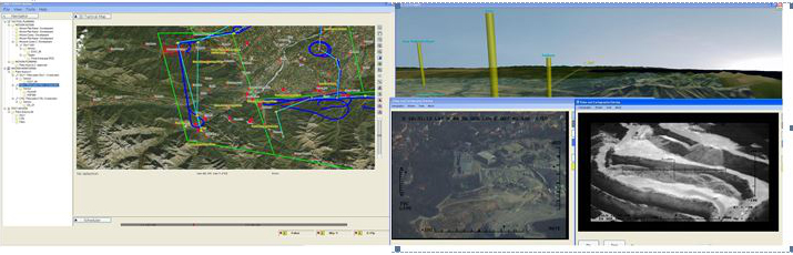
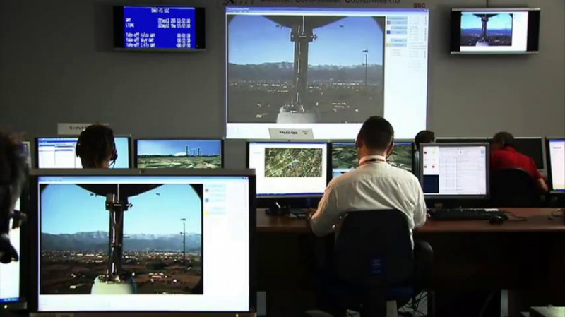
The SMAT F2 project aims to deploy a small fleet of UAVs, remotely controlled by a network of control stations (SSC). The SSC will operate on the ground and that will be responsible for to collect and first processing data.
CNR IRPI is involved in the definition of useful and mandatory requirements for the development of applications and algorithms related to data processing in geo-hydrological contexts.
Products
The products expected from the SMAT project will consolidate the fleet and will improve innovations and technological solutions developed during the first phase of the project. The final products are to completion of the Supervision and Coordination Station (SSC), the implementation and development of on-board sensors and the definition of the interface for end-user / SMAT system.
The expected product for the CNR IRPI is the identification of standard procedures to be implemented and validated in different geo-hydrological scenarios. These processes must be able to generate a final product intelligible and easily usable by end users.
Conclusions
The capabilities acquired from SMAT system will be demonstrated in a final event, which will be defined in detail in the course of the project. This demonstrative demo will simulate a real operational context. The starting point is the capability of the fleet to fly at the same time controlled by a single Supervision and Coordination Station (SSC). The final expectations will be the ability to acquire and transmit data in real time to the SSC. In the SSC the data collected will have a first processing with production of first set of information.
The final contribution of the CNR IRPI involves the participation in the demo with a simulation of a hydrogeological scenario. It is possible to use during the final event the mobile laboratory equipped by the Geohazard Monitoring Group.
 Internal contact person: giorgio lollino -