Dynamic flooding scenarios
Background
The project activities were carried out in two phases:
- “dynamic scenarios of flood risk” identification through hydrologic-hydraulic modeling addressed to Civil Protection activities (2009-2011);
- operational implementation of developed dynamic scenarios of flood risk and results dissemination trough web-GIS technologies, also within the context of Floods Directive 2007/60 /EC (2012-203); flood forecasting models implementation; assessment of bridge piers/abutments and levee vulnerability.
Purpose
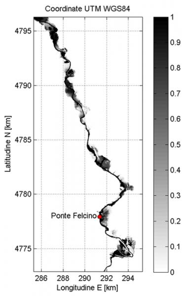
- data collection of historical flood events in the Umbrian territory;
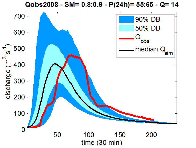
- identification of “dynamic flooding scenarios” by applying hydrological-hydraulic modelling for supporting Civil Protection activities addressed to flood risk management in real time;
- dissemination the results trough web-GIS technologies;
- application of models for operational flood forecasting in river reaches of interest within the Umbrian territory;
- assessment of bridge piers/abutments vulnerability to scour, bridge overtopping frequency, levee vulnerability to seepage and levee overtopping vulnerability.