Identification of the channel network in the Autonomous Province of Trento
Definition of a methodology for the identification of the channel network of the Autonomous Province of Trento, northen Italy, and application to the entire territory of the province
Background
The accurate representation of the channel network is fundamental in cartography. The increasing availability of high-resolution, LiDAR-derived DTMs provides an excellent topographic basis for the representation of the channel network, but requires innovative techniques for managing and processing data.
Purpose
The objectives of the project were the development of methods for a semi-automatic derivation of the channel network applicable to LiDAR-derived DTMs and their application in the territory of the Autonomous Province of Trento (Italy).
Methods
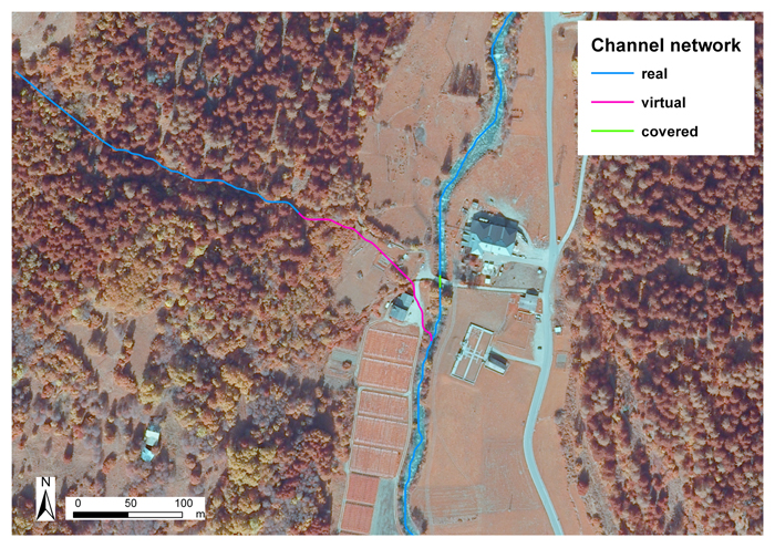
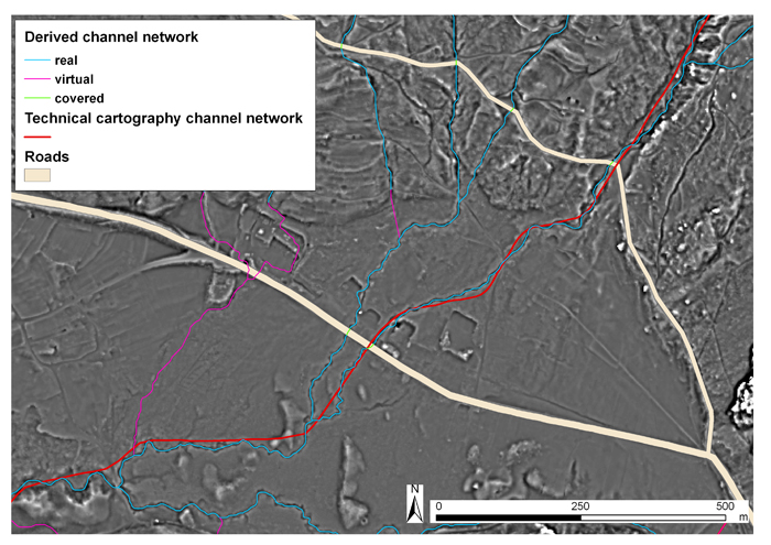
The method for the definition of the channel network consisted of two steps: (i) the automatic derivation from a high-resolution DTM of a preliminary channel network by means of the analysis of morphometric variables, and (ii) supervised control aimed at the refinement of the preliminary channel network.
Results
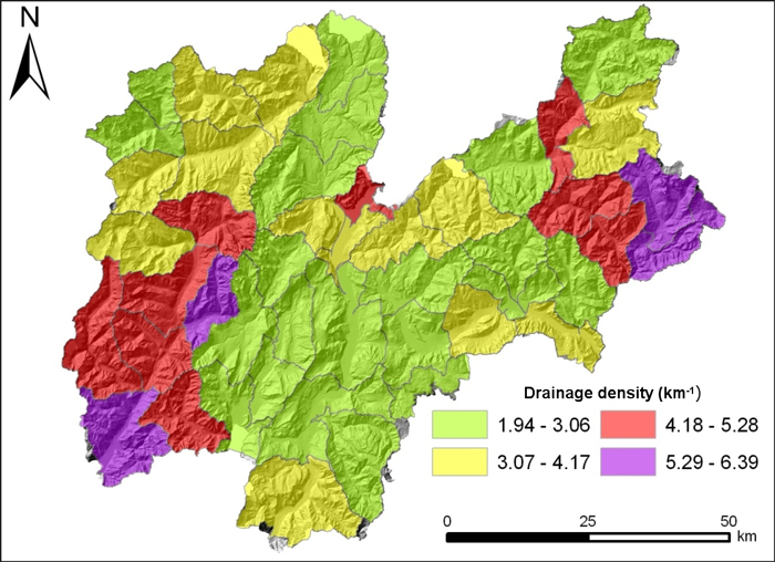
A new representation of the channel network in the study region, based on a LiDAR-derived DTM, was derived. The method used in the study can be applied in other mountainous areas where high-resolution DTMs are available.
Products
The main outcome of the study are GIS informative layers of the channel network in the territory of the Province of Trento. Technical reports and a research paper describe the method devised for channel network definition and the results obtained.
Conclusions
The methodology devised and applied in the territory of the Autonomous Province of Trento is cost/time efficient and fits well with the needs of a constantly up-to-date cartography resulting in a highly detailed definition of channel network.