
Railways Meteo Security System
Multisensory analysis for the forecasting and geo-location of intense rainfall events in Calabria aimed at preventing and mitigating the risk along the railway of the Reggio Calabria department (RAMSES)
Background
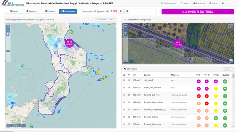
In recent years, following short and intense meteoric events, along the railway line of the Department of Reggio Calabria, there have been a series of interruptions in correspondence of basins below 3-4 km2. Based on the current procedures for risk mitigation in RFI, in the event of a “red alert” issued by the Civil Protection, RFI management locate along the railway line personal in correspondence of the area in question. This procedure is particularly expansive, as the warnings can affect sections of track extended even hundreds of kilometers. An accurate and timely localization of the major problems that may occur along the railway line due to heavy rainfall would allow the optimization of the management of the resources to be used in the inspection activities, reducing the extension of the sections to be checked and the time needed for the inspections.
Purpose
The experimental research project, had as its main objectives the development of geo-hydrological risk mitigation tools along the railway network of the Reggio C. RFI Department, with particular attention to small and very small basins ( > 0.75 sq. Km). The main activities were aimed at:
- identify the precipitation field at time t = 0 to calculate the inflows on the basins using radar data, and therefore the flow rates at the rail crossings section;
- create a nowcasting at t = 30-60 minutes, to anticipate probable critical conditions;
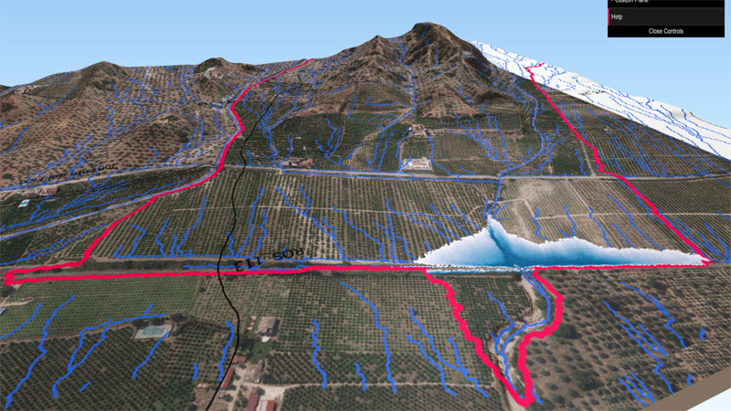
- for some pre-set hydrological scenarios, estimate the probable effects of events on the ground.
Methods
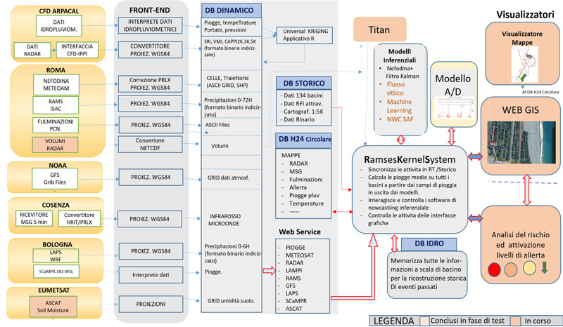
To achieve the objectives, a series of applications have been realized aimed at:
- Construction of the rainfall field by radar or in its absence by rain gauges, NCW-SAF tools based on Meteosat and atmospheric parameters taken from ECMWF forecast models, microwave satellites.
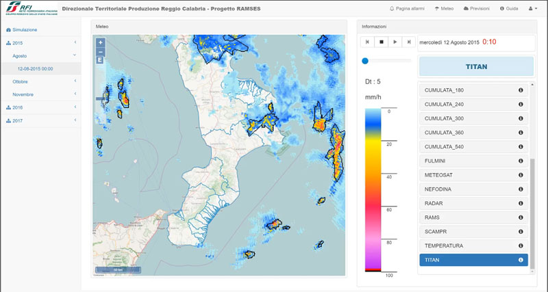
- 30/60 minute Nowcasting based on radar volumes processed using TITAN software.
- 3-hour forecast model using LapsWRF model
- 24 hour LAM forecasting model based on RAMS forecaster.
- Real-time inflows / outflows models
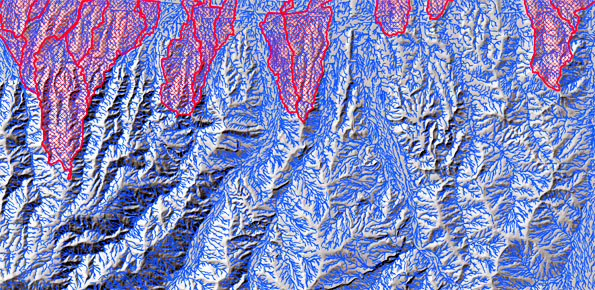
- Regional model for the probabilistic localization of soil slip. The model is based on a LIDAR 2×2 morphometric platform, soil moisture model in real time, maximum areal precipitation for intervals ranging from 30 ‘to 48 hours, lithology, land use.
Products
Per il raggiungimento degli obiettivi è stata realizzata una complessa piattaforma informatica costituita da:
- sistemi di interfaccia con i dati esterni
- DB relazionali per la gestione di tutte le informazioni
- modelli per la elaborazioni di: dati radar, umidità del suolo, suscettibilità dinamica, afflussi/deflussi, previsione meteo a 3 /24 ore.
- Applicazioni Flow-2D, automi cellulari per la modellazione statica di debris-flow
- Modelli per la stima delle precipitazioni da satelliti a microonde, meteosat
- I risultati di tutte le elaborazioni del sistema per la notifica degli allarmi sono divulgati mediante
Conclusions
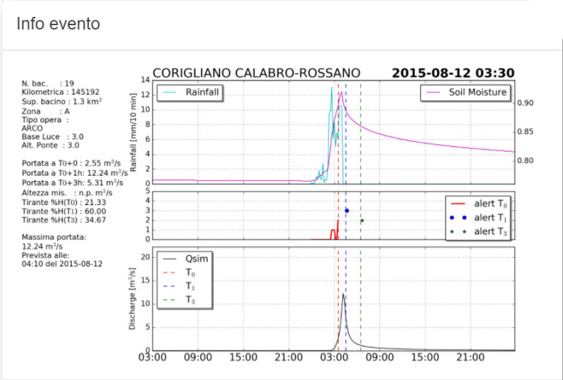
The first exploratory phase of the project ended on 31 December 2017. During the last year, the system performance was assessed through the reconstruction of numerous flood events occurred in 2015/16.The results were encouraging, the system anticipated of 15/30 minutes the occurrence of critical events that caused railway interruptions. Some critical issues have been found in the analysis of radar data, especially in the peripheral area of Reggio Calabria.

 Internal contact person: salvatore patrizio gabriele -