Landslide Early Warning Integrated System
(LEWIS)
Background
The focus on landslides results from the recognition that in many European countries slope instabilities affect urbanized areas and are a major threat to populations.
Through the integration of remotely sensed data with ground data we identify significant surface changes which are taking place on landslide susceptible slopes and this is used as input to the assessment of hazard.
Purpose
The main objective: the development of a prototype landslide warning service to the citizen trough the application of a methodology based on the integration of Earth Observation (EO) data and ground data. The secondary objective: integrate multidisciplinary research expertise in geological, physical and computing science for solving the important problem of landslide damage mitigation and prevention.
Methods
The Project approach relies on the integration of remotely sensed data (derived mainly from low-cost optical and radar satellite imagery) with ground data (e.g., topographic, geologic, geomorphic, geotechnic). Then there is focus on periodic detection of surface feature changes which can be correlated with the development of instability mechanisms.
Results
The main result was the development and implementation of the landslide early warning system (relying on the integration of earth observation data and ground data), considered a working prototype of a future operational system.
Products
The main products include:
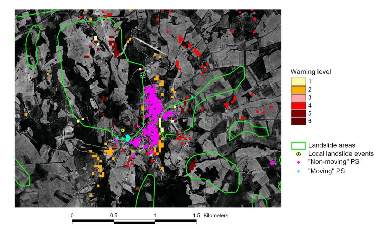
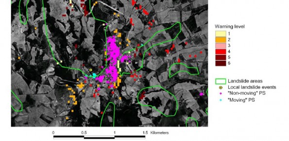
- Watch map: all the information, static and dynamic, collected from EO data and from ground networks and included in the GIS after all processing.
- Susceptibility map, which consists of a “zonation” of the areas of interest into levels of susceptibility.
- Warning map or updateable susceptibility map, which is the final product highlighting levels of warning.
Conclusions
The developed working prototype of the landslide early warning system is open to improvements. New sensors in the visible and IR wavelengths as well as in the microwave bands can be easily incorporated, as they become available, to improve change detection reliability for land use and thus prediction of slope instability.