
EUMETSAT Satellite Application Facility on Support to Operational Hydrology and Water Management
(H SAF)
Background
The H-SAF generates and archives high-quality data sets and products for operational hydrological applications starting from the acquisition and processing of data from Earth observation satellites in geostationary and polar orbits operated both by EUMETSAT and other satellite organization. The retrieval of products uses data from microwave and infrared instruments and aims at reaching the best possible accuracy compatible with satellite systems as available today or in the near future. H-SAF applications fit with the objectives of other European and international programmes (including GMES) with special relevance to those initiatives which want to mitigate hazards and natural disasters such as flash floods, forest fires, landslides and drought conditions, and improve water management.
Purpose
H-SAF objectives are:
- to provide new satellite-derived products from existing and future satellites with sufficient time and space resolution to satisfy the needs of operational hydrology, by mean of the following identified products:
- precipitation (liquid, solid, rate, accumulated);
- soil moisture (at large-scale, at local-scale, at surface, in the roots region);
- snow parameters (detection, cover, melting conditions, water equivalent);
- to perform independent validation of the usefulness of the new products for fighting against floods, landslides, avalanches, and evaluating water resources; the activity includes:
- downscaling/upscaling modelling from observed/predicted fields to basin level;
- fusion of satellite-derived measurements with data from radar and raingauge networks;
- assimilation of satellite-derived products in hydrological models;
- assessment of the impact of the new satellite-derived products on hydrological applications.
Methods
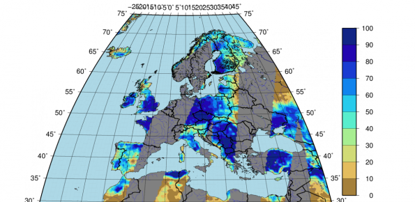
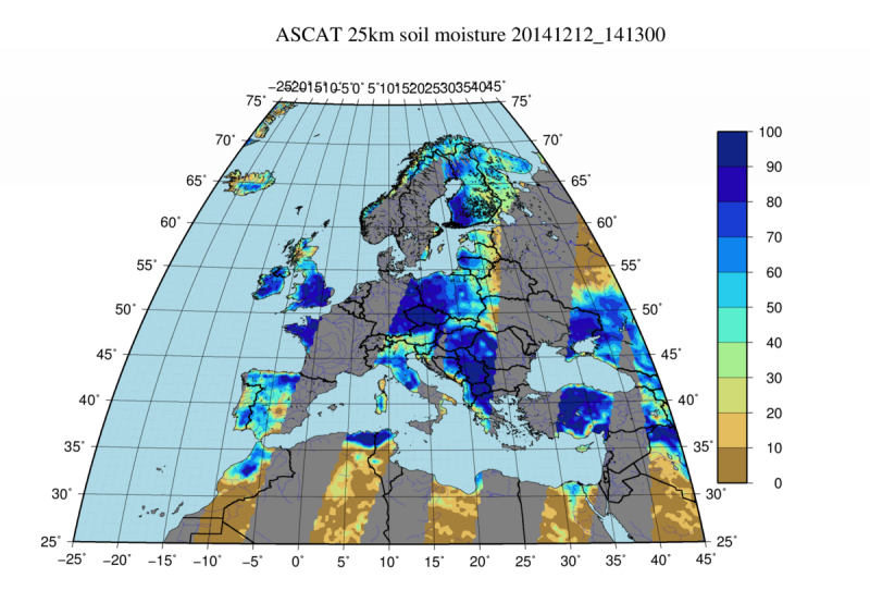
The precipitation estimates are obtained by the application of retrieval and blending algorithms to the data obtained through a constellation of microwave and infrared satellites. The soil moisture data are obtained through the Advanced Scatterometer (ASCAT) data and through land data assimilation system (provided by ECMWF). The snow products are obtained by applying a thresholding method to the brilliance temperature recorder by the infrared sensors.
Products
Several products are available within the H-SAF project:
- H01: Precipitation rate at ground by microwave conical scanners;
- H02: Precipitation rate at ground by microwave cross-track scanners;
- H03: Precipitation rate at ground by blending infrared and microwave information;
- H04: Precipitation rate at ground by merging infrared and microwave information through a morphing technique;
- H05: Accumulated precipitation at ground by blending infrared and microwave information;
- H06: Instantaneous and accumulated precipitation at ground computed by a numerical weather prediction model;
- H07: Large scale surface soil moisture by radar scatterometer;
- H08: Small scale surface soil moisture by radar scatterometer;
- H14: Profile index in the root region by scatterometer data assimilation;
- H25: Metop ASCAT soil moisture time series;
- H10: Smow detection by infrared and visible radiometry;
- H11: Snow status by microwave radiometry;
- H12: Effective snow cover by infrared and visible radiometry;
- H13: Snow water equivalent by microwave radiometry.
 Internal contact person: luca brocca -