
Cooperative Internet-of-Data Rural/Alpine Community Environment
Creation of a technical platform for the collection, management and dissemination of data (real time and historical data) weather-hydrological and agrometeorological, from stations and observers (CIRCE)
Background
Environmental sensor monitoring is continuously developing, both in terms of quantity (i.e. measurement sites), and quality (i.e. technological innovation). Environmental monitoring is carried out by either public or private entities for their own specific purposes, such as scientific research, civil protection, support to industrial and agricultural activities, services for citizens, security, education and information.
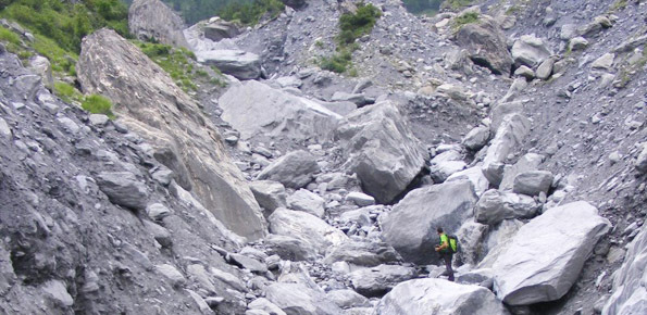
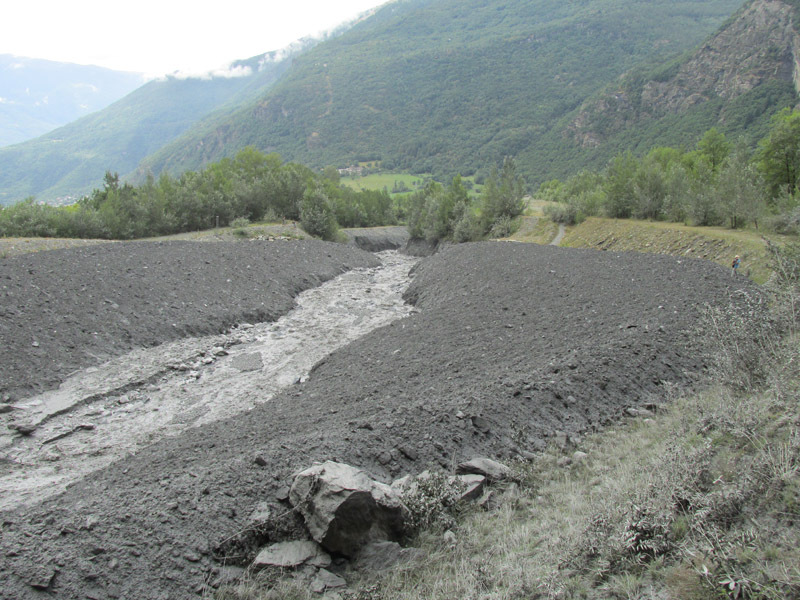
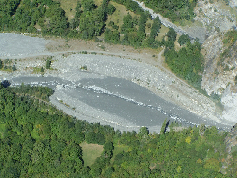
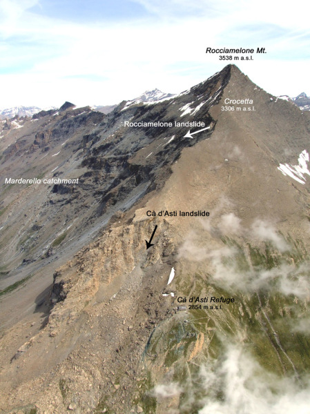
The left Cenischia valley includes some of the best known alpine basins prone to debris flow in Northwestern Italian Alps. In particular, in the Marderello catchment (6,6 km2), a left tributary of the Cenischia river, 31 important debris flood/flow events occurred during the last one hundred years. According to the chronicles of the last three centuries, events with significant volumes are on the average liable to take place every 3-4 years, whereas minor events may occur even twice per year. Due to the high frequency of activations, the site is of relevant interest for monitoring purposes. Since the early nineties, the CNR IRPI equipped the Marderello basin with meteorological monitoring devices.
Purpose
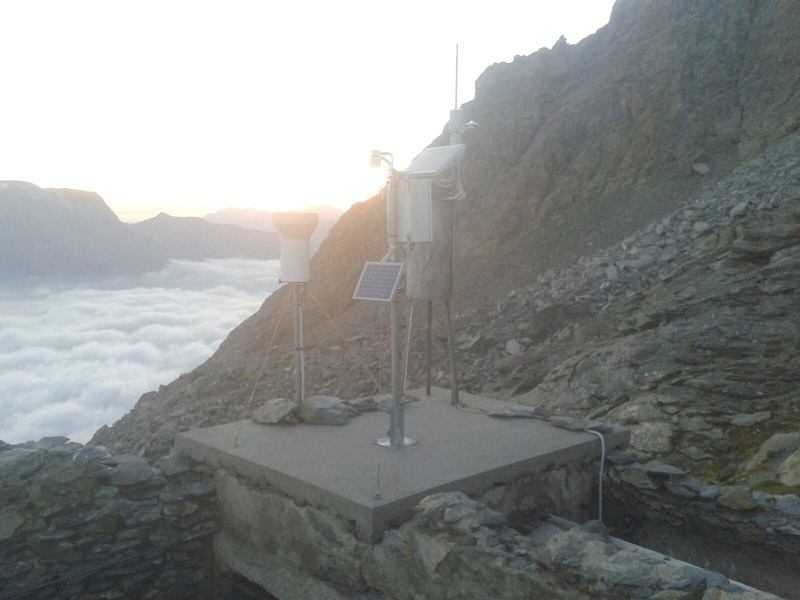
The rainfall monitoring network consists of six rain gauges, placed at different elevations, between 800 m a.s.l. and 2854 m a.s.l. Other meteorological data (air moisture and temperature, atmospheric pressure, wind speed and direction) are provided by some stations located at 3150, 2150 and 830 m a.s.l. The main objective of the monitoring is the investigation of the triggering conditions for debris flows initiation. In the scientific bibliography the prediction of debris flows is often tackled by the use of empirical methods, based on the analysis of past activation and related rainfall triggering conditions. In complex sites, as the Alpine catchments are, the remarkable elevation gaps between the source areas of debris flows and the rain gauges position make it difficult to identify the triggering rainfall. To attain more reliable results, the elevation effect must be considered. In fact, elevation influences the precipitation in terms of cumulative values and, as a result of the temperature gradient, it controls the nature of the precipitation (rain/snow).
Methods
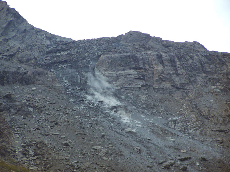
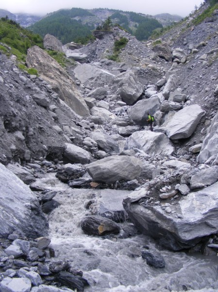
The Marderello catchment is frequently affected by mud flow phenomena (1 per year, on the average), and as a consequence, it was chosen as monitoring site. The Ground vibration detectors (GVD) network consists of four vertical geophones (natural frequency of 10 Hz) installed on the alluvial fan, along a straight reach of the torrent. The catchment is also equipped with three video cameras, two rainfall stations and an ultrasonic stage sensor. The final goal of the ongoing research activities is to develop and test warning algorithms.
Results
The traces of the flow data are recorded on 17 July 2013 and 9 and 14 August 2015 , by the GVD network installed in the Marderello catchment. The waveforms that can be observed are typical of debris flow, mud flow phenomena and hyperconcentrate flow.
Products
They were disseminated the results at Conferences and in partly in International journal.
The CIRCE network is currently constituted by a total amount of hundreds of sensors remotely connected and originally belonging to different networks, including mountain sites that are very difficult to access.
In addition to real-time data, the CIRCE database includes many historical datasets, which were uniformed and adapted to the database architecture. Non-specialists participate in enrichment of the sensor punctual data with sending qualitative and quantitative information about observed processes (e.g. watercourse levels, erosion processes, presence of pathogens, damage pictures, etc.) by means of two specifically developed APPs. All data are available on CIRCE’s web platform, mobile APPs and as open source data on the Piedmont platform.
Conclusions
In the present Project we use the rainfall and temperature monitoring data collected in the Marderello basin to investigate the effect of the elevation on the recorded precipitation. The capability to find a correlation between elevation and rainfall can be useful to have a better comprehension of triggering mechanisms, to identify the source areas and to produce reliable event predictions.
 Internal contact person: laura turconi -