
Making reports of rockfall in the area affected by the earthquake in central Italy in ...
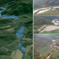
The service is based on a procedure consisting of four main steps: the analysis of hydro-meteorological data for the reconstruction of flood event in terms of precipitations and saturation conditions of the soils; assessment of the hydrological response of the basin; runoff estimation in each hydrometric site of interest; flooded areas delineation and comparison with in-situ ...
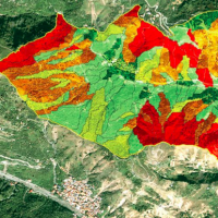
A landslide susceptibility map forecasts where landslides are expected to occur in the future based on terrain conditions, including local morphological, geological, and land use settings. Using different colors, a landslide susceptibility map shows forecasted levels of landslide susceptibility in a region. Using specific software, LSMMs can be prepared whene new landslides or new environmental (e.g., morphological, geological, land use) data ...
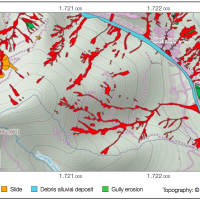
An Event Landslide Inventory Map (ELIM) shows the location and extent of landslides caused by a specific natural trigger, such as an intense rainfall event, a period of prolonged rainfall, a rapid snowmelt event, or an earthquake. The methods and tools developed by CNR-IRPI allow preparation of an ELIM anywhere recent landslides have left discernible ...
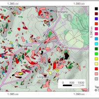
A Landslide Inventory Map (LIM) shows the location, spatial extent and type of landslides in a ...
