Levees vulnerability database
National levees database: cataloging, vulnerability, inspection and maintenance
Description
National levees database, where the levees are identified by a code consisting in two parts: the first one identifies the river; the second one is a sequential number increasing from downstream to upstream. For each levee the location, the characteristics and topographic surveys are reported along with vulnerability to overtopping and piping, flood hazard maps and information about levee inspection and maintenance
Users/Purpose
Local Civil Protection authorities, National Department of Civil Protection, bodies responsible for territory conservation and protection to address the levees inspection/maintenance.
Methods and technologies
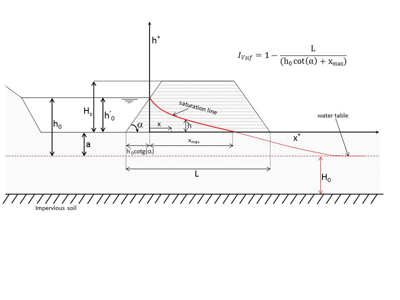
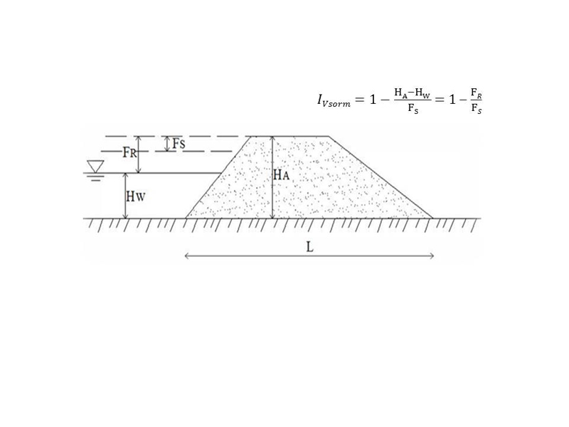
In order to estimate the overtopping levee vulnerability, the IVsorm index, which is a function of the safety freeboard and the effective freeboard, is considered. The value that this index assumes indicates no vulnerability (IVsorm<0), mean vulnerability (0 ≤ IV sorm <1) or high vulnerability (IVsorm ≥1). As concerns the piping levee vulnerability estimation, the IVsif index, referred to a dimensionless levee, is considered. In particular, the fragility curves, relating the index value and the probability that the levee is vulnerable to piping, are drawn.