Landslide monitoring
Description
Following the recent technological development, the role of landslides monitoring has become increasingly important, especially for the study and management of large landslides in emergency scenarios. In the last decades, CNR IRPI developed a range of skills dedicated to the design, installation and management of monitoring systems that can be considered for a technical and scientific support in many national emergencies. CNR IRPI can apply different monitoring strategies depending on the peculiarities of the context, and on the level of criticality of the landslide. Moreover, multi-instrumental networks are often considered to efficiently control key physical parameters and to better interpret landslide phenomena over space and time. In this context, CNR IRPI has extensive expertise on the remote management of monitoring networks in near real time, on the management of early warning systems based on thresholds and/or on the application of forecast models, as well as on the online publication of the results in dedicated web-gis platforms.
Users/Purpose
Monitoring activities are directed primarily to increase knowledge of a specific landslide, and to identify the relationship between its evolution due to external factors, such as rainfall precipitation and/or fluctuations of the water table. The knowledge acquired is often made available to support the authorities responsible for the management on their decision process.
Methods and technologies
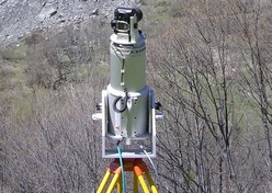
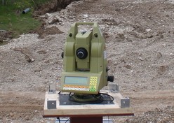
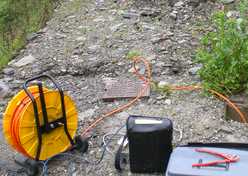
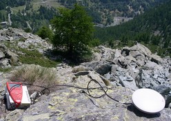
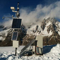
Modern monitoring approachesare usually based on the use of technologically advanced tools. A monitoring network is composed of in situ monitoring instrumentation (e.g. robotic total station, GBinSAR, GPS, strain gauges, etc.) and an infrastructure allowing for remote transfer of the data acquired. In addition, the infrastructure is composed of dedicated server facilities located at CNR IRPI, where the data is stored, processed, and published using dedicated software tools developed by the CNR IRPI, in part protected by copyright (eg. 3DA - three-dimensional displacement analysis). Last but not least, monitoring results are published on dedicated web pages in near real time.
Products
The products of monitoring activities can be divided into near real time elaborations, (thematic maps and plots produced automatically, published online) and periodical bulletins for a more detailed analysis of landslide phenomena.